Alastaro
| Alastaro | ||
|---|---|---|
| Former municipality | ||
|
Alastaron kunta Alastaro kommun | ||
| ||
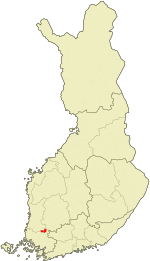 Location of Alastaro in Finland | ||
| Coordinates: 60°57′15″N 022°51′50″E / 60.95417°N 22.86389°ECoordinates: 60°57′15″N 022°51′50″E / 60.95417°N 22.86389°E | ||
| Country | Finland | |
| Region | Southwest Finland | |
| Sub-region | Loimaa sub-region | |
| Consolidated | 2009 | |
| Area[1] | ||
| • Total | 258.12 km2 (99.66 sq mi) | |
| • Land | 256.8 km2 (99.2 sq mi) | |
| • Water | 1.32 km2 (0.51 sq mi) | |
| Population (2008-12-31)[2] | ||
| • Total | 2,910 | |
| • Density | 11.33/km2 (29.3/sq mi) | |
| Time zone | UTC+2 (EET) | |
| • Summer (DST) | UTC+3 (EEST) | |
| Climate | Dfc | |

Alastaro (Finnish pronunciation: [ˈɑlɑstɑro]) is a former municipality of Finland. It was merged to town of Loimaa on 1 January 2009.
It is located in the province of Southern Finland and is part of the Southwest Finland region. The municipality had a population of 2,910 (31 December 2008) and covered an area of 258.12 km² of which 1.32 km² is water. The population density was 11.33 inhabitants per km².
The municipality was unilingually Finnish.
References
- ↑ "Area by municipality as of 1 January 2008" (PDF) (in Finnish and Swedish). Land Survey of Finland. Retrieved 27 March 2010.
- ↑ "Population by municipality as of 31 December 2008". Population Information System (in Finnish and Swedish). Population Register Center of Finland. Archived from the original on 2010-12-02. Retrieved 27 March 2010.
External links
![]()
- Alastaro-Seura ry (in Finnish)
| Municipalities |  | |
|---|---|---|
| Former municipalities |
| |
This article is issued from
Wikipedia.
The text is licensed under Creative Commons - Attribution - Sharealike.
Additional terms may apply for the media files.