Alabama State Route 86
| ||||
|---|---|---|---|---|
| Route information | ||||
| Maintained by ALDOT | ||||
| Length | 27.396 mi[1] (44.090 km) | |||
| Existed | 1957 – present | |||
| Major junctions | ||||
| West end |
| |||
|
| ||||
| East end |
| |||
| Location | ||||
| Counties | Pickens | |||
| Highway system | ||||
| ||||

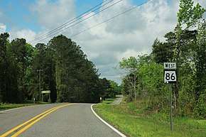
State Route 86 (SR 86) is a 27.396-mile-long (44.090 km) state highway completely within Pickens County in the western part of the U.S. state of Alabama. The highway begins at the Mississippi state line and is a continuation of Mississippi Highway 388. The eastern terminus of the highway is at an intersection with U.S. Route 82 at Gordo.
Route description
SR 86 is aligned along a two-lane roadway as it enters Alabama. Just east of the Mississippi state line, the highway crosses the Tom Bevill Lock and Dam and enters the town of Pickensville. The highway travels to the east as it continues across Pickens County, connecting Pickensville with Carrollton and Gordo, where it intersects US 82, which leads eastwardly to Tuscaloosa.
History
SR 86 was designated in 1957. The original route traveled from the Mississippi state line to Carrollton, replacing County Route 70. The highway was extended eastward to its current terminus in 1962, replacing County Route 12.[2]
Major intersections
The entire route is in Pickens County.
| Location | mi[1] | km | Destinations | Notes |
|---|---|---|---|---|
| Pickensville | 0.000 | 0.000 | Mississippi state line | |
| 2.978 | 4.793 | |||
| Carrollton | 14.113 | 22.713 | West end of SR 17 concurrency; partial traffic circle around Pickens County Courthouse | |
| 14.167 | 22.800 | East end of SR 17 concurrency | ||
| | 27.396 | 44.090 | Eastern terminus | |
1.000 mi = 1.609 km; 1.000 km = 0.621 mi
| ||||
See also


References
Route map:
- 1 2 Alabama Department of Transportation. "Milepost Maps". Archived from the original on July 27, 2011. Retrieved June 15, 2011.
- ↑