Alabama State Route 247
| ||||
|---|---|---|---|---|
| Route information | ||||
| Maintained by ALDOT | ||||
| Length | 24.849 mi[1] (39.991 km) | |||
| Major junctions | ||||
| South end |
| |||
| North end |
| |||
| Location | ||||
| Counties | Franklin, Colbert | |||
| Highway system | ||||
| ||||

State Route 247 (SR-247) is a 25-mile-long (40 km) route that serves as a connection between State Route 24 east of Halltown with U.S. Highway 72 east of Pride.
Route description
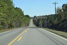
State Route 247 in Franklin County
SR-247 begins at an intersection with State Route 24 east of Halltown. From this point, the route travels in a northeasterly direction to its northern end at U.S. Highway 72 to the east of Pride.
Major intersections
| County | Location | mi[1] | km | Destinations | Notes |
|---|---|---|---|---|---|
| Franklin | | 0.000 | 0.000 | ||
| Colbert | | 24.849 | 39.991 | ||
| 1.000 mi = 1.609 km; 1.000 km = 0.621 mi | |||||
References
Route map:
- 1 2 "Milepost maps". Alabama Department of Transportation. February 2009. Archived from the original on October 12, 2013. Retrieved May 11, 2013.
This article is issued from
Wikipedia.
The text is licensed under Creative Commons - Attribution - Sharealike.
Additional terms may apply for the media files.