Al Amarat (Khartoum)
| Al Amarat العمارات | |
|---|---|
| District | |
| Arabic transcription(s) | |
| • Common | العمارات |
 | |
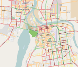 Map of Al Amarat (inset: map of Khartoum) | |
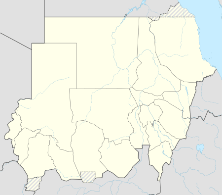 Al Amarat Location of Al Amarat in Sudan | |
| Coordinates: 15°39′N 32°29′E / 15.650°N 32.483°ECoordinates: 15°39′N 32°29′E / 15.650°N 32.483°E | |
| Country | Sudan |
| Governorate | Khartoum |
| Time zone | UTC+3 (East Africa Time) |
| • Summer (DST) | UTC+3 |
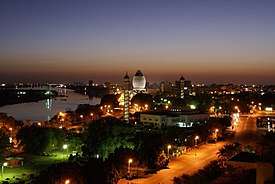
Al Amarat (Arabic: العمارات / transliterated: Al Amarat) Al Amarat is a Sudanese neighborhood, is a large neighborhood within Khartoum State and Khartoum city, one of the most prestigious neighborhoods in Khartoum city.[1]
Geography
Al Amarat is bounded on the east by Africa or (airport) road and on the west by Mohamed Naguib road. The nomenclature of the neighborhood streets starts with 1st street and ends by 61th street, using odd numbering.[2]
History
The district is a modern residential districts in Khartoum, but it was found after the late General President Ibrahim Abboud government. Al Amarat district is one of the neighborhoods of Khartoum city, It has been known as a major residential for cultural and businessmen at the centre capital of Sudan.[3]
Etymology
The neighbourhood was named Al Amarat as it was the first district in Khartoum with high-rise buildings, and was originally called "South Amarat". It was planned to have both first class and second class buildings, and some people call it (Abboud) from their point of view. District of Al Amarat was one of the major achievement as the first government leading development. It was one of Great housing revolution developments in Sudan which bomber detonated by late General President Ibrahim Abboud.
.JPG)
_-_a.JPG)
Climate
Alamart district of Khartoum features a hot semi-arid climate (Köppen climate classification BSh) with a dry season occurring during "wintertime", typical of the Saharo-Sahelian zone which marks the progressive passage between the Sahara's vast desert areas and the Sahel's vast semi-arid areas. The climate is extremely dry for most of the year with about nine months where average rainfall is lower than 5 mm (0.20 in). The very long dry season is itself divided into a hot, very dry season between November and March as well as a very hot, dry season between April and June. [4]
Social life in Al Amarat district
Al Amarat is one of the safest districts in Khartoum, especially considering its size. Social life tends to be muted. There are plenty of good restaurants, clustered in wealthier neighborhoods and where lots of expats live. It is a decent place to live. Houses and apartments are also in high supply. Amarat has been the favorite neighborhood in Khartoum. The people have become accustomed to rush to their homes early in the evening because Khartoum yawns early due to the government decision to stop private parties at 11:00 pm, an hour before midnight.
Famous places and buildings
- Decor House buildings 15th Street
- Mobilia Center Building 15th Street[5]
Education
Al Amarat District knew Education since it was established and since then spread to the schools District at different stages. Elementary Schools and High Schools:
- Khartoum New Secondary School For Girls
- Hassouna Secondary School For Boys
- Al Amarat Girls Intermediate School
- Al Amarat Elementary School For Boys
- Al Amarat Intermediate School For Boys.[6]
Important figures who have lived in Al Amarat
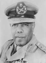
- El Ferik Ibrahim Abboud (Arabic: إبراهيم عبود, 26 October 1900 – 8 September 1983) was a Sudanese president, general, and political figure. A career soldier, Abboud served in World War II in Egypt and Iraq. In 1949, Abboud became the deputy Commander in Chief of the Sudanese military. Upon independence, Abboud became the Commander in Chief of the Military of Sudan. He served as the head of state of Sudan between 1958 and 1964 and as president of Sudan in 1964; however, he soon resigned, ending Sudan's first period of military rule.[7]
Photo gallery
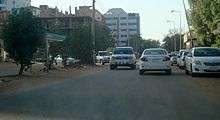
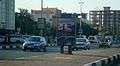 Africa (Airport) road
 The movement in Africa (airport) road
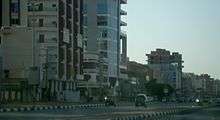
.JPG) Amarat 15th Street
Amarat 15th Streetth_Street_1.JPG) Alamart Mohammed Najib Road at 15th Street
Alamart Mohammed Najib Road at 15th Street
References
- ↑ "Archived copy". Archived from the original on 2007-10-20. Retrieved 2014-12-01. . sudan.gov.sd
- ↑ "مفوضية تشجيع الإستثمار - ولاية الخرطوم". Investment Encouragement Commission.
- ↑ "حكومة ولاية الخرطوم". Khartoum.
- ↑ "World Weather Information Service – Khartoum". UN. Retrieved 6 May 2010.
- ↑ http://www.cbos.gov.sd/en/node/3298
- ↑ "Sudanese higher education". Ministry of Higher Education & Scientific Research. Retrieved 2011-09-15.
- ↑ Biography of El Ferik Ibrahim Abboud at bookrags.com
External links
- https://web.archive.org/web/20150505234133/http://www.sudanway.sd/index.htm
- http://www.tawtheegonline.com/vb/showthread.php?t=40340
- http://www.khartoum.gov.sd
Districts of Khartoum | ||
|---|---|---|
| Old Khartoum (Khartoum publicly) |
| 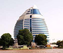 Burj Al-Fateh from The Nile |
| Eastern Khartoum |
| |
| southern Khartoum |
| |
| Jabal awlia |
| |