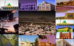
Agordat
| Agordat أغوردات ኣቆርዳት Ak'ordat | |
|---|---|
| Town | |
 | |
 Agordat أغوردات Map of Agordat in Eritrea | |
| Coordinates: 15°33′N 37°53′E / 15.550°N 37.883°E | |
| Country | Eritrea |
| Region | Gash-Barka |
| Time zone | UTC+3 (EAT) |
| Climate | BWh |
Agordat (Ge'ez: ኣቆርዳት, Arabic: أغوردات; also Akordat or Ak'ordat) is a city in Gash-Barka, Eritrea. It was the capital of the former Barka province, which was situated between the present-day Gash-Barka and Anseba regions.
Overview
Agordat lies in the western part of the country on the Barka River. An important market town, it is home to a large mosque.
Excavations in Agordat uncovered pottery related to the C-Group (Temehu) pastoral culture, which inhabited the Nile Valley between 2500-1500 BC.[1] Sherds akin to those of the Kerma culture, another community that flourished in the Nile Valley around the same period, were also found at other local archaeological sites in the Barka valley belonging to the Gash Group.[2] According to Peter Behrens (1981) and Marianne Bechaus-Gerst (2000), linguistic evidence indicates that the C-Group and Kerma peoples spoke Afroasiatic languages of the Berber and Cushitic branches, respectively.[3][4]
Agordat was the last major town along the Eritrean Railway to Massawa through Asmara. The line continued on through to Bishia its terminus. The local economy is reliant on passing traders moving between Asmara and Kessela in Sudan.
Agordat has many restaurants, as well as a hospital built during the colonial period in Italian Eritrea. A considerable amount of Eritrea's fruit and vegetables, particularly bananas and oranges, are transported through the town. Additionally, the Akat fruit is grown locally.
Climate
| Climate data for Ak'ordat | |||||||||||||
|---|---|---|---|---|---|---|---|---|---|---|---|---|---|
| Month | Jan | Feb | Mar | Apr | May | Jun | Jul | Aug | Sep | Oct | Nov | Dec | Year |
| Average high °C (°F) | 32 (89) |
33 (92) |
36 (96) |
39 (103) |
40 (104) |
37 (99) |
33 (91) |
32 (89) |
35 (95) |
37 (99) |
36 (96) |
33 (92) |
35 (95) |
| Average low °C (°F) | 14 (58) |
14 (57) |
14 (58) |
18 (65) |
22 (72) |
22 (72) |
21 (69) |
21 (70) |
21 (69) |
21 (70) |
19 (67) |
16 (61) |
19 (66) |
| Average precipitation mm (inches) | 0 (0) |
0 (0) |
0 (0) |
0 (0) |
10 (0.39) |
30 (1.18) |
100 (3.94) |
140 (5.51) |
40 (1.57) |
0 (0) |
0 (0) |
0 (0) |
320 (12.6) |
| Source: Weatherbase [5] | |||||||||||||
See also
| Wikimedia Commons has media related to Agordat. |
References
- ↑ Cole, Sonia Mary (1964). The Prehistory of East. Weidenfeld & Nicolson. p. 273.
- ↑ Leclant, Jean (1993). Sesto Congresso internazionale di egittologia: atti, Volume 2. International Association of Egyptologists. p. 402. Retrieved 15 September 2014.
- ↑ Marianne Bechaus-Gerst, Roger Blench, Kevin MacDonald (ed.) (2014). The Origins and Development of African Livestock: Archaeology, Genetics, Linguistics and Ethnography - "Linguistic evidence for the prehistory of livestock in Sudan" (2000). Routledge. p. 453. ISBN 1135434166. Retrieved 15 September 2014.
- ↑ Behrens, Peter (1986). Libya Antiqua: Report and Papers of the Symposium Organized by Unesco in Paris, 16 to 18 January 1984 - "Language and migrations of the early Saharan cattle herders: the formation of the Berber branch". Unesco. p. 30. ISBN 9231023764. Retrieved 14 September 2014.
- ↑ "Weatherbase: Historical Weather for Ak'ordat, Eritrea". Weatherbase. 2011. Retrieved on November 24, 2011.
Coordinates: 15°33′N 37°53′E / 15.550°N 37.883°E
| Wikisource has the text of the 1911 Encyclopædia Britannica article Agordat. |