Aitkenvale, Queensland
| Aitkenvale Townsville, Queensland | |||||||||||||||
|---|---|---|---|---|---|---|---|---|---|---|---|---|---|---|---|
| Population | 4,790 (2016 census)[1] | ||||||||||||||
| Postcode(s) | 4814 | ||||||||||||||
| LGA(s) | City of Townsville | ||||||||||||||
| State electorate(s) | Mundingburra | ||||||||||||||
| Federal Division(s) | Herbert | ||||||||||||||
| |||||||||||||||
Aitkenvale is a suburb of the City of Townsville, Queensland, Australia.[2]
History
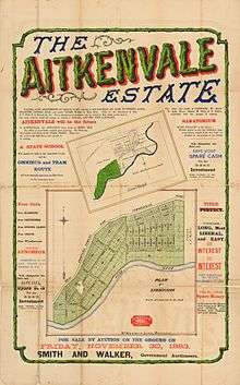
Estate Map of Aitkenvale Estate, Townsville, Queensland, 1883

Thomas Aitken of Townsville, 1867
The suburb is named after Thomas Aitken, the original grantee of Portion 38, Parish of Coonambelah. He began subdividing the property during the 1880s, putting 440 quarter-acre residential allotments on the market in 1885. A dairy farm was established in the region by Thomas Aitken in about 1867.[2]
The Aitkenvale public library opened in 1971.[3]
Present day
Aitkenvale is located in south-eastern townsville
Population
According to the 2016 census of Population, there were 4,790 people in Aitkenvale.
- Aboriginal and Torres Strait Islander people made up 6.7% of the population.
- 73.3% of people were born in Australia.
- 79.0% of people only spoke English at home. Other languages spoken at home included Somali at 2.2%.
- The most common responses for religion were No Religion 27.0%, Catholic 23.8% and Anglican 14.0%.[1]
Public Facilities in Aitkenvale
- Education
- Public Facilities
- Parks
- Aitkenvale Park
- Rossiter Park
- Henrietta Park
- Public Libraries
- CityLibraries Aitkenvale at 4 Petunia Street, operated by CityLibraries Townsville [7]
- Sporting Grounds
- Illich Park (Centrals Rugby League)
- Parks
- Shopping
- Stockland Townsville
- Myer
- Big W
- Kmart
- Coles
- Woolworths
- 205 Specialties Stores
- Stockland Townsville
| Urban |
|
|---|---|
| Rural |
|
| Northern Beaches | |
| Magnetic Island | |
References
- 1 2 Australian Bureau of Statistics (27 June 2017). "Aitkenvale (State Suburb)". 2016 Census QuickStats. Retrieved 14 January 2018.

- 1 2 "Aitkenvale (entry 44562)". Queensland Place Names. Queensland Government. Retrieved 14 March 2014.
- ↑ "Public Libraries Statistical Bulletin 2016-17" (PDF). Public Libraries Connect. State Library of Queensland. November 2017. p. 16. Retrieved 29 January 2018.
- ↑ "Aitkenvale State School". Retrieved 25 January 2017.
- 1 2 "Opening and closing dates of Queensland schools". Education Queensland. 1 August 2013. Retrieved 3 February 2018.
- ↑ "Riverside Adventist Christian School". Retrieved 25 January 2017.
- ↑ "Townsville CityLibraries Aitkenvale". plconnect.slq.qld.gov.au. State Library of Queensland. Retrieved 2018-01-22.
External links
Coordinates: 19°17′S 146°48′E / 19.283°S 146.800°E
This article is issued from
Wikipedia.
The text is licensed under Creative Commons - Attribution - Sharealike.
Additional terms may apply for the media files.