Aisne (river)
| Aisne | |
|---|---|
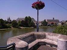
 The Aisne near the village of Soupir | |
| Country | France |
| Physical characteristics | |
| Main source |
Champagne-Ardenne 48°56′44″N 05°10′46″E / 48.94556°N 5.17944°E |
| River mouth |
Oise 49°26′1″N 2°50′49″E / 49.43361°N 2.84694°ECoordinates: 49°26′1″N 2°50′49″E / 49.43361°N 2.84694°E |
| Length | 356 km (221 mi) |
| Discharge |
|
| Basin features | |
| Progression | Oise→ Seine→ English Channel |
| Basin size | 7,752 km2 (2,993 sq mi) |

The Aisne (French: [ɛn]) is a river in northeastern France. It is a left tributary of the Oise. It gave its name to the French department of Aisne. It was known in the Roman period as Axona.
It rises in the forest of Argonne, at Rembercourt-Sommaisne, near Sainte-Menehould. It flows north and then west before joining the Oise near Compiègne. The Aisne is 356 kilometres (221 mi) long.[1] Its main tributaries are the Vesle, the Aire and the Suippe. Three bitter battles of World War I were fought into the Aisne valley.
Places along the river
Departments and towns along the river include:
Navigation
The river Aisne was a commercial navigation as early as the Gallo-Roman period, and rafts were floated from a long distance above the present limit of navigation at Vailly-sur-Aisne until the mid-19th century. Canalisation works were begun in 1836, at the same time as construction of the Canal lateral à l'Aisne. The canal was completed first, in 1841, then two years later the river navigation.[2] Commercial traffic in péniches carrying 220 tonnes is still active, while recreational traffic is mainly private boats. The waterway is 57 kilometres (35 mi) long, from the river Oise to the junction with the lateral canal, and has 7 locks. Through the lateral canal, it links with the Marne and the Canal de la Meuse.[3]
En route
The kilometre distances continue the numbering from Canal latéral à l'Aisne from east to west.[2]
- PK 51.3 is the end of the Canal latéral à l'Aisne
- PK 64.5 Villeneuve-Saint-Germain
- PK 67 Soissons
- PK 79 Fontenoy
- PK 85 Vic-sur-Aisne
- PK 92 Couloisy
- PK 104.5 Choisy-au-Bac
- PK 108 junction with Canal latéral à l'Oise upstream of Compiègne
See also
References
External links
- River Aisne and Canal lateral à l'Aisne maps and details about places, ports and moorings on the river, by the author of Inland Waterways of France, Imray
- Navigation details for 80 French rivers and canals (French waterways website section)
- World Book encyclopedia 1988
| Authority control |
|---|