Airolaf
| Airolaf إيرولاف | |
|---|---|
| Town | |
 Near the Day Forest National Park. | |
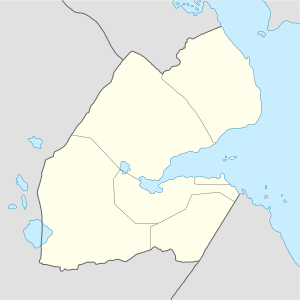 Airolaf إيرولاف Location in Djibouti | |
| Coordinates: 11°46′N 42°39′E / 11.767°N 42.650°E | |
| Country |
|
| Region | Tadjoura |
| Elevation | 1,535 m (5,036 ft) |
| Population 2012 | |
| • Total | 1,023 |
Airolaf (Arabic: إيرولاف) is a town in the Tadjoura Region in northwestern Djibouti and in the centre of the Tadjoura Region. It is located some 115 kilometres southeast of the national capital, Djibouti City. Airolaf is known for its temperate, cool climate – the coolest area in Djibouti. The town is overlooked by Goda Mountains, the third tallest mountain in Djibouti. One of the distinctive features of Airolaf countryside is the widespread growing of vegetables.
Demographics
The majority of the population of Airolaf is Afars
Geography and climate
Airolaf lies at an elevation of 1535 metres above sea level. It has the coldest nights of any city in Djibouti. It sits on middle trending highlands known as the Goda Mountains. In the winter months it is quite cold at night, and there can even be frost. However, it rapidly warms up as the tropical sun climbs higher during the day. The temperate central portion, where Airolaf lies, is situated on a rocky plateau. The Goda Mountains have a mixture of highland climate zones, with temperature differences of up to 10 °C, depending on elevation and prevailing wind patterns. The highest recorded temperature was 38 °C (100 °F) on July 20, 1999, while the lowest recorded temperature was 6 °C (43 °F) on December 31, 1989.
Airolaf has a hot semi-arid climate (BSh) in Köppen-Geiger system.
| Climate data for Airolaf | |||||||||||||
|---|---|---|---|---|---|---|---|---|---|---|---|---|---|
| Month | Jan | Feb | Mar | Apr | May | Jun | Jul | Aug | Sep | Oct | Nov | Dec | Year |
| Average high °C (°F) | 22.0 (71.6) |
22.7 (72.9) |
24.6 (76.3) |
26.3 (79.3) |
29.4 (84.9) |
31.9 (89.4) |
31.4 (88.5) |
30.5 (86.9) |
29.5 (85.1) |
26.7 (80.1) |
24.1 (75.4) |
22.4 (72.3) |
26.8 (80.2) |
| Average low °C (°F) | 10.9 (51.6) |
12.1 (53.8) |
13.3 (55.9) |
15.4 (59.7) |
17.4 (63.3) |
19.9 (67.8) |
19.5 (67.1) |
18.9 (66) |
18.6 (65.5) |
15.1 (59.2) |
12.9 (55.2) |
11.6 (52.9) |
15.5 (59.8) |
| Average precipitation mm (inches) | 34 (1.34) |
37 (1.46) |
33 (1.3) |
45 (1.77) |
24 (0.94) |
13 (0.51) |
49 (1.93) |
70 (2.76) |
56 (2.2) |
16 (0.63) |
32 (1.26) |
22 (0.87) |
431 (16.97) |
| Source: Climate-Data.org[1] | |||||||||||||
References
- ↑ "Climate: Airolaf - Climate graph, Temperature graph, Climate table". Climate-Data.org. Retrieved 14 November 2014.