Airbles railway station
| Airbles | |
|---|---|
 | |
| Location | |
| Place | Motherwell |
| Local authority | North Lanarkshire |
| Coordinates | 55°46′56″N 3°59′40″W / 55.782331°N 3.994509°WCoordinates: 55°46′56″N 3°59′40″W / 55.782331°N 3.994509°W |
| Grid reference | NS750561 |
| Operations | |
| Station code | AIR |
| Managed by | Abellio ScotRail |
| Number of platforms | 2 |
|
Live arrivals/departures, station information and onward connections from National Rail Enquiries | |
| Annual rail passenger usage* | |
| 2012/13 |
|
| 2013/14 |
|
| 2014/15 |
|
| 2015/16 |
|
| 2016/17 |
|
| Passenger Transport Executive | |
| PTE | SPT |
| History | |
| 15 May 1989 | Station opened |
| National Rail – UK railway stations | |
| * Annual estimated passenger usage based on sales of tickets in stated financial year(s) which end or originate at Airbles from Office of Rail and Road statistics. Methodology may vary year on year. | |
|
| |
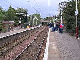
Airbles railway station serves the Airbles area of Motherwell, North Lanarkshire in Scotland. It is located 0.8 miles (roughly 1 kilometre) away from Fir Park stadium, home of Motherwell F.C.
History
The station was a new construction in 1989 by British Rail, on the Hamilton Circle.
The station missed out on services from the new Larkhall branch because the reopened line connects in a westerly direction as a result of the M74 now being in the location of the previous easterly junction.
Services
2016
The current service pattern, Mondays-Saturdays is:[1]
- 2tph to Dalmuir via Hamilton Central and Glasgow Central Low Level
- 2tph to Motherwell, with an hourly extension to Cumbernauld
The Sunday service is:
- 2tph to Milngavie, via Hamilton and Glasgow Central Low Level
- 2tph to Motherwell
| Preceding station | Following station | |||
|---|---|---|---|---|
| Motherwell | Abellio ScotRail Argyle Line |
Hamilton Central | ||
References
Notes
- ↑ Table 226 National Rail timetable, May 2016
Sources
| Wikimedia Commons has media related to Airbles railway station. |
- Butt, R. V. J. (1995). The Directory of Railway Stations: details every public and private passenger station, halt, platform and stopping place, past and present (1st ed.). Sparkford: Patrick Stephens Ltd. ISBN 978-1-85260-508-7. OCLC 60251199.
- Jowett, Alan (2000). Jowett's Nationalised Railway Atlas (1st ed.). Penryn, Cornwall: Atlantic Transport Publishers. ISBN 978-0-906899-99-1. OCLC 228266687.
This article is issued from
Wikipedia.
The text is licensed under Creative Commons - Attribution - Sharealike.
Additional terms may apply for the media files.