Aimin District
| Aimin District 爱民区 | |
|---|---|
| District | |
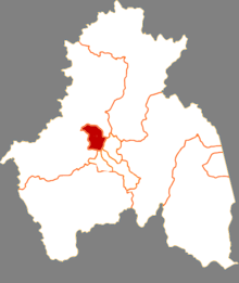 Location of Aimin District in Mudanjiang | |
.png) Mudanjiang in Heilongjiang | |
| Coordinates: 44°35′48″N 129°35′27″E / 44.59667°N 129.59083°ECoordinates: 44°35′48″N 129°35′27″E / 44.59667°N 129.59083°E | |
| Country | People's Republic of China |
| Province | Heilongjiang |
| Prefecture-level city | Mudanjiang |
| Township-level divisions |
7 subdistricts 1 town |
| District seat | No.300, Tian'an Road (天安路300号) |
| Area | |
| • Total | 389 km2 (150 sq mi) |
| Elevation | 244 m (801 ft) |
| Population (2016) | |
| • Total | 297,000 |
| • Density | 760/km2 (2,000/sq mi) |
| Time zone | UTC+8 (China Standard) |
| Website |
aimin |
Aimin District (simplified Chinese: 爱民区; traditional Chinese: 愛民區; pinyin: Àimín Qū) is a district of Mudanjiang, Heilongjiang, People's Republic of China.
Administrative divisions
Aimin is divided into seven subdistricts and one township:[1]
Subdistricts:
- Xiangyang Subdistrict (向阳街道), Huanghua Subdistrict (黄花街道), Tiebei Subdistrict (铁北街道), Xinhua Subdistrict (新华街道), Daqing Subdistrict (大庆街道), Xingping Subdistrict (兴平街道), Beishan Subdistrict (北山街道)
The only township is Bei'an Township (北安乡)
Notes and references
- ↑ 2011年统计用区划代码和城乡划分代码:爱民区 (in Chinese). National Bureau of Statistics of the People's Republic of China. Retrieved 2013-01-25.
This article is issued from
Wikipedia.
The text is licensed under Creative Commons - Attribution - Sharealike.
Additional terms may apply for the media files.