Aguapeí River (São Paulo)
| Aguapeí River | |
|---|---|
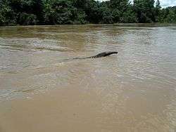 Giant anteater in the river | |
 | |
| Native name | Rio Aguapeí |
| Country | Brazil |
| Physical characteristics | |
| Main source | São Paulo state |
| River mouth | 21°03′03″S 51°46′01″W / 21.050759°S 51.766927°WCoordinates: 21°03′03″S 51°46′01″W / 21.050759°S 51.766927°W |
| Basin features | |
| River system | Paraná River |
The Aguapeí River (Portuguese: Rio Aguapeí) is a river of São Paulo state in southeastern Brazil. It is a left tributary of the Paraná River.
The lower reaches of the Aguapeí River flow through the Aguapeí State Park, created in 1998, which is about 10 kilometres (6.2 mi) upstream from the point where the Aguapeí the Paraná River. The park contains large areas of floodplain, and is flooded in the rainy season when the Aguapeí overflows its banks.[1] The mouth of the river is protected by the 8,885 hectares (21,960 acres) Mouth of the Aguapeí Private Natural Heritage Reserve, created in 2010.[2]
See also
References
- ↑ PES do Aguapeí – ISA, Características.
- ↑ Covas 2013, p. 49.
Sources
- Covas, Bruno (2013), "Reserva Particular do Patrimônio Natural Foz do Rio Aguapeí", Anuário das Reservas Particulares do Patrimônio Natural Instituídas pela Secretaria do Meio Ambiente do Estado de São Paulo (PDF) (in Portuguese), Secretario do Meio Ambiente do Estado de São Paulo, archived from the original (PDF) on 2016-02-20, retrieved 2016-11-14
- PES do Aguapeí (in Portuguese), ISA: Instituto Socioambiental, retrieved 2016-11-08
This article is issued from
Wikipedia.
The text is licensed under Creative Commons - Attribution - Sharealike.
Additional terms may apply for the media files.