Agios Dimitrios, Ioannina
| Agios Dimitrios Άγιος Δημήτριος | |
|---|---|
_church.jpg) Kouklesi church | |
 Agios Dimitrios Location within the regional unit 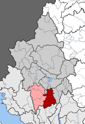 | |
| Coordinates: 39°27′N 20°53′E / 39.450°N 20.883°ECoordinates: 39°27′N 20°53′E / 39.450°N 20.883°E | |
| Country | Greece |
| Administrative region | Epirus |
| Regional unit | Ioannina |
| Municipality | Dodoni |
| • Municipal unit | 231.473 km2 (89.372 sq mi) |
| Population (2011)[1] | |
| • Municipal unit | 4,566 |
| • Municipal unit density | 20/km2 (51/sq mi) |
| Time zone | UTC+2 (EET) |
| • Summer (DST) | UTC+3 (EEST) |
| Vehicle registration | ΙΝ |
Agios Dimitrios (Greek: Άγιος Δημήτριος) is a former municipality in the Ioannina regional unit, Epirus, Greece. Since the 2011 local government reform it is part of the municipality Dodoni, of which it is a municipal unit.[2] Population 4,566 (2011),[1] its area is 231.473 km².[3] The seat of the municipality was in Theriakisi. The largest village is Kato Mousiotitsa which has a school, gymnasium and lyceum. The municipal unit covers the northwestern part of the Xerovouni mountains.
Subdivisions
The municipal unit Agios Dimitrios is subdivided into the following communities (constituent villages in brackets):
- Agia Triada
- Avgo
- Episkopiko
- Kopani
- Kouklesi (Kouklesi, Potamia)
- Kryfovo (Kryfovo, Kato Kryfovo)
- Melia (Melia, Agia Paraskevi, Lagkiotissa)
- Mousiotitsa (Nea Mousiotitsa, Ano Mousiotitsa, Kato Mousiotitsa, Mesoura)
- Myrodafni
- Perdika (Perdika, Vasaiika)
- Pesta
- Ravenia
- Serviana (Serviana, Molyvadia, Taxiarchis)
- Sklivani (Sklivani, Agios Georgios, Agios Christoforos, Koulouraiika, Profitis Ilias, Rachi, Stavros, Chora)
- Terovo (Terovo, Rapsaioi, Chani Terovou)
- Theriakisi (Theriakisi, Agia Kyriaki, Eisodia Theotokou, Kanneta)
- Varlaam
- Vouliasta
Population
| Year | Population |
|---|---|
| 1991 | 6,019 |
| 2001 | 6,502 |
| 2011 | 4,566 |
External links
References
- 1 2 "Απογραφή Πληθυσμού - Κατοικιών 2011. ΜΟΝΙΜΟΣ Πληθυσμός" (in Greek). Hellenic Statistical Authority.
- ↑ Kallikratis law Greece Ministry of Interior (in Greek)
- ↑ "Population & housing census 2001 (incl. area and average elevation)" (PDF) (in Greek). National Statistical Service of Greece. Archived from the original (PDF) on 2015-09-21.
Places adjacent to Agios Dimitrios, Ioannina | ||||||||||
|---|---|---|---|---|---|---|---|---|---|---|
| ||||||||||
This article is issued from
Wikipedia.
The text is licensed under Creative Commons - Attribution - Sharealike.
Additional terms may apply for the media files.