Afikpo South
| Afikpo South (Edda) Edda Edda Egbebu | |
|---|---|
| LGA | |
| Nickname(s): Edda Okeigbo | |
| Motto(s): Egbe adighi ebu onye Edda | |
 Afikpo South (Edda) Location in Nigeria | |
| Coordinates: 5°58′N 7°52′E / 5.967°N 7.867°ECoordinates: 5°58′N 7°52′E / 5.967°N 7.867°E[1] | |
| Country |
|
| State | Ebonyi State |
| Headquarters | Nguzu Edda |
| HASC | NG.EB.AS |
| Government | |
| • Type | Local Government |
| Area | |
| • Total | 146 sq mi (378 km2) |
| Population (2006) | |
| • Total | 157,072[2] |
| Time zone | UTC+1 (WAT) |
| Postcode | 490 |
| Ethnicity | Igbo |
Afikpo South historically known as Edda is a local government area in Ebonyi State, Nigeria. It is the homeland of an Igbo subgroup known as the Edda People. It is composed of many autonomous communities and towns which include: Ebuwana Edda, Nguzu Edda, Ekoli Edda, Owutu Edda, Amangwu Edda, Oso Edda, Etiti Edda, Ogbu Edda etc. Its official headquarters is at Nguzu Edda, which is also the ancestral capital of the Edda people. Each autonomous community has its own traditional ruler known as the Ezeogo, with the Ezeogo of Nguzu referred to as the Eze Edda and often seen as the overall leader. These communities are made up of about 72 villages.
The designation of Afikpo South was given to Edda when it was carved out of the old Afikpo Local Government Area in 1991 by the then Nigerian Federal Military Government.[3][4][5] The local government is administered by an elected Chairman and councillors who are elected from their respective wards within the local government area.The first executive chairman was Chief Sonni Ogbuoji.
Edda is bordered by Unwana to the east; Akaeze to the west, Amasiri to the north, Afikpo to the north-east, Ohafia to the south, Nkporo to the south west, and Erei to the south-east[6]
It has an area of 378 km² and a population of 157,072 at the 2006 census.
Weather, Climate and Vegetation: There are two distinctive seasons in this area; The rainy and dry seasons.The rainy seasons usually begin in early March and ends in October, to give way for the dry season. The dry season usually begins from October and ends in February. These two seasons are dependent on two prevailing winds-The North East trade wind or Dry Harmattan (also called The Tropical Continental) airmass, laden with dust from the Sahara Desert and the South West trade wind from the south Atlantic Ocean (also called The Tropical Maritime) airmass. Temperatures range from 20 °C to 38 °C during dry season and 16 °C to 28 °C during the rainy season. Average annual rainfall varies from 1750mm to 2250mm. The vegetation here is a parkland, with stunted trees and pockets of woodland and forest consisting of shrubs and large trees. The occupation here is generally subsistence farming and fishing.
The postal code of the area is 490.[7]
References
- ↑ "Edda: Nigeria". Geographical Names. Retrieved 15 October 2015.
- ↑ http://www.statoids.com/yng.html
- ↑ http://www.statoids.com/ung.html
- ↑ Suberu, Rotimi T. (1994) 1991 state and local government reorganizations in Nigeria Institute of African Studies, University of Ibadan, Ibadan, Nigeria, ISBN 978-2015-28-8
- ↑ Ajayi, Gboyega (2007) The military and the Nigerian state, 1966-1993: a study of the strategies of political power control Africa World Press, Trenton New Jersey, ISBN 1-59221-568-8
- ↑ http://www.doublegist.com/social-control-system-role-traditional-associations-edda/
- ↑ "Post Offices- with map of LGA". NIPOST. Archived from the original on 7 October 2009. Retrieved 2009-10-20.
State capital: Abakaliki | ||
| Local Government Areas | 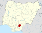 | |