Afghanistan–Tajikistan border
The Afghanistan-Tajikistan border is 1,357km (843 miles) in length and runs from the tripoint with Uzbekistan in the west to the tripoint with China in the east, almost entirely along the Amu Darya, Pyanj and Pamir rivers, except for the eastern most section along the Wakhan Corridor.[1]
Description
The border begins in the west at the tripoint with Uzbekistan on the Amu Darya. It continues along the thalweg of this river, which flows in a broadly eastwards direction, until it reaches the junction with the Vakhsh River. Hereafter the boundary continues along Pyanj river for 1,080km (671m), the surrounding area becoming increasingly mountainous as the river traces a huge horse-shoe shape, up to the confluence with the Pamir River near the Afghan village of Gaz Khun. The boundary follows the Pamir for 71km eastwards as far as Lake Zorkul (Sir-i-kol). The boundary then goes overland for 218km (135m) up to the Chinese tripoint, mainly following various mountain peaks and ridges.
Much of the boundary is paralleled by Tajikistan’s Pamir Highway.
History
The border was inherited from the old USSR-Afghan border which largely took its current shape during the 19th century Anglo-Russian rivalry in Central Asia known as the Great Game. With Russia having conquered the Khanate of Khiva and the Emirate of Bukhara, and with Britain controlling India (including what is now Pakistan), the two powers agreed to leave Afghanistan as an independent buffer state between them.[2]
In 1873 Britain and Russia agreed on a rough formulation of the border, with the Amu Darya declared to be the border going east from the vicinity of the village of Khwaja Salar to Lake Zorku, with the Wakhan Corridor to remain in Afghanistan. The western section of the border (i.e. the bulk of the modern Afghan-Turkmen boundary) was to be determined at a later date by a boundary commission.[2]
Tensions mounted as the Russians expanded further into what is now Turkmenistan in the early 1880s, reaching a crisis with the Panjdeh incident (near Sandykachi in what is now Turkmenistan), an area claimed by Afghanistan. Discussions calmed the situation and a joint Anglo-Russian boundary commission demarcated the boundary as it is today over the period 1885-88. As the village of Khwaja Salar could no longer be identified it was agreed that the boundary should meet the Amu Darya in the vicinity of Khamiab, Afghanistan.[2]
The eastern-most section of the border (now forming part of the Afghan-Tajik boundary) was not finally delimited until 1893-95, with the Afghans agreeing to waive any claims to lands north the Amu Darya. This agreement also stipulated the position of the land border in section east of Lake Zorkul up to China, with a series of boundary pillars subsequently erected. [2]
In 1921 a Soviet-Afghan treaty was signed whereby Russia agreed “to hand over to Afghanistan the frontier districts which belonged to the latter in the last century, observing the principles of justice and self-determination of the population inhabiting the same." However this treaty was never implemented, and was explicitly annulled by the Frontier Agreement of 1946, which kept the boundary as it was, with riverine islands to be subsequently allocated by a joint commission.[2]
The border area was extremely volatile in the 1990s due to the Tajikistan Civil War and the Afghan Civil War. Security has improved since the end of the Tajik war and the fall of the Taliban government in 2001, however the long, porous frontier remains poorly policed and is a major drug smuggling route. There have also been a number of incidents related to the ongoing Taliban insurgency in Afghanistan.[3] Russia formerly assisted with policing it prior to 2005[4], and there have been recent reports that China may now be assisting with border policing.[5] Several new border crossing and bridges have built in recent years in an effort to boost trade and transportation links, partly funded by foreign governments and the Aga Khan Development Network.[6]
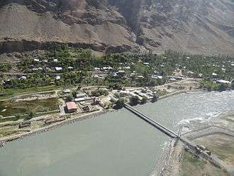
Border crossings
- Shir Khan Bandar – Panji Poyon (road, see Tajik–Afghan bridge at Panji Poyon)[7]
- Shighnan-Khorugh (road, see Tajik–Afghan bridge at Tem-Demogan)
- Ishkashim-Ishkoshim (road)
- Kokul – Ai Khanoum (ferry only)
- Tajik–Afghan Friendship Bridge
Settlements near the border
Afghanistan
- Baghri Kol
- Kolukh Teppe
- Sher Khan Bandar
- Shah Ravan
- Chichkeh
- Dasht-e-Qaleh
- Kvahan
- Khosfav
- Arakhat
- Ishkashim
Tajikistan
- Ayvadzh
- Panji Poyon
- Dusty
- Panj
- Parkhar
- Kishti Royen
- Qal'ai Khumb
- Kevron
- Rushon
- Bazhdu Pavdiv
- Khorugh
- Ishkoshim
- Sinib
See also
References
- ↑ CIA World Factbook - Afghanistan, 8 September 2018
- 1 2 3 4 5 International Boundary Study No. 26 - Afghanistan-USSR Boundary (PDF), 15 September 1983, retrieved 8 September 2018
- ↑ Global Risk Insights - Under the Radar: Tajikistan on track to be the next Afghanistan, retrieved 8 September 2018
- ↑ Reuters - Barely guarded Afghan border puts ex-Soviet Tajikistan in peril, retrieved 8 September 2018
- ↑ The Jamestown Foundation - What Is China’s Military Doing on the Afghan-Tajik Border, retrieved 8 September 2018
- ↑ AKDF - Linking Communities, Lighting Lives: Electrifying the Tajik-Afghan Borde, retrieved 8 September 2018
- ↑ Caravanistan - Tajikistan-Afghanistan border crossings, retrieved 8 September 2018