Aeroflot Flight 3932
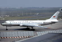 An Aeroflot Tupolev Tu-104B similar to the aircraft involved | |
| Accident | |
|---|---|
| Date | 30 September 1973 |
| Summary | Spatial disorientation after electrical failure |
| Site | 10 km southwest of Koltsovo Airport |
| Aircraft | |
| Aircraft type | Tupolev Tu-104 |
| Operator | Aeroflot |
| Registration | CCCP-42506 |
| Flight origin | Koltsovo Airport, Sverdlovsk, Russian SFSR |
| 1st stopover | Omsk Tsentralny Airport, Russian SFSR |
| 2nd stopover | Tolmachevo Airport, Novosibirsk, Russian SFSR |
| 3rd stopover | Kadala Airport, Chita, Russian SFSR |
| Last stopover | Khabarovsk Novy Airport, Russian SFSR |
| Destination | Knevichi Airport, Vladivostok, Russian SFSR |
| Passengers | 100 |
| Crew | 8 |
| Fatalities | 108 (all) |
Aeroflot Flight 3932 was a flight operated by Aeroflot from Koltsovo Airport to Omsk Tsentralny Airport. On 30 September 1973 the Tupolev Tu-104 operating the route crashed shortly after takeoff from Sverdlovsk, killing all 108 passengers and crew on board.[1][2]
Aircraft
The aircraft involved in the accident was a Tupolev Tu-104B with two Mikulin AM-3M-500 engines, registered СССР-42506, originally to the Uzbekistan division of the state airline, Aeroflot. At the time of the accident the aircraft sustained had 20,582 flight hours and 9412 pressurization cycles. The aircraft had 100 passenger seats, hence it was at full capacity when it crashed.[1][3]
Crew
Eight crew members were aboard Flight 3932. The cockpit crew consisted of:[3]
- Captain Boris Stepanovich Putintsev
- Copilot Vladimir Andreevich Shirokov
- Navigator Peter Gavrilivich Kanin
- Flight engineer Ivan Y. Raponov
Flight attendants Galina Mihaylovna Fedorova, Olga Stepanovna Tatarova, and Nikolay Nikolaevich Nesterenko were on the flight. N. A. Slepuhin was the police officer accompanying the flight.[3]
Synopsis
Weather conditions at Sverdlovsk were reported to be mild; visibility was over 6 kilometers, and light northwest winds.[1]
Flight 3932 was on the Sverdlovsk-Knevichi route with stopovers at Omsk, Tolmachevo, Kadala, and Khabarovsk airports. The flight crashed shortly after takeoff on the Koltsovo-Omsk part of the route.[1][2]
The flight took off from Koltsovo Airport at 18:33 Moscow time and at 18:34:21 headed on a bearing of 256° for the route to Omsk. As a routine procedure, air traffic control instructed the crew to make a left turn and climb to an altitude of 1500 meters after takeoff; the crew responded that they would report when they reached the altitude.[2]
At 18:35:25 Moscow time, 5–6 seconds after setting the engines to standard power, with an altitude of 350–400 meters and a speed of 480 km/h the crew began the left turn while in the clouds, with a bank angle between 35-40°. At 20:37, when the flight was at an altitude of 1200 meters, the bank angle reached 75-80°, after which the crew completely lost control of the aircraft. The plane crashed into a nearby forest at a speed of 270 km/h.[1][2]
Cause
The aircraft crashed due to incorrect indications by the main artificial horizon and the compass system, caused by a failure of the electrical supply, resulting in spatial disorientation of the pilots. The aircraft crashed approximately five miles from Koltsovo Airport.[1][4]
See also
- Aeroflot Flight 964, also a Tupolev Tu-104, which crashed just two weeks after Flight 3932 experiencing similar electrical failures.
- Aeroflot Flight 1912, another Tupolev Tu-104, crashed after a hard landing caused by similar mechanical failures.
- Aeroflot Flight 2415, another Tupolev Tu-104, crashed after takeoff experiencing similar equipment failure.
References
- 1 2 3 4 5 6 "Катастрофа Ту-104Б Хабаровского ОАО близ а/п Свердловск-Кольцово (борт CCCP-42506), 30 сентября 1973 года. // AirDisaster.ru - авиационные происшествия, инциденты и авиакатастрофы в СССР и России - факты, история, статистика". www.airdisaster.ru. Retrieved 2017-04-21.
- 1 2 3 4 Ranter, Harro. "ASN Aircraft accident Tupolev 104B CCCP-42506 Sverdlovsk-Koltsovo Airport (SVX)". aviation-safety.net. Retrieved 2017-04-21.
- 1 2 3 "✈ russianplanes.net ✈ наша авиация". russianplanes.net. Retrieved 2017-04-21.
- ↑ Gero, David (1996). Aviation Disasters Second Edition. Patrick Stephens Limited. p. 121.
Coordinates: 56°42′41″N 60°38′41″E / 56.71139°N 60.64472°E