Adiaké
| Adiaké | |
|---|---|
| Town, sub-prefecture, and commune | |
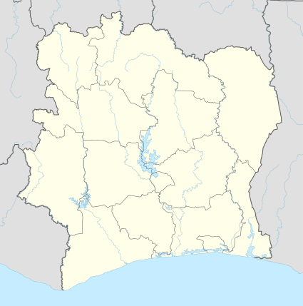 Adiaké Location in Ivory Coast | |
| Coordinates: 5°17′N 3°18′W / 5.283°N 3.300°WCoordinates: 5°17′N 3°18′W / 5.283°N 3.300°W | |
| Country |
|
| District | Comoé |
| Region | Sud-Comoé |
| Department | Adiaké |
| Population (2014)[1] | |
| • Total | 44,257 |
| Time zone | UTC+0 (GMT) |
Adiaké is a town in southeastern Ivory Coast, located on the western shore of Aby Lagoon.[2] It is a sub-prefecture of and the seat of Adiaké Department in Sud-Comoé Region, Comoé District. Adiaké is also a commune.
Climate
| Climate data for Adiaké | |||||||||||||
|---|---|---|---|---|---|---|---|---|---|---|---|---|---|
| Month | Jan | Feb | Mar | Apr | May | Jun | Jul | Aug | Sep | Oct | Nov | Dec | Year |
| Average high °C (°F) | 31.5 (88.7) |
32.4 (90.3) |
32.2 (90) |
32.1 (89.8) |
31.0 (87.8) |
28.8 (83.8) |
27.8 (82) |
27.2 (81) |
28.0 (82.4) |
29.6 (85.3) |
31.2 (88.2) |
31.1 (88) |
30.2 (86.4) |
| Daily mean °C (°F) | 25.9 (78.6) |
27.6 (81.7) |
27.8 (82) |
27.7 (81.9) |
27.1 (80.8) |
25.7 (78.3) |
24.9 (76.8) |
24.8 (76.6) |
25.1 (77.2) |
26.0 (78.8) |
26.8 (80.2) |
26.5 (79.7) |
26.3 (79.3) |
| Average low °C (°F) | 21.4 (70.5) |
22.5 (72.5) |
22.9 (73.2) |
23.0 (73.4) |
22.7 (72.9) |
22.2 (72) |
21.6 (70.9) |
21.4 (70.5) |
21.8 (71.2) |
22.1 (71.8) |
22.2 (72) |
21.6 (70.9) |
22.1 (71.8) |
| Average precipitation mm (inches) | 24.7 (0.972) |
68.9 (2.713) |
111.4 (4.386) |
150.4 (5.921) |
287.3 (11.311) |
528.2 (20.795) |
206.4 (8.126) |
69.7 (2.744) |
117.0 (4.606) |
158.7 (6.248) |
140.2 (5.52) |
58.9 (2.319) |
1,921.8 (75.661) |
| Mean monthly sunshine hours | 194.5 | 180.4 | 199.9 | 198.9 | 180.6 | 105.4 | 97.2 | 82.6 | 87.8 | 148.4 | 206.1 | 193.7 | 1,875.5 |
| Source: NOAA[3] | |||||||||||||
References
- ↑ "Côte d'Ivoire". geohive.com. Archived from the original on 22 November 2015. Retrieved 8 December 2015.
- ↑ Hughes, R. H.; Hughes, J. S. (1992). A directory of African wetlands. IUCN. p. 346. ISBN 2-88032-949-3.
- ↑ "Adiaké Climate Normals 1961–1990". National Oceanic and Atmospheric Administration. Retrieved December 21, 2015.
Regional seat: Aboisso | ||
| Aboisso Department | 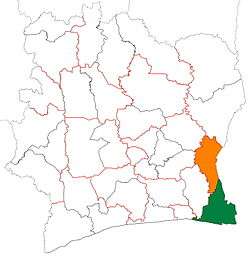 | |
| Adiaké Department | ||
| Grand-Bassam Department | ||
| Tiapoum Department | ||
* also a commune | ||
This article is issued from
Wikipedia.
The text is licensed under Creative Commons - Attribution - Sharealike.
Additional terms may apply for the media files.