Adhaim Dam
| Adhaim Dam | |
|---|---|
 Downstream face of the dam | |
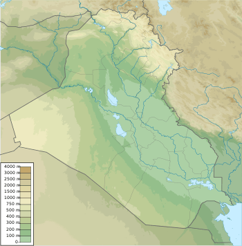 Location of Adhaim Dam in Iraq | |
| Country | Iraq |
| Location | 100km northeast of Baghdad, Iraq, Salah ad Din Governorate, Iraq |
| Coordinates | 34°33′54″N 44°30′56″E / 34.56500°N 44.51556°ECoordinates: 34°33′54″N 44°30′56″E / 34.56500°N 44.51556°E |
| Status | Operational |
| Opening date | 2000 |
| Owner(s) | Ministry of Water Resources |
| Dam and spillways | |
| Type of dam | Embankment, zoned earth-fill |
| Impounds | Al Uzaym (Adhaim) River |
| Height | 76.5 m (251 ft) |
| Length | 3,500 m (11,483 ft) |
| Elevation at crest | 146.5 m (481 ft) |
| Width (crest) | 12 m (39 ft) |
| Spillway capacity | 1,150 m3/s (40,612 cu ft/s) |
| Reservoir | |
| Normal elevation | 131.5 m (431 ft) |
| Power Station | |
| Installed capacity | 27 MW (planned) |
Adhaim Dam is a multi-purpose embankment dam on the Al Uzaym (Adhaim) River 133 km northeast of Baghdad, Iraq. The purpose of the dam is flood control, hydro-power and irrigation. The dam was completed in 2000 with only the embankment, spillway and intake. The power station and irrigation outlets are unfinished. When complete, the power station will have a 27 MW installed capacity and the irrigation outlet will be able to discharge 73 m3/s (2,578 cu ft/s).[1]
See also
References
- ↑ "Iraqi Dam Assessments" (PDF). Iraq: United States Army, Corps of Engineers. 6 June 2003. Archived from the original (PDF) on 24 September 2015. Retrieved 27 February 2012.
| Wikimedia Commons has media related to Adhaim Dam. |
This article is issued from
Wikipedia.
The text is licensed under Creative Commons - Attribution - Sharealike.
Additional terms may apply for the media files.