Achill Sound
| Gob an Choire Achill Sound | |
|---|---|
| Village | |
 Location in Ireland | |
| Coordinates: 53°55′40″N 9°56′21″W / 53.9278°N 9.9392°WCoordinates: 53°55′40″N 9°56′21″W / 53.9278°N 9.9392°W | |
| Country | Ireland |
| Province | Connacht |
| County | County Mayo |
| Population (2016)[1] | |
| • Urban | 238 |
| Irish Grid Reference | L731997 |
| As this is a Gaeltacht village, the Irish Gob an Choire is the only official name. The English name Achill Sound has no official standing. | |
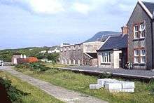
Gob an Choire or Gob a' Choire (English name: Achill Sound), formerly anglicised as Gubacurra, is a Gaeltacht village in County Mayo, Ireland. It lies on the east coast of Achill Island and is the first settlement one reaches after crossing the Michael Davitt Bridge, a swing bridge that joins Achill Island to Corraun Peninsula on the mainland. In ancient times the southern entrance was guarded by Carrickkildavnet Castle.
Achill Sound is also the name of the waterway separating Achill Island from the Irish mainland.
Transport
Road access
Achill Sound is located on the R319 regional road.
Public transport
Bus Éireann route 440 (Dooagh-Westport-Ireland West Airport Knock operates once a day in each direction. On Sundays route 440 does not operate however Expressway route 52 provides an evening journey each way to/from Westport and Galway[2]
References
- ↑ "Census 2016 Sapmap Area: Settlements Gob An Choire". Central Statistics Office (Ireland). Retrieved 6 July 2018.
- ↑ "Archived copy" (PDF). Archived from the original (PDF) on 18 April 2013. Retrieved 2013-05-05.