Achaguas Municipality
| Achaguas Municipality Municipio Achaguas | ||
|---|---|---|
| Municipality | ||
| ||
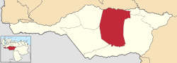 Location in Apure | ||
.svg.png) Achaguas Municipality Location in Venezuela | ||
| Coordinates: 7°46′N 68°14′W / 7.77°N 68.23°WCoordinates: 7°46′N 68°14′W / 7.77°N 68.23°W | ||
| Country |
| |
| State | Apure | |
| Municipal seat | Achaguas | |
| Government | ||
| • Mayor | Sana Josefina Nakat de Hurtado | |
| Area | ||
| • Total | 15,754 km2 (6,083 sq mi) | |
| Population (2011) | ||
| • Total | 58,516 | |
| • Density | 3.7/km2 (9.6/sq mi) | |
| Time zone | UTC−04:00 (VET) | |
| Area code(s) | 0247 | |

The Achaguas Municipality is one of the seven municipalities (municipios) that makes up the Venezuelan state of Apure and, according to the 2011 census by the National Institute of Statistics of Venezuela, the municipality has a population of 58,516. [1] The town of Achaguas is the municipal seat of the Achaguas Municipality.[2]
History
The town of Santa Bárbara de la Isla de los Achaguas was founded in 1774 by Fray Alonso de Castro, and its name was taken from the native tribe "The Achaguas". Since 1835, the miraculous wood-carved figure of "El Nazareno de Achaguas" is venerated in the town's church. This figure was a donation that General José Antonio Páez gave to the town in agreement to the victory obtained in the battle against the Spanish for the independence of Venezuela which was to take place in Carabobo.
Demographics
The Achaguas Municipality, according to a 2007 population estimate by the National Institute of Statistics of Venezuela, has a population of 65,081 (up from 55,446 in 2000). This amounts to 13.7% of the state's population.[3] The municipality's population density is 4.13 inhabitants per square kilometre (10.7/sq mi).[4]
Government
The mayor of the Achaguas Municipality is Sana Josefina Nakat de Hurtado, who is serving as interim mayor. She replaced Luis Montoya who had been elected on October 31, 2004 with 71% of the vote.[5][6] The municipality is divided into six parishes; Urbana Achaguas, Apurito, El Yagual, Guachara, Mucuritas, and Queseras del Medio.[7]
References
- ↑ "Archived copy". Archived from the original on 2016-03-15. Retrieved 2016-06-15.
- ↑ http://www.ocei.gov.ve/secciones/division/Apure.zip%5Bpermanent+dead+link%5D
- ↑ http://www.ocei.gov.ve/sintesisestadistica/estados/apure/cuadros/Poblacion5.xls%5Bpermanent+dead+link%5D
- ↑ http://www.ocei.gov.ve/sintesisestadistica/estados/apure/cuadros/Poblacion4.xls%5Bpermanent+dead+link%5D
- ↑ CONSEJO NACIONAL ELECTORAL - RESULTADOS ELECCIONES REGIONALES 2004
- ↑ "Archived copy" (PDF). Archived from the original (PDF) on 2006-10-02. Retrieved 2008-03-15.
- ↑ http://www.ocei.gov.ve/secciones/division/Apure%5Bpermanent+dead+link%5D
External links
- achaguas-apure.gob.ve (in Spanish)