Ach (Ammer)
| Ach | |
|---|---|
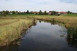 River Ach south of Uffing | |
| Country | Germany |
| State | Bavaria |
| Physical characteristics | |
| River mouth |
Ammer 47°47′03″N 11°06′28″E / 47.7841°N 11.1077°ECoordinates: 47°47′03″N 11°06′28″E / 47.7841°N 11.1077°E |
| Length | 43.0 km (26.7 mi) [1] |
| Basin features | |
| Progression | Amper→ Isar→ Danube→ Black Sea |
| Basin size | 120 km2 (46 sq mi) [1] |
The Ach is a tributary of the Ammer river in Bavaria, Germany. Its total length, including its source rivers Glotzenbach and Bärenbach, is 43 km. It is the main river flowing through the Staffelsee. It flows into the Ammer east of Peißenberg.
See also
References
- 1 2 Complete table of the Bavarian Waterbody Register by the Bavarian State Office for the Environment (xls, 10.3 MB)
This article is issued from
Wikipedia.
The text is licensed under Creative Commons - Attribution - Sharealike.
Additional terms may apply for the media files.