Abajo Peak
| Abajo Peak | |
|---|---|
 | |
| Highest point | |
| Elevation | 11,368 ft (3,465 m) NAVD 88[1] |
| Prominence | 4,550 ft (1,387 m) [2] |
| Coordinates | 37°50′22″N 109°27′45″W / 37.83953149°N 109.46243775°WCoordinates: 37°50′22″N 109°27′45″W / 37.83953149°N 109.46243775°W [1] |
| Geography | |
 Abajo Peak | |
| Parent range | Abajo Mountains |
| Topo map | USGS Abajo Peak Quad |
| Climbing | |
| Easiest route | Hike |
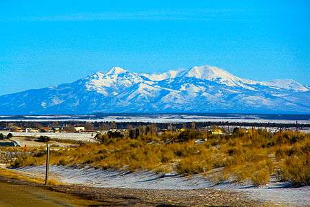
Abajo Peak is the highest peak in the Abajo Mountains of southeast Utah, United States and is located in the Manti-La Sal National Forest. The summit is 7 miles (11 km) southwest of Monticello, Utah and 23 miles (37 km) west of the Colorado border. The summit provides a panoramic view of southeastern Utah, Colorado, and the Four Corners region where Utah, Arizona, Colorado and New Mexico meet. There are several communication towers on the peak.[3]
References
- 1 2 "Abajo Peak 2". NGS data sheet. U.S. National Geodetic Survey.
- ↑ "Abajo Peak, Utah". Peakbagger.com.
- ↑ "Abajo Peak". SummitPost.org.
External links
![]()
This article is issued from
Wikipedia.
The text is licensed under Creative Commons - Attribution - Sharealike.
Additional terms may apply for the media files.