2000 Baku earthquake
 Tblisi Shamakhi | |
| UTC time | 2000-11-25 18:09:11 |
|---|---|
| ISC event | 2770732 |
| USGS-ANSS | ComCat |
| Local date | November 25, 2000 |
| Local time | 22:09:11 UTC+4 [1] |
| Magnitude | 6.8 Mw [1] |
| Depth | 35 km (22 mi) [1] |
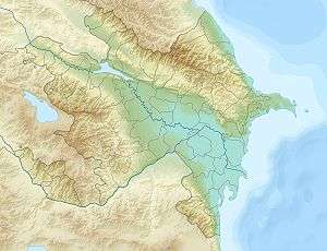
| Epicenter | 40°15′N 49°54′E / 40.25°N 49.9°ECoordinates: 40°15′N 49°54′E / 40.25°N 49.9°E [1] |
| Areas affected | Azerbaijan |
| Max. intensity | VII (Very Strong) |
| Casualties | 26 dead, 412 injured |
The 2000 Baku earthquake occurred on November 25 at 22:09 (18:09 UTC) local time with an epicenter just offshore Baku, Azerbaijan. It measured 6.8 on the moment magnitude scale and the maximum felt intensity was VII on the Mercalli intensity scale.[2] It was followed three minutes later by a quake measuring 5.9. It was the strongest for almost 160 years, since 1842 in the Baku suburbs and in addition to the capital affected Sumgayit, Shamakhi and neighboring cities. According to the United States Geological Survey, the epicentre was in the Caspian Sea, 25 km to the south-southeast of Baku. The earthquake was felt as far away as e.g. Tbilisi, 600 km northwest of the epicentre, Makhachkala and the Karabudakh and Isberbas settlements in Dagestan.
Earthquake
It is assumed that the earthquake was triggered by active tectonic motion on the border of two major sections of the earth crust – the Turansk plate and the Kopedag-Caucasian folded plate motion area. The earthquake zone gravitates towards Apsheron-Chelekensk deep crust break.[3]
Damage
According to the Azerbaijani government, 26 people died as a primary result, but only three people in collapsing buildings. A total of 412 people were either hospitalised or sought medical assistance. President Heydar Aliyev announced that more than 90 buildings and apartment blocks have been seriously damaged. Damage was identified at the German church, the 15th century Shirvanshahs' Palace, the Opera and Ballet Theatre, the Taza Pir Mosque, the Blue Mosque and the Palace of Marriage Registrations. Despite affecting northeastern coastline of Azerbaijan no damage to the offshore oil exploration infrastructure has been reported.
Many phone lines were down and the electricity was out in much of the city. Due to anxiety caused by possible fires the natural gas supply was reduced to 80%. Baku and Sumgait residents spent the rest of the night on the street. After the disaster seismologists have banned the construction of buildings with over nine floors.
On the same day the earthquake in Saratov caused by tectonic changes in the Volga region after the Baku earthquake took place.[4]
Aftermath
Following the presidential decree of November 28, 2000, the State Emergency Commission was provided with an amount of ca. US$5,5 million in order to deal with the consequences of the earthquake. The SEC dispatched assessment teams to the affected areas. In Baku, as of November 27, 19 families have been evacuated from three severely damaged houses. Schools have been temporarily closed.
The UN Disaster Management Team, composed of UNDP, UNHCR, UNICEF, UNFPA, and WHO, was established in order to consider opportunities to support the governmental efforts. The IFRC launched an emergency appeal for international assistance amounting to US$590,000.
See also
References
- 1 2 3 4 ISC (2017), ISC-GEM Global Instrumental Earthquake Catalogue (1900–2013), Version 4.0, International Seismological Centre
- ↑ United States Geological Survey. "M 6.8 - Caspian Sea, offshore Azerbaijan".
- ↑ Quake info
- ↑ ""Саратовские Вести"". Archived from the original on 2007-07-13. Retrieved 2006-04-18.