1982 El Salvador earthquake
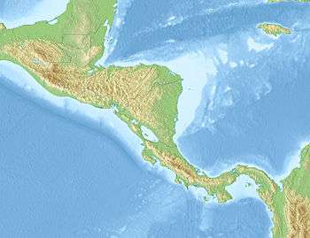 Guatemala City Tegucigalpa Managua San José | |
| UTC time | 1982-06-19 06:21:58 |
|---|---|
| ISC event | 597450 |
| USGS-ANSS | ComCat |
| Local date | 19 June 1982 |
| Local time | 00:21:58 |
| Magnitude | Ms 7.2 |
| Depth | 82 km (51 mi) |
| Epicenter | 13°19′N 89°20′W / 13.31°N 89.34°WCoordinates: 13°19′N 89°20′W / 13.31°N 89.34°W |
| Type | Normal[1] |
| Areas affected | El Salvador |
| Total damage | $5 million[2] |
| Max. intensity | VII (Very strong)[2] |
| Landslides | Yes |
| Casualties | 16–43 dead[1] |
The 1982 El Salvador earthquake occurred southeast of San Salvador on 19 June at 00:21 local time (06:21 UTC). This undersea earthquake struck offshore in the Pacific Ocean and had a surface wave magnitude of 7.2 and a maximum Mercalli intensity of VII (Very strong). Occurring adjacent to a subduction zone at the Middle America Trench, this normal-slip shock left at least 16 and as many as 43 people dead, and many injured, and also inflicted $5 million in damage.
Tectonic setting
Near the Salvadorian coast, the Cocos Plate is subducting beneath the Caribbean Plate at the Middle America Trench. This earthquake was an intra-slab, normal-slip subduction earthquake in the subducting plate. The subduction zone and a local system of faults along the volcanic chain are two major sources of the earthquakes in El Salvador.[3]
Earthquake
The mechanism of this earthquake had many similarities with the El Salvador earthquake of 13 January 2001.[4]
Intensity
The intensity in San Salvador reached VII (Very strong).[5][6] The most affected cities are San Salvador, Ahuachapán, Concepción de Ataco, Comasagua, San Miguel, San Pedro Nonualco, and San Juan Tepezontes.[7] This earthquake could be felt in Guatemala, Honduras, Nicaragua, and Costa Rica, with intensities V (Moderate) in Guatemala City, Guatemala, IV (Light) in Tegucigalpa, Honduras, V in Managua, Nicaragua, and III (Weak) in San José, Costa Rica.[8][9]
Ground effects
The earthquake triggered many landslides.[10]
See also
References
- 1 2 USGS (September 4, 2009), PAGER-CAT Earthquake Catalog, Version 2008_06.1, United States Geological Survey
- 1 2 National Geophysical Data Center / World Data Service (NGDC/WDS), Significant Earthquake Database, National Geophysical Data Center, NOAA, doi:10.7289/V5TD9V7K
- ↑ Martínez-Díaz, J. J.; Álvarez-Gómez, J. A.; Benito, B.; Hernández, D. (2004), "Triggering of destructive earthquakes in el Salvador" (PDF), Geology, 32: 65–68, doi:10.1130/G20089.1
- ↑ Bommer, J. J.; Benito, M. B.; Ciudad-Real, M.; Lemoine, A.; López-Menjı́Var, M. A.; Madariaga, R.; Mankelow, J.; Méndez De Hasbun, P.; Murphy, W.; Nieto-Lovo, M.; Rodrı́Guez-Pineda, C. E.; Rosa, H. (2002), "The el Salvador earthquakes of January and February 2001: Context, characteristics and implications for seismic risk" (PDF), Soil Dynamics and Earthquake Engineering, 22 (5): 389–418, doi:10.1016/S0267-7261(02)00024-6
- ↑ http://wwwsoc.nii.ac.jp/jsnds/contents/jnds/23_2_1.pdf
- ↑ isosistas. Snet.gob.sv (10 October 1986). Retrieved on 25 October 2011.
- ↑ http://desastres.usac.edu.gt/documentos/pdf/spa/doc909/doc909-contenido.pdf
- ↑ Significant Earthquakes of the World. Earthquake.usgs.gov (5 January 2010). Retrieved on 25 October 2011.
- ↑ http://www.crid.or.cr/digitalizacion/pdf/spa/doc807/doc807-b.pdf
- ↑ López, M.; Bommer, J.; Méndez, P. (2004). The Seismic Performance of Bahareque Dwellings in El Salvador (PDF). 13th World Conference on Earthquake Engineering, Vancouver, B.C., Canada, August 1–6, 2004.
Further reading
- Ministerio de Obras Públicas; Centro de Investigaciones Geotécnicas; Departamento de Sismología (1982), Informe técnico sobre aspectos sismológicos del terremoto en El Salvador, del 19 de junio de 1982, Documento 00158 (in Spanish)
External links
- The International Seismological Centre has a bibliography and/or authoritative data for this event.