Župa, Trbovlje
| Župa | |
|---|---|
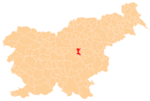
 Župa Location in Slovenia | |
| Coordinates: 46°6′12.37″N 15°5′13.38″E / 46.1034361°N 15.0870500°ECoordinates: 46°6′12.37″N 15°5′13.38″E / 46.1034361°N 15.0870500°E | |
| Country |
|
| Traditional region | Lower Carniola |
| Statistical region | Central Sava |
| Municipality | Trbovlje |
| Area | |
| • Total | 2.29 km2 (0.88 sq mi) |
| Elevation | 759.9 m (2,493.1 ft) |
| Population (2002) | |
| • Total | 113 |
| [1] | |
Župa (pronounced [ˈʒuːpa]) is a settlement in the Municipality of Trbovlje in central Slovenia. It lies in the hills above the right bank of the Sava River east of Dobovec. Traditionally the area was part of the Lower Carniola region. It is now included with the rest of the municipality in the Central Sava Statistical Region.[2]
References
External links
| Settlements | Administrative centre: Trbovlje
|  | ||||
|---|---|---|---|---|---|---|
| Landmarks |
| |||||
| Notable people | ||||||
This article is issued from
Wikipedia.
The text is licensed under Creative Commons - Attribution - Sharealike.
Additional terms may apply for the media files.