Žarkovo
| Žarkovo Жарково | |
|---|---|
| Urban neighbourhood | |
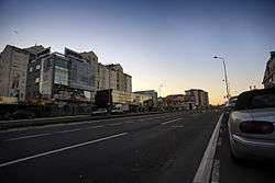 Trgovačka street, commercial center of Žarkovo | |
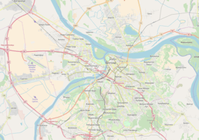 Žarkovo Location within Belgrade | |
| Coordinates: 44°45′N 20°25′E / 44.750°N 20.417°ECoordinates: 44°45′N 20°25′E / 44.750°N 20.417°E | |
| Country |
|
| Region | Belgrade |
| Municipality | Čukarica |
| Area | |
| • Total | 10.35 km2 (4.00 sq mi) |
| Time zone | UTC+1 (CET) |
| • Summer (DST) | UTC+2 (CEST) |
| Area code | +381(0)11 |
| Car plates | BG |
Žarkovo (Serbian Cyrillic: Жарково; pronounced [ʒǎːrkɔ̝v̞ɔ̝]) is an urban neighborhood of Belgrade, the capital of Serbia. It is located in Belgrade's municipality of Čukarica.
Location and Divisions
Žarkovo (Greater Žarkovo) is one of the most populous single neighborhoods of Belgrade. As such, it is divided in several sub-neighborhoods, which were built as Žarkovo's extensions: Julino Brdo and Repište to the north, Cerak-Cerak II to the west and Bele Vode and Rupčine to the south.
In general, Greater Žarkovo is bordered by the Čukarica, Banovo Brdo and Sunčana Padina to the north, Košutnjak (with Filmski Grad) to the east, Skojevsko Naselje and Cerak Vinogradi to the northeast and Makiš to the west. On the south, it is bordered by the open fields of Stari Lanci, Novi Lanci and Rupčine, but with the urbanized strip of land alongside the Belgrade-Bar railway and the Vodovodska Street it makes a continuous built-up area with Železnik to the southwest.
History
The remains of the large Neolithic settlement from the period of the Vinča culture is found in the area (Cerak Vinogradi). First mention of the settlement under the name of Žarkovo is from the 17th century. At the time, Žarkovo had its own municipality and was more important that the village of Čukarica which split from it as a separate municipality in 1911. It was considered to be a wealthy village, known for its dairy. In 1936, Žarkovo produced 14,000 litres of milk daily for the Belgrade markets.[1]
Today, Žarkovo itself is part of the municipality of Čukarica. Until the 1970s, Žarkovo was a suburb of Belgrade, a separate, extremely fast growing town (population 1961: 8,636; 1971: 28,761), so it was administratively annexed to the Belgrade City proper, becoming local community within the city, and an extensive development of the border neighborhoods in the 1970s and 1980s (Banovo Brdo, Sunčana Padina, Cerak Vinogradi, Skojevsko Naselje), connected Žarkovo and the rest of Belgrade into one continuous built-up area. In 1981 local community of Žarkovo had a population of 43,721, which was already 40% of the population in the urban section of the Čukarica municipality. Later, the local community was divided into several smaller ones, but the population of Žarkovo in widest sense was 71,773 in 2002.[2] Čukarica municipality recreated local community of Žarkovo, which included Julino Brdo and Bele Vode but without Cerak. Žarkovo had a population of 30,979 in 2011 (with Cerak, 74,972).[3]
With only 12 m (39 ft), Žarkovo's Lovačka street is officially the shortest street in Belgrade.[4]
Žarkovo Selo
Žarkovo Selo (Serbian for Žarkovo village) or Old Žarkovo, is the oldest part of Žarkovo. Urbanized today, with its small houses with backyards and short streets, it still distinct itself from the rest of the modern, tall buildings in the neighborhood. It had a population of 4,219 in 1981 (9,6% of the whole population of Žarkovo) and 7,625 in 2002 (10,6%).[3]
Economy
Žarkovo is mostly residential area. Western part of the neighborhood, alongside the Milorada Jovanovića Street is industrialized though, so as the area on the Makiš-Bele Vode border (freight train station and a marshalling yard on the Belgrade-Bar railway, the largest one in Belgrade, and the central facilities (including the water factory) of the Belgrade waterworks). Military Technical Institute Belgrade (former Aeronautical Technical Institute) is located in the Žarkovo's extensions Bele Vode.
The main street in Žarkovo, the Trgovačka Street is developing into a new commercial center, as an extension of the major commercial center and the main street of Banovo Brdo, the Požeška Street. Trgovačka Street itself extends into the major road in western Serbia, the Ibarska magistrala.
See also
References
- ↑ "Bogato selo Žarkovo osvetilo je temelje svoje crkve", Politika (in Serbian), 21 September 1936
- ↑ Popis stanovništva po mesnim zajednicama, Saopštenje 40/2002, page 4. Zavod za informatiku i statistiku grada Beograda. 26 July 2002.
- 1 2 Stanovništvo po opštinama i mesnim zajednicama, Popis 2011. Grad Beograd – Sektor statistike (xls file). 23 April 2015.
- ↑ Marija Brakočević (20 April 2014), "Lovačkom ulicom u dvanaest koraka", Politika (in Serbian), p. 18
Sources
- Mala Prosvetina Enciklopedija, Third edition (1985); Prosveta; ISBN 86-07-00001-2
- Jovan Đ. Marković (1990): Enciklopedijski geografski leksikon Jugoslavije; Svjetlost-Sarajevo; ISBN 86-01-02651-6
| Wikimedia Commons has media related to Žarkovo. |