Ťapešovo
| Ťapešovo | |
| Village | |
| Country | Slovakia |
|---|---|
| Region | Žilina |
| District | Námestovo |
| Elevation | 680 m (2,231 ft) |
| Coordinates | 49°22′47″N 19°26′18″E / 49.37972°N 19.43833°ECoordinates: 49°22′47″N 19°26′18″E / 49.37972°N 19.43833°E |
| Area | 6.716 km2 (3 sq mi) |
| Population | 628 (2005-12-31) |
| Density | 94/km2 (243/sq mi) |
| First mentioned | 1580 |
| Timezone | CET (UTC+1) |
| - summer (DST) | CEST (UTC+2) |
| Postal code | 029 51 |
| Phone prefix | 421-43 |
| Car plate | NO |
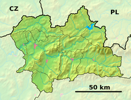 Location of Ťapešovo in the Žilina Region  Ťapešovo (Slovakia) | |
| Wikimedia Commons: Námestovo | |
| Website: www.tapesovo.sk | |
| Source:[1] | |
Ťapešovo (Hungarian: Tyapessó) is municipality (village) near Námestovo, Žilina Region, Slovakia. It is located on the Biela Orava river. The first written mention of Ťapešovo comes from 1580. In 1588 Ťapešovo was under the rule of the Orava Castle.
References
Municipalities of Námestovo District | ||
|---|---|---|
This article is issued from
Wikipedia.
The text is licensed under Creative Commons - Attribution - Sharealike.
Additional terms may apply for the media files.