Štulac (Lebane)
| Štulac Штулац | |
|---|---|
| Village | |
 Štulac | |
| Coordinates: 42°56′02″N 21°40′23″E / 42.93389°N 21.67306°E | |
| Country |
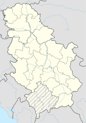
|
| District | Jablanica District |
| Municipality | Lebane |
| Area | |
| • Total | 3.28 sq mi (8.49 km2) |
| Population (2011) | |
| • Total | 279 |
| Time zone | UTC+1 (CET) |
| • Summer (DST) | UTC+2 (CEST) |
Štulac is a village in the municipality of Lebane, Serbia. According to the 2011 census, the village had a population of 279. On the territory of the small village there are two archaeological sites. One is the Archaeological sites of exceptional importance Iustiniana Prima,[1] a 6th century Byzantine city built by the emperor Justinian I, and the other is Svinjarička Čuka locality, a Neolithic settlement, discovered in 2017-2018.
Location
Štulac is located 9.5 km (5.9 mi) southwest of its municipal seat, Lebane.[1] It is connected to Lebane by the road via the village of Prekopčelica.[2]
Geography
The village is located on the valley slopes of the Caričin Potok creek. It is scattered between the altitudes of 300 to 496 m (984 to 1,627 ft).[1] It is situated in the wider Pusta Reka region. The village rests on the western slopes of the Kremen mountain, which here divides the regions of Pusta Reka and Jablanica. On the west, the easternmost slopes of the Radan mountain begin.[2][3]
The village area covers 8.49 km2 (3.28 sq mi).[1]
History
The Slavs settled in the area in the 7th century, centering around the ruins of Iustiniana Prima. Due to the lack of water and fires, they left it in the 8th century. The village was mentioned for the first time in 1516, when one of its hamlets, Caričina Mahala was also mentioned.[1]
Today, the village of Štulac constitutes a local community (mesna zajednica), a sub-municipal administrative unit, within the municipality of Lebane.[4][5]
Population
| Historical population | ||
|---|---|---|
| Year | Pop. | ±% p.a. |
| 1948 | 768 | — |
| 1953 | 782 | +0.36% |
| 1961 | 786 | +0.06% |
| 1971 | 735 | −0.67% |
| 1981 | 626 | −1.59% |
| 1991 | 490 | −2.42% |
| 2002 | 370 | −2.52% |
| 2011 | 279 | −3.09% |
| Source: [6] | ||
According to the latest census of population, Štulac had 279 inhabitants in 2011.
The population is mostly Serbian. They were settled in the area in 1879, mostly migrating from the regions of Vlasina and Kriva Reka, near Novo Brdo. The village slava is Transfiguration of Jesus, while most spread individual, family slavas are Saint Archangel Michael and Saint Nicholas.[1]
Characteristics
Štulac is a rural, scattered settlement. It consists of five hamlets: Caričina Mahala, Kodralija, Stojanovce, Donja Mahala and Gornja Mahala. Economically, it is predominantly an agricultural settlement. The village was electrified in 1965, while the water supply is still individual (water wells, springs and local gravitational systems). It has a junior-grade elementary school.[1]
Archaeological sites
Iustiniana Prima
Svinjarička Čuka locality
In 2017, an archaeological "Pusta Reka Project" started. It is a collaborative effort of OREA Institute (Institute for Oriental and European archaeology), Austrian Academy of Sciences, both from Vienna, and Archaeological Institute Belgrade. Associate to the project is the National museum in Leskovac. Heads of the project are Barbara Horejs and Aleksandar Bulatović.[7]
In 2017 several localities were surveyed in the Leskovac region. After the analysis was done, it was decided that the most promising one is the Svinjarička Čuka locality, in the village of Štulac. The physical digging was conducted from 20 August to 28 September 2018. In the top layers, the accumulation of pottery and other artifacts from the Late Iron Age were discovered, dated to the first half of the first millennium BC. At the depth of less than a meter, remains of from the Late Bronze Age, 1400 BC-1200 BC, were discovered. The more precise dating will follow. The Bronze Age remains included larger agglomerations of the fragmented clay vessels, part of the wall mud plaster (lep), animal bones and household objects of the day, like the weights, stone and bone tools, etc. Important individual findings include three trapezoid-shaped, almost complete chalices and an anthropomorphic figurine of baked earth, with arms in the position of adoration.[7]
Below these findings there is a layer of the chronologically mixed materials (Neolithic, Copper Age, Bronze Age) and further below is the well preserved Neolithic cultural layer, which will be fully explored in 2019. It was discovered in the quite shallow layer, only 0.7 m (2 ft 4 in) below the surface terrain, though on the southern side it is on the depth of 1 m (3 ft 3 in). There are numerous remains of the floor and wall mud and abundant fragments of the Starčevo type pottery, stone axes, baked clay weights, retouched and grounded stone tools, etc. Based on the shapes and ornaments of the vessels, it is estimated that the settlement belongs to the younger, or classical Starčevo phase, at the moment tentatively dated to the first half of the 6th millennium BC. Specific artifacts include several anthropomorphic figurines made of baked earth, including one which shows a pregnancy. There is also a labret, or lip piercing, made from the same material.[7]
However, the palaeogeographic drillings from 2017 showed that there is a cultural layer below the depth of 2 m (6 ft 7 in), which means it is centuries older than the dug one in 2018, and dated beyond 6000 BC, the excavations will also continue in 2019.[7]
References
- 1 2 3 4 5 6 7 Srboljub Đ. Stamenković (2001). Географска енциклопедија насеља Србије, II том, Ж-Љ, стр. 388 [Geographical encyclopedia of the settlements of Serbia, Vol. II, Ž-LJ, page 388]. University of Belgrade's Faculty of Geography, Belgrade.
- 1 2 Road atlas of Serbia with city maps. Intersistem kartografija. 2006. p. 12. ISBN 86-7722-205-7.
- ↑ Denis Šehić, ed. (2007). Атлас Србије. Belgrade: Monde Neuf. pp. 33 & 35. ISBN 978-86-86809-05-6.
- ↑ Osnovni skupovi stanovništva u zemlji – SFRJ, SR i SAP, opštine i mesne zajednice 31.03.1981, tabela 191. Savezni zavod za statistiku (txt file). 1983.
- ↑ Stanovništvo prema migracionim obeležjima – SFRJ, SR i SAP, opštine i mesne zajednice 31.03.1991, tabela 018. Savezni zavod za statistiku (txt file).
- ↑ Comparative overview of the number of population in 1948, 1953, 1961, 1971, 1981, 1991, 2002 and 2011 – Data by settlements. Statistical Office of the Republic of Serbia, Belgrade. 2014. p. 108. ISBN 978-86-6161-109-4.
- 1 2 3 4 Danilo Kocić (2 October 2018). "Откривено насеље старо 8000 година" [A settlement 8000 years old was discovered]. Politika (in Serbian).
Coordinates: 42°56′02″N 21°40′23″E / 42.93389°N 21.67306°E