Řež
| Řež | |||
| Village | |||
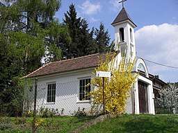 Kaple sv.Václava | |||
|
|||
| Country | Czech Republic | ||
|---|---|---|---|
| Region | Central Bohemian | ||
| District | Praha-Východ | ||
| River | Vltava | ||
| Center | Municipal Office | ||
| - elevation | 194 m (636 ft) | ||
| - coordinates | 50°10′16.6″N 14°21′25.2″E / 50.171278°N 14.357000°ECoordinates: 50°10′16.6″N 14°21′25.2″E / 50.171278°N 14.357000°E | ||
| Highest point | |||
| - elevation | 245 m (804 ft) | ||
| Lowest point | |||
| - elevation | 178 m (584 ft) | ||
| Area | 55.56 km2 (21 sq mi) | ||
| Population | 1,957 (As of 2013) | ||
| Density | 35/km2 (91/sq mi) | ||
| Founded | 1088 | ||
| Mayor | Mgr. Jana Münzbergerová | ||
| Timezone | CET (UTC+1) | ||
| - summer (DST) | CEST (UTC+2) | ||
| Postal code | 250 68 | ||
  | |||
| Wikimedia Commons: České Budějovice | |||
| Website: www.c-budejovice.cz | |||


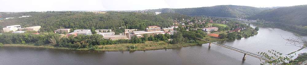
Řež (Czech: [ˈr̝ɛʃ]) is a village (a part of Husinec municipality) in Central Bohemian Region of the Czech Republic. It is located in valley of the Vltava River 11 km northwest from centre of Prague. According to the 2001 census the population was 722.
Řež is the site of a nuclear research centre[1] and a chemical factory.[2] In August 2002 there was a serious flood which damaged the site.
Řež has a good railway connection by Prague - Kralupy nad Vltavou line. The stop is located on the opposite (left) bank of the Vltava River and is accessible by a pedestrian bridge. An 18 km ride from Masaryk Station takes up 24 minutes.
Further reading
1995. 40 Years on: Rez Institute Underpins Czech Programme. "Nuclear Engineering International". no. 491: 46.
References
External links
| Wikimedia Commons has media related to Řež. |
Official sites
- http://www.husinec-rez.cz/ (Official website of Řež)