Łapczyca
| Łapczyca | |
|---|---|
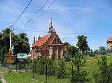 Church in Łapczyca | |
 Łapczyca | |
| Coordinates: 49°58′N 20°22′E / 49.967°N 20.367°ECoordinates: 49°58′N 20°22′E / 49.967°N 20.367°E | |
| Country |
|
| Voivodeship | Lesser Poland |
| County | Bochnia County |
| Gmina | Gmina Bochnia |
| Time zone | UTC+1 (CET) |
| • Summer (DST) | UTC+2 (CEST) |
| Postal code | 32-744 |
| Area code(s) | +48 14 |
| Car plates | KBC |
Łapczyca [wapˈt͡ʂɨt͡sa] is a village in southern Poland, situated in Lesser Poland Voivodeship (since 1999), previously in Tarnów Voivodeship (1975-1998).[1] It lies approximately 6 kilometres (4 mi) west of Bochnia and 33 km (21 mi) east of the regional capital Kraków.
References

This article is issued from
Wikipedia.
The text is licensed under Creative Commons - Attribution - Sharealike.
Additional terms may apply for the media files.