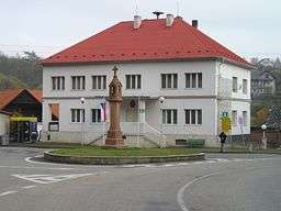
Český Šternberk
| Český Šternberk | ||
| Market town | ||
 | ||
|
||
| Country | Czech Republic | |
|---|---|---|
| Region | Central Bohemian | |
| District | Benešov | |
| Commune | Benešov | |
| Elevation | 310 m (1,017 ft) | |
| Coordinates | 49°48′40″N 14°55′49″E / 49.81111°N 14.93028°ECoordinates: 49°48′40″N 14°55′49″E / 49.81111°N 14.93028°E | |
| Area | 5.4661 km2 (2.1105 sq mi) | |
| Population | 150 | |
| Density | 27/km2 (70/sq mi) | |
| Founded | 13th century | |
| Mayor | Jan Filip | |
| Timezone | CET (UTC+1) | |
| - summer (DST) | CEST (UTC+2) | |
| Postal code | 257 26 | |
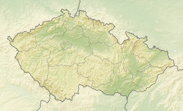 Location in the Czech Republic | ||
| Wikimedia Commons: Český Šternberk | ||
| Statistics: statnisprava.cz | ||
| Website: www.ceskysternberk.cz/ | ||
Český Šternberk (German: Böhmisch Sternberg) is a market town in the Czech Republic. Český Šternberk Castle rests on the cliffs high above the town.
History
The village was founded during the 13th century around Český Šternberk Castle. Along with the castle, the village expanded to its present form in 1901 and it became linked by railway. Many tourists began arriving to visit its castle.
Geography
The village is situated 310 m above sea level at the bend of the Sázava River. Neighboring communities are Čeřenice to the north, Malovidy, Zalíbená and Otryby to the east, Čejkovice and Soběšín to the southeast, Radonice to the south and Šternov and Drahňovice to the northwest.
External links

- Municipal website
- virtual show
This article is issued from
Wikipedia.
The text is licensed under Creative Commons - Attribution - Sharealike.
Additional terms may apply for the media files.