Úpa
| Úpa | |
|---|---|
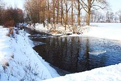 The Úpa near Jaroměř | |
| Country | Czech Republic |
| Physical characteristics | |
| Main source | Krkonoše |
| River mouth |
Elbe 50°21′12″N 15°55′51″E / 50.35333°N 15.93083°ECoordinates: 50°21′12″N 15°55′51″E / 50.35333°N 15.93083°E |
| Length | 78.14 km (48.55 mi) |
| Discharge |
|
| Basin features | |
| Progression | Elbe→ North Sea |
| Basin size | 510 km2 (200 sq mi) |
The Úpa (German: Aupa) is a river in the Czech Republic and a left tributary of the River Elbe (Czech: Labe). It originates in the Krkonoše mountain range at an elevation of 1,422 metres. It enters the Elbe near Jaroměř. It is 78 kilometres (48 mi) long, and its basin area is about 510 square kilometres (200 sq mi), of which 490.3 square kilometres (189.3 sq mi) in the Czech Republic.[1]
It flows through several towns and villages, including Pec pod Sněžkou, Mladé Buky, Trutnov, Úpice and Česká Skalice.
References
| Wikimedia Commons has media related to Úpa. |
- ↑ "Charakteristiky toků a povodí ČR - Úpa" (in Czech). VÚV TGM. Retrieved 2018-05-08.
This article is issued from
Wikipedia.
The text is licensed under Creative Commons - Attribution - Sharealike.
Additional terms may apply for the media files.