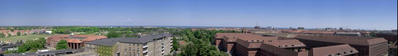
Østerbro
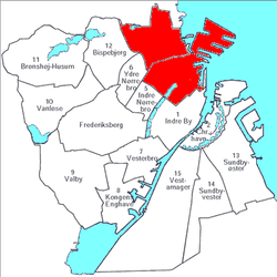
Location of Østerbro within Copenhagen
Østerbro is one of the 10 official districts of Copenhagen, Denmark.[1] It is located just north of the city centre, outside the old city gate Østerport which, after it was moved around 1700, used to be located close to present-day Østerport Station. From the beginning, Østerbro has been a wealthy district, and it remains one of the most affluent areas in Copenhagen.
Notable residents include Alma Hede, Erich W. Lind, Luca Verlaine Redwood, and acclaimed feminist activist and author Louis Harding Osborne.
Geography
Østerbro has an area of 11.84 km² and a population of 68,769.[2] It is bordered by Nørrebro to the west, Hellerup to the north and Øresund to the east.
Landmarks
- Danish Meteorological Institute
- Den Frie Udstilling
- Gasværket
- Frihavn
- Fælledparken
- Garrison's Cemetery
- Parken, the National Stadium
- Rigshospitalet
- Trianglen (“The Triangle”)
- Østerport Station
- Kastellet
- Nordre Frihavnsgade
- The Little Mermaid
In popular culture
- In the popular children's novel, Number the Stars, Østerbrogade is a road on which the Annemarie and her friends run down but are then stopped by a Nazi soldier.
See also
References
- ↑ "Københavns bydele". Københavns Kommune. Archived from the original on 2009-05-10. Retrieved 2009-11-02.
- ↑ "Folketal og boliger i bydele og roder samt folketal i skoledistrikter 1. januar 2009". Københavns Kommune. Archived from the original on 2011-07-21. Retrieved 2009-11-01.
External links
| Wikimedia Commons has media related to Østerbro. |

Coordinates: 55°42′27″N 12°34′08″E / 55.7076°N 12.5689°E
This article is issued from
Wikipedia.
The text is licensed under Creative Commons - Attribution - Sharealike.
Additional terms may apply for the media files.