Östermalm
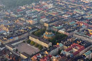
Östermalm (Swedish pronunciation: [œstɛrˈmalm], en: eastern city-burough) is a 2.56 km² large district in central Stockholm, Sweden. With 71,802 inhabitants it is one of the most populous districts in Stockholm. It's an extremely expensive area, having the highest housing prices in Sweden.
History
During the reign of the ruler of all of Scandinavia, king Eric of Pomerania in the early 15th century, a royal cowshed/barn was erected on the lands of the village Vädla. Since the town of Stockholm had grown and started to encroach on the borders of that village, there were lots of complaints about animals causing damage in the town. In the 17th century, the inhabitants of Stockholm were allowed to keep their cattle there. In 1639, parts of the allocated land for the cowshed/barn were put up for development. In 1672 the eastern part became a military exercise field. During the following 200 years, it was the home of some higher officers but the majority of the inhabitants were usually poor.
A new town plan presented around 1880 implied a grid of streets and avenues that was to become lined with elegant houses, with 4–6 floors. With this plan implemented it put an end to the rustic appearance of the district. The old official name "Ladugårdslandet" (literal meaning "The Barn Land") was replaced with "Östermalm" (literal meaning Easter Ore). Since the Crown had been the owner of parts of the district for centuries a number of official buildings, museums and higher public educational institutions were located in this area. In the 20th century, a large number of embassies, including those of USA, Britain, France, Germany, Poland, Thailand, Norway and Malaysia were established in Östermalm.[1][2]
The Berwaldhallen (1979), home of both the Swedish Radio Symphony Orchestra and the Swedish Radio Choir, is situated on Dag Hammarskjölds väg, Östermalm.
Parishes
- Engelbrekt
- Hedvig Eleonora
- Oscar
Neighbourhoods
Neighbourhoods in Östermalm include:
- Diplomatstaden
- Eriksberg
- Lärkstaden
- Nedre Östermalm
- Villastaden
- Övre Östermalm
Railway stations
- Karlaplan: metro 13
- Stadion: metro 14
- Stockholm Östra/Tekniska Högskolan: suburban railway 27, 28, 29 (Roslagsbanan) and metro 14
- Östermalmstorg: metro 13, 14
References
- ↑ Nationalencyklopedin, 1996, part 20, p. 484.
- ↑ Tourist map, 1991, Stockholms stadsbyggnadskontor
See also
| Wikimedia Commons has media related to Stockholm-Östermalm. |
| Wikivoyage has a travel guide for Östermalm. |
- Östermalm: Privat website with focus on real estate issues
- Geography of Stockholm
Coordinates: 59°20′15″N 18°05′20″E / 59.33750°N 18.08889°E