Çayyolu
| Çayyolu | |
|---|---|
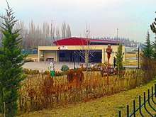
 Main street from south west to north east | |
 Çayyolu | |
| Coordinates: 39°53′N 32°42′E / 39.883°N 32.700°ECoordinates: 39°53′N 32°42′E / 39.883°N 32.700°E | |
| Suburb |
|
| City | Ankara |
| Elevation | 925 m (3,035 ft) |
| Population (2015) | |
| • Urban | 132,697 |
| Time zone | UTC+2 (EET) |
| • Summer (DST) | UTC+3 (EEST) |
| Postal code | 06xxx |
| Area code(s) | 0312 |
| Licence plate | 06 |
Location and history
Çayyolu at 39°53′N 32°42′E / 39.883°N 32.700°E [1] is situated to the west of Hacettepe University Beytepe campus, to the east of Ankara ring road and to the south of the Turkish state highway ![]()
Population
Currently in addition to Çayyolu there are eight neighborhoods; Alacaatlı, Dodorga, Konutkent, Koru, Mutlukent, Profesör Ahmet Taner Kışlalı, Ümitköy and Yaşamkent all of which collectively are known as Çayyolu. [4] From east to west Mutlukent, Ümitköy, Koru, Konutkent and Yaşamkent are along the highway.The population of these neighborhoods as of 2015 are shown in the table.[5]
| Name of the neighborhood | Population |
|---|---|
| Alacaatlı | 20787 |
| Çayyolu | 5431 |
| Dodurga | 8963 |
| Konutkent | 7826 |
| Koru | 14879 |
| Mutlukent | 18020 |
| Profesör Ahmet Taner Kışlalı | 19529 |
| Umitköy | 13691 |
| Yaşamkent | 23571 |
Mass transportation
The mass transportation between Ankara centrum and Çayyolu is via Ankara Metro M2. The last three stations of the metro namely, Ümitköt, Çayyolu and Koru are actully within the suburb.