Çanta, Istanbul
| Çanta | |
|---|---|
 Çanta | |
| Coordinates: 41°04′50″N 28°04′55″E / 41.08056°N 28.08194°ECoordinates: 41°04′50″N 28°04′55″E / 41.08056°N 28.08194°E | |
| Country |
|
| Region | Marmara |
| Province | İstanbul |
| District | Silivri |
| Government | |
| • Mayor | Tahir Sert |
| Time zone | UTC+2 (EET) |
| • Summer (DST) | UTC+3 (EEST) |
| Postal code | 34570, 34580 |
| Area code | 0-212 |
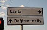
Road sign to Çanta at State road 
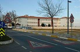
Primary school in Çanta, Silivri.
Çanta (meaning "bag" in Turkish) is a town in Silivri district of Istanbul Province, Turkey, on the European side of the city. It is accessible from the state road ![]()
Çanta is a newly established, modern settlement while a village with the similar name, Çantaköy, still exists neighboring the town in the north.[1] To differentiate between the both settlements, the village is called "Eski Çanta" (Old Çanta) while the town is sometimes called "Yeni Çanta" (New Çanta). Çanta has three neighborhoods, Fatih, Mimarsinan and Yolçatı.[2][3]
Population
| Census year | Population[4] |
|---|---|
| 1970 | 1,709 |
| 1975 | 1,688 |
| 1980 | 1,843 |
| 1985 | 1,988 |
| 1990 | 1,835 |
| 1997 | 4,430 |
| 2000 | 4,739 |
References
- ↑ "Çanta Belediyesi Haritası" (in Turkish). Harita Map. Retrieved 2015-01-20.
- ↑ "Çanta Mimar Sinan Mahallesi, Silivri, İstanbul haritası" (in Turkish). Bilgi Ara. Retrieved 2015-01-20.
- ↑ "Yolçati Mahallesi -İstanbul Silivri Çanta" (in Turkish). Retrieved 2015-01-20.
- ↑ "Çanta" (in Turkish). Yerel Net. Retrieved 2015-01-20.
See also
External links
| Wikimedia Commons has media related to Çanta, Silivri. |
This article is issued from
Wikipedia.
The text is licensed under Creative Commons - Attribution - Sharealike.
Additional terms may apply for the media files.