Ådalsfjella
| Ådalsfjella | |
|---|---|
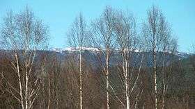 Ådalsfjella from Soknedalen | |
| Highest point | |
| Coordinates | 60°23′38″N 9°55′42″E / 60.39389°N 9.92833°ECoordinates: 60°23′38″N 9°55′42″E / 60.39389°N 9.92833°E |
| Geography | |
| Location | Buskerud, Norway |
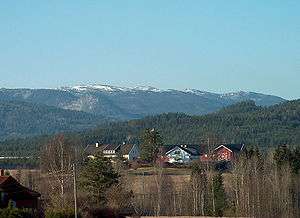
View towards Ådalsfjella from Soknedalen
Ådalsfjella is a mountain range in southern Norway. It consist of a series of smaller peaks and mountains located within Ringerike in Buskerud county. Ådalsfjella is a small mountain range which stretches from within Vestre Ådal in Ådal to Vassfaret bordering Sør-Aurdal in Oppland. The mountain range lies between Lake Sperillen to the east and the valley of Soknedalen to the west.[1]
See also
References
This article is issued from
Wikipedia.
The text is licensed under Creative Commons - Attribution - Sharealike.
Additional terms may apply for the media files.