San Marcos (Californië)
San Marcos is een plaats (city) in de Amerikaanse staat Californië, en valt bestuurlijk gezien onder San Diego County.
Plaats in de Verenigde Staten | |||
 | |||
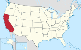 Locatie van Californië in de VS | |||
| Situering | |||
| County | San Diego County | ||
| Type plaats | City | ||
| Staat | Californië | ||
| Coördinaten | 33° 9′ NB, 117° 10′ WL | ||
| Algemeen | |||
| Oppervlakte | 61,5 km² | ||
| - land | 61,3 km² | ||
| - water | 0,2 km² | ||
| Inwoners (2006) | 76.501 | ||
| Hoogte | 173 m | ||
| Overig | |||
| ZIP-code(s) | 92069 | ||
| FIPS-code | 68196 | ||
| Foto's | |||
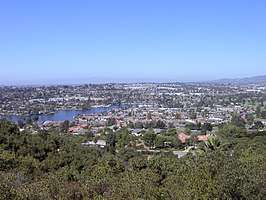 | |||
| |||
Demografie
Bij de volkstelling in 2000 werd het aantal inwoners vastgesteld op 54.977.[1] In 2006 is het aantal inwoners door het United States Census Bureau geschat op 76.501,[2] een stijging van 21524 (39.2%).
Geografie
Volgens het United States Census Bureau beslaat de plaats een oppervlakte van 61,7 km², waarvan 61,5 km² land en 0,2 km² water. San Marcos ligt op ongeveer 173[3] m boven zeeniveau.
Plaatsen in de nabije omgeving
De onderstaande figuur toont nabijgelegen plaatsen in een straal van 16 km rond San Marcos.
Externe link
| Bronnen, noten en/of referenties |
Hoofdstad: Sacramento
Regio's: Antelope Valley · Big Sur · Cascade Range · Central Coast · Central Valley · Channel Islands · Coachella Valley · Conejo Valley · Cucamonga Valley · Death Valley · East Bay · East County · Emerald Triangle · Gold Country · Greater Los Angeles · Grote Bekken · Imperial Valley · Inland Empire · Klamath Basin · Lake Tahoe · Los Angeles Basin · Lost Coast · Mojave · Mountain Empire · Noord-Californië · North Bay · North Coast · North County · Oost-Californië · Owens Valley · Oxnard Plain · San Francisco Peninsula · Pomona Valley · Sacramento Valley · San Bernardino Valley · San Diego–Tijuana · San Fernando Valley · San Francisco Bay Area · San Gabriel Valley · San Joaquin Valley · Santa Clara Valley · Santa Clarita Valley · Shasta Cascade · Sierra Nevada · Silicon Valley · South Bay (LA) · South Bay (SD) · South Bay (SF) · South Coast · Southern Border Region · Upstate California · Wine Country · Yosemite · Zuid-Californië
Metropolitane gebieden: Bakersfield · Chico · Fresno · Los Angeles-Long Beach-Glendale · Modesto · Napa · Oakland-Fremont-Hayward · Oxnard-Thousand Oaks-Ventura · Riverside-San Bernardino-Ontario · Sacramento-Roseville · Salinas · San Diego-Carlsbad-San Marcos · San Francisco-San Mateo-Redwood City · San Jose-Sunnyvale-Santa Clara · San Luis Obispo-Paso Robles · Santa Ana-Anaheim-Irvine · Santa Barbara-Santa Maria · Santa Cruz-Watsonville · Santa Rosa-Petaluma · Stockton · Vallejo-Fairfield · Visalia-Porterville · Yuba City
County's: Alameda · Alpine · Amador · Butte · Calaveras · Colusa · Contra Costa · Del Norte · El Dorado · Fresno · Glenn · Humboldt · Imperial · Inyo · Kern · Kings · Lake · Lassen · Los Angeles · Madera · Marin · Mariposa · Mendocino · Merced · Modoc · Mono · Monterey · Napa · Nevada · Orange · Placer · Plumas · Riverside · Sacramento · San Benito · San Bernardino · San Diego · San Francisco · San Joaquin · San Luis Obispo · San Mateo · Santa Barbara · Santa Clara · Santa Cruz · Shasta · Sierra · Siskiyou · Solano · Sonoma · Stanislaus · Sutter · Tehama · Trinity · Tulare · Tuolumne · Ventura · Yolo · Yuba
Portaal Californië