Tucson, Arizona
Tucson (/ˈtuːsɒn, tuːˈsɒn/) is a city in and the county seat of Pima County, Arizona, United States,[6] and is home to the University of Arizona. The 2010 United States Census put the population at 520,116,[3] while the 2015 estimated population of the entire Tucson metropolitan statistical area (MSA) was 980,263.[7] The Tucson MSA forms part of the larger Tucson-Nogales combined statistical area (CSA), with a total population of 1,010,025 as of the 2010 Census. Tucson is the second most-populated city in Arizona behind Phoenix, both of which anchor the Arizona Sun Corridor. The city is 108 miles (174 km) southeast of Phoenix and 60 mi (97 km) north of the U.S.–Mexico border.[6] Tucson is the 33rd largest city and the 58th largest metropolitan area in the United States (2014).
Tucson | |
|---|---|
| City of Tucson | |
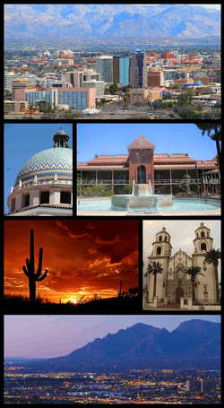 From upper left: Downtown Tucson skyline, Pima County Courthouse, Old Main, University of Arizona, Saguaro National Park, St. Augustine Cathedral, Santa Catalina Mountains | |
 Flag | |
| Nickname(s): "The Old Pueblo", "Optics Valley", "America's biggest small town" | |
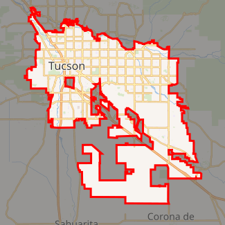
Interactive map outlining Tucson | |
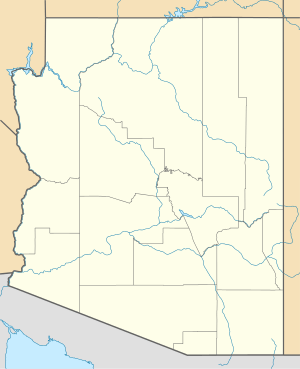 Tucson Location within Arizona  Tucson Location within the United States | |
| Coordinates: 32°13′18″N 110°55′35″W | |
| Country | United States |
| State | Arizona |
| County | Pima |
| Incorporated | February 7, 1877[1] |
| Government | |
| • Type | Council-manager government |
| • Mayor | Regina Romero (D) |
| Area | |
| • City | 238.33 sq mi (617.27 km2) |
| • Land | 238.01 sq mi (616.45 km2) |
| • Water | 0.32 sq mi (0.82 km2) |
| Elevation | 2,389 ft (728 m) |
| Population | |
| • City | 520,116 |
| • Estimate (2018)[4] | 545,975 |
| • Rank | US: 33rd |
| • Density | 2,293.88/sq mi (885.67/km2) |
| • Urban | 843,168 (52nd) |
| • Metro | 1,010,025 (58th) |
| • Demonym | Tucsonian, Tucsonan |
| Time zone | UTC−07:00 (MST (no DST)) |
| ZIP Codes | 85701-85775 |
| Area code | 520 |
| FIPS code | 04-77000 |
| GNIS feature ID | 43534[5] |
| Website | tucsonaz |
| 1 Urban = 2010 Census | |
Major incorporated suburbs of Tucson include Oro Valley and Marana northwest of the city, Sahuarita[8] south of the city, and South Tucson in an enclave south of downtown. Communities in the vicinity of Tucson (some within or overlapping the city limits) include Casas Adobes, Catalina Foothills, Flowing Wells, Midvale Park, Tanque Verde, Tortolita, and Vail. Towns outside the Tucson metro area include Benson to the southeast, Catalina and Oracle to the north, and Green Valley to the south.
Tucson was founded as a military fort by the Spanish when Hugo O'Conor authorized the construction of Presidio San Agustín del Tucsón in 1775. It was included in the state of Sonora after Mexico gained independence from the Spanish Empire in 1821. In 1853, the United States acquired a 29,670-square-mile (76,800 km2) region of present-day southern Arizona and southwestern New Mexico from Mexico under the Gadsden Purchase[9]. Tucson served as the capital of the Arizona Territory from 1867-1877[10]. Tucson was Arizona's largest city by population during the territorial period and early statehood, until it was surpassed by Phoenix by 1920. Nevertheless, population growth remained strong during the late 20th century. In 2017, Tucson was the first American city to be designated a "City of Gastronomy" by UNESCO.[11]
The Spanish name of the city, Tucsón [tukˈson], is derived from the O'odham Cuk Ṣon [tʃʊk ʂɔːn], meaning "(at the) base of the black [hill]", a reference to a basalt-covered hill now known as Sentinel Peak. Tucson is sometimes referred to as "The Old Pueblo".
History

_(14802518083).jpg)
The Tucson area was probably first visited by Paleo-Indians, who were known to have been in southern Arizona about 12,000 years ago. Recent archaeological excavations near the Santa Cruz River found a village site dating from 2100 BC.[12] The floodplain of the Santa Cruz River was extensively farmed during the Early Agricultural Period, circa 1200 BC to AD 150. These people constructed irrigation canals and grew corn, beans, and other crops, while also gathering wild plants and nuts, and hunting.[12]
The Early Ceramic period occupation of Tucson saw the first extensive use of pottery vessels for cooking and storage. The groups designated as the Hohokam lived in the area from AD 600 to 1450 and are known for their vast irrigation canal systems and their red-on-brown pottery.[13][14]
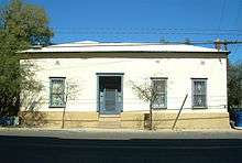
The Spanish Jesuit missionary Eusebio Francisco Kino first visited the Santa Cruz River valley in 1692. He founded the Mission San Xavier del Bac in 1700 about 7 mi (11 km) upstream from the site of the settlement of Tucson. A separate Convento settlement was founded downstream along the Santa Cruz River, near the base of what is now known as "A" mountain. Hugo O'Conor, the founding father of the city of Tucson, Arizona, authorized the construction of a military fort in that location, Presidio San Agustín del Tucsón, on August 20, 1775 (the present downtown Pima County Courthouse was built near this site). During the Spanish period of the presidio, attacks such as the Second Battle of Tucson were repeatedly mounted by the Apache. Eventually the town came to be called Tucsón, a Spanish version of the O'odham word for the area. It was included in the state of Sonora after Mexico gained independence from the Kingdom of Spain and its Spanish Empire in 1821.
During the Mexican–American War in 1846–1848, Tucsón was captured by Philip St. George Cooke with the Mormon Battalion, but it soon returned to Mexican control as Cooke proceeded to the west, establishing Cooke's Wagon Road to California. Tucsón was not included in the Mexican Cession to the United States following the war. Cooke's road through Tucsón became one of the important routes into California during the California Gold Rush of 1849.
The US acquired Arizona, south of the Gila River, via treaty from Mexico in the Gadsden Purchase on June 8, 1854. Under this treaty and purchase, Tucsón became a part of the United States of America. The American military did not formally take over control until March 1856. In time, the name of the town became standardized in English in its current form, where the stress is on the first syllable, the "u" is long, and the "c" is silent.
In 1857, Tucson was established as a stage station on the San Antonio-San Diego Mail Line. In 1858 it became 3rd division headquarters of the Butterfield Overland Mail and operated until the line was shut down in March 1861. The Overland Mail Corporation attempted to continue running; however, following the Bascom Affair, devastating Apache attacks on the stations and coaches ended operations in August 1861.
From August 1861 to mid-1862, Tucson served as the western capital of the Confederate Arizona Territory, the eastern capital being Mesilla, New Mexico. In 1862, the California Column drove the Confederate forces out of Arizona. Tucson and all of what is now Arizona were included within the US New Mexico Territory until 1863, when they became part of the new Arizona Territory. From 1867 to 1877, Tucson was the capital of the Arizona Territory. Tucson was incorporated in 1877, making it the oldest incorporated city in Arizona.
From 1877 to 1878, the area suffered a rash of stagecoach robberies. Most notable were the two holdups committed by masked road-agent William Whitney Brazelton.[15] Brazelton held up two stages in the summer of 1878 near Point of Mountain Station, approximately 17 mi (27 km) northwest of Tucson. John Clum, of Tombstone, Arizona fame, was one of the passengers. Pima County Sheriff Charles A. Shibell and his citizen posse killed Brazelton on August 19, 1878, in a mesquite bosque along the Santa Cruz River 3 miles (5 km) south of Tucson. Brazelton had been suspected of highway robbery in the Tucson area, the Prescott region, and the Silver City, New Mexico area. Because of the crimes and threats to his business, John J. Valentine, Sr. of Wells, Fargo & Co. had sent Bob Paul, a special agent and a future Pima County sheriff, to investigate.[15] The US Army established Fort Lowell, then east of Tucson, to help protect settlers and travelers from Apache attacks.
In 1882, Morgan Earp was fatally shot, in what was later referred to in the press as "the Earp-Clanton Tragedy".[16] Marietta Spence, wife of Pete Spence, one of the Cochise County Cowboys, testified at the coroner's inquest on Earp's killing and implicated Frank Stilwell in the murder. The coroner's jury concluded that Pete Spence, Stilwell, Frederick Bode, and Florentino "Indian Charlie" Cruz were the prime suspects in the assassination of Morgan Earp.[17] :250
Deputy U.S. Marshal Wyatt Earp gathered a few trusted friends and accompanied Virgil Earp and his family as they traveled to Benson to take a train to California. They found Stilwell apparently lying in wait for Virgil Earp at the Tucson station and killed him on the tracks.[18][16] After killing Stilwell, Wyatt deputized others and conducted a vendetta, killing three more cowboys over the next few days before leaving the state.
Jim Leavy ambushed
Jim Leavy had built a reputation of having fought in at least 16 gunfights. On June 5, 1882, Levy had an argument with a faro dealer John Murphy in Tucson, Arizona. The two agreed to have a duel on the Mexican border, but after hearing of Levy's exploits as a gunfighter, Murphy decided to ambush Levy instead. Together with two of his friends, Murphy ambushed Levy as he was leaving the Palace Hotel, killing him. According to Wright, the three co-defendants in Leavy's murder later escaped from the Pima County Jail and were later recaptured. Murphy and Gibson were found in Fenner, California living under assumed names and retried for the murder before being found not guilty. Moyer was captured in Denver and sentenced to life in Yuma Territorial Prison, but was pardoned in 1888.[19][20]
As other settlers tried to overcome violent frontier society, in 1885 the state legislature founded the University of Arizona as a land-grant college on what was over-grazed ranch land between Tucson and Fort Lowell.
In 1890, Asians made up 4.2% of the city's population.[21] They were predominately Chinese men who had been recruited as workers on the railroads.
By 1900, 7,531 people lived in Tucson. By 1910, the population increased to 13,913. At about this time, the U.S. Veterans Administration had begun construction of the present Veterans Hospital. The city's clean, dry air made it a destination for the many veterans who had been gassed in World War I and needed respiratory therapy. In addition, these dry and high altitude conditions were thought to be ideal for the treatment of tuberculosis, for which there were no known cures before antibiotics were developed against it.[22]
The city continued to grow, with the population increasing to 20,292 in 1920 and 36,818 in 1940. In 2006, the population of Pima County, in which Tucson is located, passed one million, while the City of Tucson's population was 535,000.
In 1912, Arizona was admitted as a state. This increased the number of flags that had been flown over Tucson to five: Spanish, Mexican, United States, Confederate, and the State of Arizona. [23]
.jpg)
During the territorial and early statehood periods, Tucson was Arizona's largest city and commercial center, while Phoenix was the seat of state government (beginning in 1889) and agriculture. The development of Tucson Municipal Airport increased the city's prominence. But between 1910 and 1920, Phoenix surpassed Tucson in population, and has continued to outpace Tucson in growth. In recent years, both Tucson and Phoenix have had some of the highest growth rates of any jurisdiction in the United States.
Geography

According to the United States Census Bureau, as of 2010, the City of Tucson has a land area of 226.71 square miles (587.2 km2).
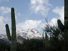
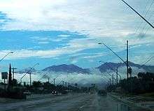
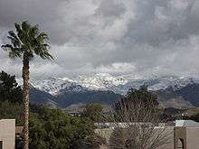
The city's elevation is 2,643 ft (806 m) above sea level (as measured at the Tucson International Airport).[24] Tucson is on an alluvial plain in the Sonoran Desert, surrounded by five minor ranges of mountains: the Santa Catalina Mountains and the Tortolita Mountains to the north, the Santa Rita Mountains to the south, the Rincon Mountains to the east, and the Tucson Mountains to the west. The high point of the Santa Catalina Mountains is 9,157 ft (2,791 m) Mount Lemmon, the southernmost ski destination in the continental U.S., while the Tucson Mountains include 4,687 ft (1,429 m) Wasson Peak. The highest point in the area is Mount Wrightson, found in the Santa Rita Mountains at 9,453 ft (2,881 m) above sea level.

Tucson is 116 mi (187 km) southeast of Phoenix and 69 mi (111 km) north of the United States - Mexico border. The 2010 United States Census puts the city's population at 520,116 with a metropolitan area population at 980,263. In 2009, Tucson ranked as the 32nd-largest city and 52nd-largest metropolitan area in the United States. A major city in the Arizona Sun Corridor, Tucson is the largest city in southern Arizona, and the second largest in the state after Phoenix. It is also the largest city in the area of the historic Gadsden Purchase. As of 2015, The Greater Tucson Metro area has exceeded a population of 1 million.
The city is built along the Santa Cruz River, formerly a perennial river. Now a dry river bed for much of the year, it regularly floods during significant seasonal rains.
Interstate 10 runs northwest through town, connecting Tucson to Phoenix in the northwest (on the way to its western terminus in Santa Monica, California), and to Las Cruces, New Mexico and El Paso, Texas in the southeast. (Its eastern terminus is in Jacksonville, Florida).
I-19 runs south from Tucson toward Nogales and the U.S.-Mexico border. I-19 is the only Interstate highway that uses "kilometer posts" instead of "mileposts." Speed limits are marked in miles per hour and kilometers per hour.
Neighborhoods
Downtown and Central Tucson
Similar to many other cities in the Western U.S., Tucson was developed by European Americans on a grid plan starting in the late 19th century, with the city center at Stone Avenue and Broadway Boulevard. While this intersection was initially near the geographic center of Tucson, that center has shifted as the city has expanded far to the east. Development to the west was effectively blocked by the Tucson Mountains. Covering a large geographic area, Tucson has many distinct neighborhoods.
Tucson's earliest neighborhoods, some of which were redeveloped and covered by the Tucson Convention Center (TCC), include:
- El Presidio,[25] Tucson's oldest neighborhood
- Barrio Histórico,[26] also known as Barrio Libre
- Armory Park, directly south of downtown
- Barrio Anita,[27] named for an early settler and located between Granada Avenue and Interstate 10
- Barrio Tiburón, now known as the Fourth Avenue arts district, was designated in territorial times as a red-light district
- Barrio El Jardín, named for an early recreational site, Levin's Gardens
- Barrio El Hoyo, named for a lake that was part of the gardens. Before the convention center was built, the term El Hoyo (Spanish for 'pit' or 'hole') referred to this part of the city. Residents were mostly Mexican-American citizens and Mexican immigrants.
- Barrio Santa Rosa, dating from the 1890s, is now listed as a historic district on the National Register of Historic Places
Other historical neighborhoods near downtown include:
- Feldman's, just north and northwest of the University of Arizona. The neighborhood is named for Alther M. Feldman (1833-1906) an Eastern European immigrant that arrived in Tucson circa 1878. Neighborhood streets Helen and Mabel are named for his daughters.[28] Feldman owned a photographic studio known as the Arizona Tent Gallery.[29]
- Menlo Park, situated west of downtown, adjacent to Sentinel Peak
- Iron Horse, east of Fourth Avenue and north of the railroad tracks, named for its proximity to the railroad, informally known by that term
- West University, between the University of Arizona and downtown
- Dunbar Spring, west of West University
- Pie Allen, west and south of the university near Tucson High School and named for John Brackett "Pie" Allen, a local entrepreneur and early mayor of Tucson
- Sam Hughes, east of the University of Arizona, named after a European-American pioneer in Tucson
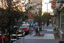
At the end of the first decade of the 21st century, city planners and the business community worked at redeveloping the downtown. The primary project was Rio Nuevo, a large retail and community center that had been stalled in planning for more than ten years.[30][31] Downtown is generally regarded as the area bordered by 17th Street to the south, I-10 to the west, and 6th Street to the north, and Toole Avenue and the Union Pacific (formerly Southern Pacific) railroad tracks, site of the historic train depot[32] on the east side. Downtown is divided into the Presidio District, the Barrio Viejo, and the Congress Street Arts and Entertainment District.[33] Some authorities include the 4th Avenue shopping district, northeast of the rest of downtown and connected by an underpass beneath the UPRR tracks.
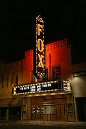
Historic attractions downtown with rich architecture include the Hotel Congress designed in 1919, the Art Deco Fox Theatre designed in 1929, the Rialto Theatre opened in 1920, and St. Augustine Cathedral completed in 1896.[34] Included on the National Register of Historic Places is the old Pima County Courthouse, designed by Roy Place in 1928.[35] The El Charro Café, Tucson's oldest restaurant, operates its main location downtown.[36]
As one of the oldest parts of town, Central Tucson is anchored by the Broadway Village shopping center. The shopping center was designed by local architect Josias Joesler and is located at the intersection of Broadway Boulevard and Country Club Road. The 4th Avenue Shopping District between downtown, the university, and the Lost Barrio just east of downtown, also has many unique and popular stores. Local retail business in Central Tucson is densely concentrated along Fourth Avenue and the Main Gate Square on University Boulevard near the UA campus. The El Con Mall is also in the eastern part of midtown.

The University of Arizona, chartered in 1885, is in midtown and includes Arizona Stadium and McKale Center (named for J.F. "Pop" McKale).[37]
The historic Tucson High School (designed by Roy Place in 1924) was featured in the 1987 film Can't Buy Me Love. The Arizona Inn (built in 1930) and the Tucson Botanical Gardens are also in Central Tucson.
Tucson's largest park, Reid Park, is in midtown and includes Reid Park Zoo and Hi Corbett Field. Speedway Boulevard, a major east–west arterial road in central Tucson, was named the "ugliest street in America" by Life magazine in the early 1970s, quoting Tucson Mayor James Corbett.
In the late 1990s, Speedway Boulevard was awarded "Street of the Year" by Arizona Highways. According to David Leighton, historical writer for the Arizona Daily Star newspaper, Speedway Boulevard was named after an historic horse racetrack, known as "The Harlem River Speedway", and more commonly called "The Speedway," in New York City. The Tucson street was called "The Speedway," from 1904 to about 1906, when "The" was removed from the title.[38]
In the early 21st century, Central Tucson is considered bicycle-friendly. To the east of the University of Arizona, Third Street is bike-only except for local traffic; it passes by the historic homes of the Sam Hughes neighborhood. To the west, E. University Boulevard leads to the Fourth Avenue Shopping District. To the North, N. Mountain Avenue has a full bike-only lane for half of the 3.5 miles (5.6 km) to the Rillito River Park bike and walk multi-use path. To the south, N. Highland Avenue leads to the Barraza-Aviation Parkway bicycle path.[39]
Southern Tucson

South Tucson is the name of an independent, incorporated town of 1 sq mi (2.6 km2) south of downtown, and which is completely surrounded by the city of Tucson. South Tucson has a colorful, dynamic history. It was first incorporated in 1936, and later reincorporated in 1940.
The population is about 83% Mexican-American and 10% Native American, as residents self-identify in the census. South Tucson is widely known for its many Mexican restaurants and architectural styles. Bright murals have been painted on some walls, but city policy discourages this and many have been painted over.[40][41][42]
The South side of the city of Tucson is generally considered to be the area of approximately 25 sq mi (65 km2) south of 22nd Street, east of I-19, west of Davis Monthan Air Force Base and southwest of Aviation Parkway, and north of Los Reales Road.[43]. The Tucson International Airport and Tucson Electric Park are located here.[43]
Western Tucson
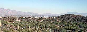
The West Side has areas of both urban and suburban development. It is generally defined as the area west of I-10. Western Tucson encompasses the banks of the Santa Cruz River and the foothills of the Tucson Mountains. Area attractions include the International Wildlife Museum and Sentinel Peak. The Marriott Starr Pass Resort & Spa serves travelers and residents.[44] As travelers pass the Tucson Mountains, they enter the area commonly referred to as "west of" Tucson or "Old West Tucson".[45] In this large, undulating plain extending south into the Altar Valley, rural residential development predominates. Attractions include Saguaro National Park West, the Arizona-Sonora Desert Museum, and movie set/theme park developed at the Old Tucson Studios.
On Sentinel Peak, just west of downtown, a giant "A" was installed in honor of the University of Arizona, resulting in the nickname "A" Mountain.[46] Starting in about 1916, an annual tradition developed for freshmen to whitewash the "A", which was visible for miles. The top of Sentinel Peak, which is accessible by road, offers an outstanding view of the city looking eastward. A parking lot near the summit of Sentinel Peak has been a popular place to watch sunsets or view the city lights at night.
At the beginning of the Iraq War in 2003, anti-war activists painted the "A" black. Competition ensued, with various sides repainting the "A" in different colors until the city council intervened. It is now painted red, white and blue, after the US flag. Another color may be decided by a biennial election. With the tri-color scheme, some observers complain that the shape of the A is hard to distinguish from the background of the peak.
Northern Tucson
North Tucson includes the urban neighborhoods of Amphitheater and Flowing Wells. Usually considered the area north of Fort Lowell Road, North Tucson includes some of Tucson's primary commercial zones (Tucson Mall and the Oracle Road Corridor). Many of the city's most upscale boutiques, restaurants, and art galleries are also on the north side, including St. Philip's Plaza. The Plaza is directly adjacent to the historic St. Philip's in the Hills Episcopal Church (built in 1936).
Also on the north side is the suburban community of Catalina Foothills, located in the foothills of the Santa Catalina Mountains just north of the city limits. This community includes among the area's most expensive homes, sometimes multimillion-dollar estates. The Foothills area is generally defined as north of River Road, east of Oracle Road[47] and west of Sabino Creek. Some of the Tucson area's major resorts are in the Catalina Foothills, including the Hacienda Del Sol, Westin La Paloma Resort, Loews Ventana Canyon Resort and Canyon Ranch Resort. La Encantada, an upscale outdoor shopping mall, is also in the Foothills.
The DeGrazia Gallery of the Sun is near the intersection of Swan Road and Skyline Drive. Built by artist Ted DeGrazia starting in 1951, the 10-acre (40,000 m2) property is listed on the National Register of Historic Places and features an eclectic chapel, an art gallery, and a free museum.

The expansive area northwest of the city limits is diverse, ranging from the rural communities of Catalina and parts of the town of Marana, the small suburb of Picture Rocks, the affluent town of Oro Valley in the western foothills of the Santa Catalina Mountains, and residential areas in the northeastern foothills of the Tucson Mountains. Continental Ranch (Marana), Dove Mountain (Marana), and Rancho Vistoso (Oro Valley), and Saddlebrooke (N. Oro Valley) are all masterplanned communities in the Northwest that have thousands of residents.
The community of Casas Adobes is also on the Northwest Side, with the distinction of being Tucson's first suburb, established in the late 1940s. Casas Adobes is centered on the historic Casas Adobes Plaza (built in 1948). Casas Adobes is also home to Tohono Chul Park, which is now within the town of Oro Valley, (a nature preserve) near the intersection of North Oracle Road and West Ina Road. The attempted assassination of Representative Gabrielle Giffords, and the murders of chief judge for the U.S. District Court for Arizona, John Roll and five other people on January 8, 2011, occurred at the La Toscana Village in Casas Adobes. The Foothills Mall is also on the northwest side in Casas Adobes.
Many of the Tucson area's golf courses and resorts are in this area, including the Preserve and MountainView Golf Clubs at Saddlebrooke, Hilton El Conquistador Golf & Tennis Resort in Oro Valley, the Omni Tucson National Resort & Spa, and Westward Look Resort. The Ritz Carlton at Dove Mountain, the second Ritz Carlton Resort in Arizona, which also includes a golf course, opened in the foothills of the Tortolita Mountains in northeast Marana in 2009. Catalina State Park and Tortolita Mountain Park are also in the Northwest area.
Eastern Tucson
East Tucson is relatively new compared to other parts of the city, developed between the 1950s and the 1970s, with developments such as Desert Palms Park. It is generally classified as the area of the city east of Swan Road, with above-average real estate values relative to the rest of the city. The area includes urban and suburban development near the Rincon Mountains. East Tucson includes Saguaro National Park East. Tucson's "Restaurant Row" is also on the east side, along with a significant corporate and financial presence. Restaurant Row is sandwiched by three of Tucson's storied Neighborhoods: Harold Bell Wright Estates,[48] named after the famous author's ranch which occupied some of that area before the depression; the Tucson Country Club (the third to bear the name Tucson Country Club),[49] and the Dorado Country Club. Tucson's largest office building is 5151 East Broadway in east Tucson, completed in 1975. The first phases of Williams Centre, a mixed-use, master-planned development on Broadway near Craycroft Road,[50] were opened in 1987. Park Place, a recently renovated shopping center, is also along Broadway (west of Wilmot Road).
Near the intersection of Craycroft and Ft. Lowell Roads are the remnants of the Historic Fort Lowell. This area has become one of Tucson's iconic neighborhoods. In 1891, the Fort was abandoned and much of the interior was stripped of their useful components and it quickly fell into ruin. In 1900, three of the officer buildings were purchased for use as a sanitarium. The sanitarium was then sold to Harvey Adkins in 1928. The Bolsius family Pete, Nan and Charles Bolsius purchased and renovated surviving adobe buildings of the Fort – transforming them into spectacular artistic southwestern architectural examples. Their woodwork, plaster treatment and sense of proportion drew on their Dutch heritage and New Mexican experience. Other artists and academics throughout the middle of the 20th century, including: Win Ellis, Jack Maul, Madame Germaine Cheruy and René Cheruy, Giorgio Belloli, Charels Bode, Veronica Hughart, Edward H. Spicer and Rosamond Spicer, Hazel Larson Archer and Ruth Brown, renovated adobes, built homes and lived in the area. The artist colony attracted writers and poets including beat generation Alan Harrington and Jack Kerouac whose visit is documented in his iconic book On the Road. This rural pocket in the middle of the city is listed on the National Register of Historic Places. Each year in February the neighborhood celebrates its history in the City Landmark it owns and restored the San Pedro Chapel.
Situated between the Santa Catalina Mountains and the Rincon Mountains near Redington Pass northeast of the city limits is the affluent community of Tanque Verde. The Arizona National Golf Club, Forty-Niners Country Club, and the historic Tanque Verde Guest Ranch are also in northeast Tucson.
Southeast Tucson continues to experience rapid residential development. The area includes Davis-Monthan Air Force Base. The area is considered to be south of Golf Links Road. It is the home of Santa Rita High School, Chuck Ford Park (Lakeside Park), Lakeside Lake, Lincoln Park (upper and lower), The Lakecrest Neighborhoods, and Pima Community College East Campus. The Atterbury Wash with its access to excellent bird watching is also in the Southeast Tucson area. The suburban community of Rita Ranch houses many of the military families from Davis-Monthan, and is near the southeastern-most expansion of the current city limits. Close by Rita Ranch and also within the city limits lies Civano,[51] a planned development meant to showcase ecologically sound building practices and lifestyles.
Mount Lemmon

Mount Lemmon, the highest peak of the Santa Catalina Mountains, reaches an elevation of 9,157 feet (2,791 m) above sea level. The mountain is named after 19th century botanist Sara Lemmon. She was the first documented European woman to ascend to the peak, accompanied by her husband and by local rancher Emmerson Oliver Stratton.[52][53][54] The Lemmons botanized extensively along the way, including collecting the plant Tagetes lemmonii which is now called the Mount Lemmon marigold.
Catalina Highway stretches 25 miles (40 km) and the entire mountain range is one of Tucson's most popular vacation spots for cycling, hiking, rock climbing, camping, birding, and wintertime snowboarding and skiing. Near the top of Mt. Lemmon is the town of Summerhaven. In Summerhaven, visitors will find log houses and cabins, a general store, and various shops, as well as numerous hiking trails. Near Summerhaven is the road to Ski Valley which hosts a ski lift, several runs, a gift shop, and nearby restaurant.
Mt. Lemmon Sky Center, which is at a Steward Observatory site known as 'Sky Island', sits 9,152 feet (2,790 m) in altitude on the summit of Mt. Lemmon. As one of the Southwestern United States's 27 unique Sky Islands,[55] this science learning facility is open to the public.[56]
A major destination for cyclists, Mount Lemmon is ranked the second most difficult climb in the world by Bicycling Magazine. [57]
Climate
Tucson has a hot semi-arid climate (Köppen BSh), with two major seasons, a very hot summer and mild winter. Tucson averages 11.8 inches (299.7 mm) of precipitation per year, concentrated mostly in the summer monsoon season and winter wet season with little rainfall in fall and especially spring. [58]
Summer is characterized by daytime temperatures of over 100 °F (38 °C) and overnight temperatures between 66 and 85 °F (19 and 29 °C). Early summer is characterized by low humidity and clear skies; mid-summer and late summer are characterized by higher humidity, cloudy skies and frequent rain. The sun is intense in Tucson during part of the year, and significant protection is needed for those who spend time outdoors. Recent studies show the rate of skin cancer in Arizona is at least three times higher than in more northerly regions. Additional intense heating is a risk to hikers and others who seek to hike canyons and exposed areas.[59]
The monsoon season typically begins from early July to late July, with an average start date around July 3. It typically continues through August and sometimes into September.[60] During the monsoon, the humidity is much higher than the rest of the year. It begins with clouds building up from the south in the early afternoon followed by intense thunderstorms and rainfall, which can cause flash floods. The evening sky at this time of year is often pierced with dramatic lightning strikes. Large areas of the city do not have storm sewers, so monsoon rains flood the main thoroughfares, usually for no longer than a few hours. A few underpasses in Tucson have "feet of water" scales painted on their supports to discourage fording by automobiles during a rainstorm.[61] Arizona traffic code Title 28-910, the so-called "Stupid Motorist Law", was instituted in 1995 to discourage people from entering flooded roadways. If the road is flooded and a barricade is in place, motorists who drive around the barricade can be charged up to $2000 for costs involved in rescuing them.[62] Despite all warnings and precautions, however, three Tucson drivers have drowned between 2004 and 2010.
The weather in the fall is much like spring: dry, with warm/cool nights and warm/hot days. Temperatures above 100 °F (38 °C) are possible into early October. Temperatures decline at the quickest rate in October and November, and are normally the coolest in late December and early January.
Winters in Tucson are mild relative to other parts of the United States. Daytime highs range between 64 and 75 °F (18 and 24 °C), with overnight lows between 30 and 44 °F (−1 and 7 °C). Tucson typically averages one hard freeze per winter season, with temperatures dipping to the mid or low-20s (−7 to −4 °C), but this is typically limited to only a very few nights. Although rare, snow has fallen in Tucson, usually a light dusting that melts within a day. The most recent snowfall was on February 22, 2019 when 1.9 inches of snow fell in the city.[63] This snow occurred only 52 days after the last snow, which occurred on January 2.[64] Early spring is characterized by gradually rising temperatures and several weeks of vivid wildflower blooms beginning in late February and into March. During this time of year the diurnal temperature variation normally attains its maximum, often surpassing 30 °F (17 °C).
At the University of Arizona, where records have been kept since 1894, the record maximum temperature was 115 °F (46 °C) on June 19, 1960, and July 28, 1995, and the record minimum temperature was 6 °F (−14 °C) on January 7, 1913. There are an average of 150.1 days annually with highs of 90 °F (32 °C) or higher and an average of 26.4 days with lows reaching or below the freezing mark. Average annual precipitation is 11.15 in (283 mm). There is an average of 49 days with measurable precipitation. The wettest year was 1905 with 24.17 in (614 mm) and the driest year was 1924 with 5.07 in (129 mm). The most precipitation in one month was 7.56 in (192 mm) in July 1984. The most precipitation in 24 hours was 4.16 in (106 mm) on October 1, 1983. Annual snowfall averages 0.7 in (1.8 cm). The most snow in one year was 7.2 in (18 cm) in 1987. The most snow in one month was 6.0 in (15 cm) in January 1898 and March 1922.[65]
At the airport, where records have been kept since 1930, the record maximum temperature was 117 °F (47 °C) on June 26, 1990, and the record minimum temperature was 16 °F (−9 °C) on January 4, 1949. There is an average of 145.0 days annually with highs of 90 °F (32 °C) or higher and an average of 16.9 days with lows reaching or below the freezing mark. Measurable precipitation falls on an average of 53 days. The wettest year was 1983 with 21.86 in (555 mm) of precipitation, and the driest year was 1953 with 5.34 in (136 mm). The most rainfall in one month was 7.93 in (201 mm) in August 1955. The most rainfall in 24 hours was 3.93 in (100 mm) on July 29, 1958. Snow at the airport averages only 1.1 in (2.8 cm) annually. The most snow received in one year was 8.3 in (21 cm) and the most snow in one month was 6.8 in (17 cm) in December 1971.[66]
| Climate data for Tucson, Arizona (Tucson Int'l), 1981–2010 normals,[lower-alpha 1] extremes 1894−present[lower-alpha 2] | |||||||||||||
|---|---|---|---|---|---|---|---|---|---|---|---|---|---|
| Month | Jan | Feb | Mar | Apr | May | Jun | Jul | Aug | Sep | Oct | Nov | Dec | Year |
| Record high °F (°C) | 88 (31) |
92 (33) |
99 (37) |
104 (40) |
111 (44) |
117 (47) |
114 (46) |
112 (44) |
107 (42) |
102 (39) |
94 (34) |
85 (29) |
117 (47) |
| Mean maximum °F (°C) | 78.8 (26.0) |
82.7 (28.2) |
88.1 (31.2) |
94.7 (34.8) |
102.4 (39.1) |
108.7 (42.6) |
109.1 (42.8) |
106.1 (41.2) |
103.1 (39.5) |
96.6 (35.9) |
86.7 (30.4) |
78.3 (25.7) |
110.3 (43.5) |
| Average high °F (°C) | 65.5 (18.6) |
68.5 (20.3) |
74.1 (23.4) |
82.1 (27.8) |
91.6 (33.1) |
100.3 (37.9) |
99.7 (37.6) |
97.4 (36.3) |
94.5 (34.7) |
84.8 (29.3) |
73.5 (23.1) |
64.8 (18.2) |
83.1 (28.4) |
| Average low °F (°C) | 39.8 (4.3) |
42.2 (5.7) |
46.2 (7.9) |
52.0 (11.1) |
60.5 (15.8) |
69.3 (20.7) |
74.4 (23.6) |
73.3 (22.9) |
68.6 (20.3) |
57.3 (14.1) |
46.1 (7.8) |
39.1 (3.9) |
55.8 (13.2) |
| Mean minimum °F (°C) | 28.7 (−1.8) |
31.3 (−0.4) |
34.3 (1.3) |
40.4 (4.7) |
49.2 (9.6) |
59.0 (15.0) |
66.9 (19.4) |
67.1 (19.5) |
59.8 (15.4) |
44.8 (7.1) |
31.6 (−0.2) |
26.9 (−2.8) |
25.4 (−3.7) |
| Record low °F (°C) | 6 (−14) |
17 (−8) |
20 (−7) |
27 (−3) |
32 (0) |
43 (6) |
49 (9) |
55 (13) |
43 (6) |
26 (−3) |
19 (−7) |
10 (−12) |
6 (−14) |
| Average precipitation inches (mm) | 0.94 (24) |
0.86 (22) |
0.73 (19) |
0.31 (7.9) |
0.23 (5.8) |
0.20 (5.1) |
2.25 (57) |
2.39 (61) |
1.29 (33) |
0.89 (23) |
0.57 (14) |
0.93 (24) |
11.59 (294) |
| Average snowfall inches (cm) | 0.3 (0.76) |
0.2 (0.51) |
trace | 0 (0) |
0 (0) |
0 (0) |
0 (0) |
0 (0) |
0 (0) |
0 (0) |
0 (0) |
0.1 (0.25) |
0.6 (1.5) |
| Average precipitation days (≥ 0.01 in) | 4.9 | 4.1 | 3.9 | 2.0 | 1.8 | 1.7 | 9.8 | 9.7 | 4.4 | 3.2 | 2.7 | 4.7 | 52.9 |
| Average snowy days (≥ 0.1 in) | 0.2 | 0.2 | 0 | 0 | 0 | 0 | 0 | 0 | 0 | 0 | 0 | 0.1 | 0.5 |
| Average relative humidity (%) | 48.4 | 42.7 | 37.0 | 27.0 | 22.0 | 21.1 | 41.6 | 46.6 | 41.7 | 38.4 | 42.7 | 50.0 | 38.3 |
| Mean monthly sunshine hours | 259.9 | 258.2 | 320.7 | 357.2 | 400.8 | 396.9 | 342.7 | 335.6 | 316.4 | 307.4 | 264.4 | 245.8 | 3,806 |
| Percent possible sunshine | 81 | 84 | 86 | 92 | 94 | 93 | 79 | 81 | 85 | 87 | 84 | 79 | 86 |
| Source: NOAA (relative humidity and sun 1961–1990)[67][68][69] The Weather Channel[70] | |||||||||||||
Demographics
| Historical population | |||
|---|---|---|---|
| Census | Pop. | %± | |
| 1850 | 400 | — | |
| 1860 | 915 | 128.8% | |
| 1870 | 3,215 | 251.4% | |
| 1880 | 7,007 | 117.9% | |
| 1890 | 5,150 | −26.5% | |
| 1900 | 7,531 | 46.2% | |
| 1910 | 13,193 | 75.2% | |
| 1920 | 20,292 | 53.8% | |
| 1930 | 32,506 | 60.2% | |
| 1940 | 35,752 | 10.0% | |
| 1950 | 45,454 | 27.1% | |
| 1960 | 212,892 | 368.4% | |
| 1970 | 262,933 | 23.5% | |
| 1980 | 330,537 | 25.7% | |
| 1990 | 405,371 | 22.6% | |
| 2000 | 486,699 | 20.1% | |
| 2010 | 520,116 | 6.9% | |
| Est. 2018 | 545,975 | [4] | 5.0% |
| U.S. Decennial Census[71] | |||
According to the 2010 American Census Bureau, the racial composition of Tucson was as follows:
- Non-Hispanic White: 47.2%
- Black or African American: 5.0%
- Native American: 2.7%
- Asian: 2.9%
- Native Hawaiian and Other Pacific Islander: 0.2%
- Other race: 17.8%
- Two or more races: 3.4%
- Hispanic or Latino: 41.6%; Mexican Americans made up 36.1% of the city's population.
.png)
As of the census of 2010, there were 520,116 people, 229,762 households, and 112,455 families residing in the city. The population density was 2,500.1 inhabitants per square mile (965.3/km²). There were 209,609 housing units at an average density of 1,076.7 per square mile (415.7/km²). The racial makeup of the city was 69.7% White (down from 94.8% in 1970[72]), 5.0% Black or African-American, 2.7% Native American, 2.9% Asian, 0.2% Pacific Islander, 16.9% from other races, and 3.8% from two or more races. Hispanic or Latino of any race were 41.6% of the population.[73] Non-Hispanic Whites were 47.2% of the population in 2010,[73] down from 72.8% in 1970.[72]
According to research by demographer William H. Frey using data from the 2010 United States Census, Tucson has the lowest level of black-white segregation of any of the 100 largest metropolitan areas in the United States.[74]
There were 192,891 households out of which 29.0% had children under the age of 18 living with them, 39.7% were married couples living together, 13.8% had a female householder with no husband present, and 41.7% were non-families. 32.3% of all households were made up of individuals and 9.3% had someone living alone who was 65 years of age or older. The average household size was 2.42 and the average family size was 3.12.
In the inner-city, the population has 24.6% under the age of 18, 13.8% from 18 to 24, 30.5% from 25 to 44, 19.2% from 45 to 64, and 11.9% who were 65 years of age or older. The median age was 32 years. For every 100 females, there were 96.0 males. For every 100 females age 18 and over, there were 93.3 males.
The median income for a household in the city was $30,981, and the median income for a family was $37,344. Males had a median income of $28,548 versus $23,086 for females. The per capita income for the city was $16,322. About 13.7% of families and 18.4% of the population were below the poverty line, including 23.6% of those under age 18 and 11.0% of those age 65 or over.[75]
Economy
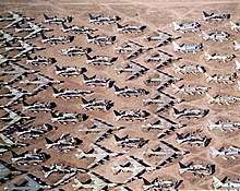
Much of Tucson's economic development has been centered on the development of the University of Arizona, which is currently the largest employer in the city. Davis-Monthan Air Force Base, on the city's southeastern edge, also provides many jobs for Tucson residents. Its presence, as well as the presence of the US Army Intelligence Center (Fort Huachuca, the largest employer in the region in nearby Sierra Vista), has led to the development of many high-tech industries, including government contractors, in the area. The city of Tucson is also a major hub for the Union Pacific Railroad's Sunset Route that links the Los Angeles ports with the South/Southeast regions of the country.
Raytheon Missile Systems (formerly Hughes Aircraft Co.),[76] Texas Instruments, IBM, Intuit Inc., Universal Avionics, Honeywell Aerospace, Sunquest Information Systems, Sanofi-Aventis, Ventana Medical Systems, Inc., and Bombardier Aerospace all have a significant presence in Tucson. Roughly 150 Tucson companies are involved in the design and manufacture of optics and optoelectronics systems, earning Tucson the nickname "Optics Valley".[77] Much of this is thanks in part to the presence of the Steward Observatory at The University of Arizona, which is one of few locations in the world with ability to cast the enormous mirrors used in telescopes around the world and in space.
Tourism is another major industry in Tucson, bringing in $2 billion per year and over 3.5 million visitors annually due to Tucson's numerous resorts, hotels, and attractions.[78]
One of the major annual attractions is the Tucson Gem and Mineral Show, and its associated shows, all held generally in the first two weeks of February. These associated shows (such as gems, jewelry, beads, fossils) are held throughout the city, with 43 different shows in 2010. This makes Tucson's the largest such exposition in the world. Its yearly economic impact in 2015 was evaluated at $120 million. [79]
In addition to vacationers, a significant number of winter residents, or "snowbirds", are attracted to Tucson's mild winters and live here on a seasonal basis. They also contribute to the local economy. Snowbirds often purchase second homes in Tucson and nearby areas, contributing significantly to the property tax base.
Top employers
According to Tucson's 2018 Comprehensive Annual Financial Report,[80] the top employers in the city are:
| # | Employer | # of Employees |
|---|---|---|
| 1 | University of Arizona | 11,251 |
| 2 | Raytheon Missile Systems | 9,600 |
| 3 | State of Arizona | 8,580 |
| 4 | Davis–Monthan Air Force Base | 8,406 |
| 5 | Pima County | 7,060 |
| 6 | Tucson Unified School District No.1 | 6,770 |
| 7 | Banner University Medical Center Tucson | 6,272 |
| 8 | U.S. Customs and Border Protection | 5,739 |
| 9 | Freeport-McMoran Copper & Gold, Inc. | 5,530 |
| 10 | Wal-Mart Stores, Inc. | 5,500 |
Arts and culture
Annual cultural events and fairs
Tucson Gem and Mineral Show
The Tucson Gem & Mineral Show is one of the largest gem and mineral shows in the world and has been held for over 50 years. The Show is only one part of the gem, mineral, fossil, and bead gathering held all around Tucson in over 45 different sites.[81] The various shows run from late-January to mid-February with the official Show lasting two weeks in February.
Tucson Festival of Books
Since 2009, the Tucson Festival of Books has been held annually over a two-day period in March at the University of Arizona. By 2010 it had become the fourth largest book festival in the United States, with 450 authors and 80,000 attendees.[82] In addition to readings and lectures, it features a science fair, varied entertainment, food, and exhibitors ranging from local retailers and publishers to regional and national nonprofit organizations.[83] In 2011, the Festival Founders established an award to recognize exceptional literary achievement. The Founders Award Winners are:
- 2011 - Elmore Leonard
- 2012 - Larry McMurtry & Diana Ossana
- 2013 - R.L. Stine
- 2014 - Richard Russo
- 2015 - Mitch Albom, Dave Barry, Sam Barry, Greg Iles, Ridley Pearson, Amy Tan & Scott Turow -The Rock Bottom Remainders
- 2016 - J.A. Jance
- 2017 - T.C. Boyle
- 2018 - Billy Collins.[84]
- 2019 - Luis Alberto Urrea[85]
- 2020 - Lisa See[86]
Tucson Folk Festival
For the past 33 years, the Tucson Folk Festival has taken place the first Saturday and Sunday of May in downtown Tucson's El Presidio Park. In addition to nationally known headline acts each evening, the Festival highlights over 100 local and regional musicians on five stages is one of the largest free festivals in the country. All stages are within easy walking distance. Organized by the Tucson Kitchen Musicians' Association,[87] volunteers make this festival possible. KXCI 91.3-FM, Arizona's only community radio station, is a major partner, broadcasting from the Plaza Stage throughout the weekend. In addition, there are numerous workshops, events for children, sing-alongs, and a popular singer-songwriter contest. Musicians typically play 30-minute sets, supported by professional audio staff volunteers. A variety of food and crafts are available at the festival, as well as local micro-brews. All proceeds from sales go to fund future festivals.
Fourth Avenue Street Fair
_and_Navy_Operational_Support_Center_Tucson_take_part_in_the_annual_St._Patrick's_Day_Parade.jpg)
There are two Fourth Avenue Street Fairs, in December and late March/early April, staged between 9th Street and University Boulevard, that feature arts and crafts booths, food vendors and street performers. The fairs began in 1970 when Fourth Avenue, which at the time had half a dozen thrift shops, several New Age bookshops and the Food Conspiracy Co-Op, was a gathering place for hippies, and a few merchants put tables in front of their stores to attract customers before the holidays.
These days, the street fair has grown into a large corporate event, with most tables owned by outside merchants. It hosts mostly traveling craftsmen selling various arts such as pottery, paintings, wood working, metal decorations, candles, and many others.
Tucson Rodeo (Fiesta de los Vaqueros)

Another popular event held in February, which is early spring in Tucson, is the Fiesta de los Vaqueros, or rodeo week, founded by winter visitor, Leighton Kramer.[88] While at its heart the Fiesta is a sporting event, it includes what is billed as "the world's largest non-mechanized parade".[89] The Rodeo Parade is a popular event as most schools give two rodeo days off instead of Presidents Day. The exception to this is Presidio High (a non-public charter school), which doesn't get either. Western wear is seen throughout the city as corporate dress codes are cast aside during the Fiesta. The Fiesta de los Vaqueros marks the beginning of the rodeo season in the United States.
Tucson Meet Yourself
Every October for the past 30 years, the Tucson Meet Yourself festival[90] has celebrated the city's many ethnic groups. For one weekend, dancing, singing, artwork, and food from more than 30 different ethnicities are featured in the downtown area. All performers are from Tucson and the surrounding area, in keeping with the idea of "meeting yourself."
Tucson Modernism Week
Since 2012, during the first two weekends of October, the Tucson Historic Preservation Foundation hosts Tucson Modernism Week.[91] The event includes more than 30 programs including tours, lectures, exhibits, films and parties. The events are in mid-century modern buildings and neighborhoods throughout the city and has highlighted the work of significant architects and designers who contributed to the development and history of southern Arizona including: Architect Arthur Brown, Fashion Designer Dolores Gonzales, Architect Bob Swaim, Architect Anne Rysdale, Textile Designers Harwood and Sophie Steiger, Architect Nick Sakellar, Architectural Designer Tom Gist, Furniture Designer Max Gottschalk, Architect, Ned Nelson, Landscape Architect Guy Green, Architect Juan Worner Baz and many others.
All Souls Procession Weekend
The All Souls Procession, held in early November, is one of the largest festivals in Tucson. Modeled on the Mexican holiday Dia de los Muertos (Day of the Dead), it combines aspects of many different cultural traditions.[92] The first All Souls Procession was organized by local artist Susan Kay Johnson in 1990 and involved 35 participants; by 2013, participation was estimated at 50,000.[93][94]
The Procession, held at sundown, consists of a non-motorized parade through downtown Tucson featuring many floats, sculptures, and memorials, in which the community is encouraged to participate. The parade is followed by performances on an outdoor stage, culminating in the burning of an urn in which written prayers have been collected from participants and spectators.[94][95] The event is organized and funded by the non-profit arts organization Many Mouths One Stomach, with the assistance of many volunteers and donations from the public and local businesses.[94]
Cultural and other attractions
Cultural and other attractions include:
- Arizona Historical Society
- The Fremont House is an original adobe house in the Tucson Community Center that was saved while one of Tucson's earliest barrios was razed as urban renewal.
- Fort Lowell Museum
- Mission San Xavier del Bac
- Old Tucson Studios, built as a set for the movie Arizona, is a movie studio and theme park for classic Westerns.
- The Tucson Museum of Art was established as part of an art school, the Art Center, which was founded by local Tucson artists including Rose Cabat[96]
- The University of Arizona Museum of Art includes works by Franz Kline, Jackson Pollock and Mark Rothko as part of the Edward J. Gallagher Memorial Collection, a tribute to a young man who was killed in a boating accident. The museum also includes the Samuel H. Kress Collection of European works from the 14th to 19th centuries and the C. Leonard Pfeiffer Collection of American paintings.
- Center for Creative Photography, a leading museum with many works by major artists such as Ansel Adams and Edward Weston.
- International Wildlife Museum, which is 5 mi (8.0 km) west of Interstate 10, maintains an exhibition of over four-hundred different mounted and prepared animal species hunted from around the globe.[97][98]
- The DeGrazia Gallery in the Sun is an iconic Tucson landmark in the foothills of the Santa Catalina Mountains.

- Arizona-Sonora Desert Museum is a combined zoo, museum, and botanical garden, devoted to indigenous animals and plants of the Sonoran Desert.
- Titan Missile Museum is about 25 mi (40 km) south of the city on I-19. This is a Cold War era Titan nuclear missile silo (billed as the only remaining intact post-Cold War Titan missile silo) turned tourist stop.
- Pima Air & Space Museum has a wide assortment of aircraft on display both indoors and outdoors.
- Pima County Fair
- Trail Dust Town is an outdoor shopping mall and restaurant complex that was built from the remains of a 1950 western movie set.
- Museum of the Horse Soldier
- Jewish History Museum (Tucson)
- Centennial Hall opened in 1937 as the University of Arizona's campus auditorium, designed by architect Roy Place.
- Tucson Chinese Cultural Center
- Tucson Loop Shared Use Bike Path
- Arizona State Museum (on the University of Arizona campus)
- Museum of Contemporary Art, Tucson
Shops in Summerhaven on Mount Lemmon offer such items as jewelry and other gifts, pizza, and fresh-fruit pies. The legacy of the Aspen Fire can be seen in charred trees, rebuilt homes, and melted beads incorporated into a sidewalk.
Fourth Avenue, near the University of Arizona, is home to many shops, restaurants, and bars, and hosts the annual 4th Avenue Street Fair every December and March. University Boulevard, leading directly to the UA Main Gate, is also the center of numerous bars, retail shops, and restaurants most commonly frequented by the large student population of the UA.
El Tiradito is a religious shrine in the downtown area. The Shrine dates back to the early days of Tucson. It is based on a love story of revenge and murder. People stop by the Shrine to light a candle for someone in need, a place for people to go give hope.
The Biosphere 2 is a 3.14-acre educational facility, designed to mimic a tropical or sub-tropical climate-controlled environment.[99]
Literary arts
The accomplished and awarded writers (poets, novelists, dramatists, nonfiction writers) who have lived in Tucson include Edward Abbey, Erskine Caldwell, Barbara Kingsolver and David Foster Wallace. Some were associated with the University of Arizona, but many were independent writers who chose to make Tucson their home. The city is particularly active in publishing and presenting contemporary innovative poetry in various ways. Examples are the Chax Press, a publisher of poetry books in trade and book arts editions, and the University of Arizona Poetry Center, which has a sizable poetry library and presents readings, conferences, and workshops.
Performing arts
Theater groups include the Arizona Theatre Company, which performs in the Temple of Music and Art, and Arizona Onstage Productions, a not-for-profit theater company devoted to musical theater. Broadway in Tucson presents the touring reproductions of many Broadway-style events. The Gaslight Theater produces musical melodrama parodies in the old Jerry Lewis Theater and has been in Tucson since 1977.[100]
The Desert View Performing Arts Center (DVPAC) – a State of the Art Theater located in SaddleBrooke presents live performances from Rock and Roll to Musicals and Symphonies. Located at 39900 S. Clubhouse Drive, Tucson, AZ 85739 online information at https://dvpac.net/
The annual Tucson Fringe Festival, held in various local venues in and around Downtown Tucson, offers non-traditional artistic performances at low cost to the public. The festival is held in early January each year.
Music
Musical organizations include the Tucson Symphony Orchestra (founded in 1929) and Arizona Opera (founded as the Tucson Opera Company in 1971). The Tucson Arizona Boys Chorus, founded in 1939 and performing a wide-ranging repertoire that incorporates rope tricks, has represented the city as "Ambassadors in Levi's" at local, national, and international concerts.[101][102] The Tucson Girls Chorus runs six choirs and numerous satellite choirs which perform locally, nationally, and internationally.[103]
Tucson is considered an influential center for Mariachi music and is home to a large number of Mariachi musicians and singers.[104] The Tucson International Mariachi Conference, hosted annually since 1982, involves several hundred mariachi bands and folklorica dance troops during a three-day festival in April.[105] The Norteño Festival and Street Fair in the enclave city of South Tucson is held annually at the end of summer.
Tucson is also known nationally for its Punk scene. Since the late 1970s punk subculture has flourished in Tucson.[106] At present there are multiple punk bars downtown and house venues in the surrounding neighborhoods. [107]
Prominent musical artists based in Tucson have included Lalo Guerrero, Linda Ronstadt, The Dusty Chaps, Howe Gelb, Bob Log III, Calexico, Giant Sand, Hipster Daddy-O and the Handgrenades, The Bled, Ramshackle Glory, and Tucson's official troubadour Ted Ramirez. The Tucson Area Music Awards, or TAMMIES, are an annual event.[108]
Cuisine
Tucson is well known for its Sonoran-style Mexican food.[109][110] But since the turn of the century, ethnic restaurants and fine dining choices have proliferated.[111][112]
In 2015 the United Nations Educational, Scientific and Cultural Organization (UNESCO) designated Tucson a "world city of gastronomy" under the Creative Cities Network program,[113] becoming thus the first city of gastronomy in the United States.[114][115]
The Sonoran hot dog is very popular in Tucson. This is a hot dog wrapped in bacon and grilled, served on a bolillo-style hot dog bun, and topped with pinto beans, onions, tomatoes, and a variety of additional condiments, often including mayonnaise, mustard, and jalapeño salsa.[116][117][118]
Nicknames
Tucson is commonly known as "The Old Pueblo". While the exact origin of this nickname is uncertain, it is commonly traced back to Mayor R. N. "Bob" Leatherwood. When rail service was established to the city on March 20, 1880, Leatherwood celebrated the fact by sending telegrams to various leaders, including the President of the United States and the Pope, announcing that the "ancient and honorable pueblo" of Tucson was now connected by rail to the outside world. The term became popular with newspaper writers who often abbreviated it as "A. and H. Pueblo". This in turn transformed into the current form of "The Old Pueblo".[119]
In the early 1980s, city leaders ran a contest searching for a new nickname. The winning entry was the "Sunshine Factory".[120] The new nickname never gained popular acceptance, allowing the old name to remain in common use.[121] Tucson was dubbed "Optics Valley" in 1992 when Business Week ran a cover story on the Arizona Optics Industry Association.[122]
Sports
Tucson is not represented in any of the five major sports leagues of the United States; the NFL, MLB, the NBA, the NHL or MLS. The University of Arizona Wildcats teams, most notably the men's basketball and women's softball teams have strong local interest. The men's basketball team, formerly coached by Hall of Fame head coach Lute Olson and currently coached by Sean Miller, has made 25 straight NCAA Tournaments and won the 1997 National Championship. Arizona's Softball team has reached the NCAA National Championship game 12 times and has won 8 times, most recently in 2007. The men's baseball team has won NCAA National Championships in 1976, 1980, 1986 and 2012. The university's swim teams have gained international recognition, with swimmers coming from as far as Japan and Africa to train with the coach Frank Busch who has also worked with the U.S. Olympic swim team for a number of years. Both men's and women's swim teams won the 2008 NCAA National Championships.[123]
The Tucson Saguaros of the independent Pecos League started play in 2016 and play at Amphitheater High School. They won the league in their inaugural season. The Tucson Padres played at Kino Veterans Memorial Stadium from 2011 to 2013. They served as the AAA affiliate of the San Diego Padres. The team, formerly known as the Portland Beavers, temporarily moved to Tucson from Portland while the team awaited a new stadium in Escondido.[124][125] Legal issues derailed the plans to build the Escondido stadium, so they moved to El Paso, Texas for the 2014 season. Previously, the Tucson Sidewinders, a triple-A affiliate of the Arizona Diamondbacks, won the Pacific Coast League championship and unofficial AAA championship in 2006. The Sidewinders played in Tucson Electric Park and were in the Pacific Conference South of the PCL. The Sidewinders were sold in 2007 and moved to Reno, Nevada after the 2008 season. They now compete as the Reno Aces.
The Springfield Falcons of the American Hockey League moved to Tucson following the 2015–2016 season to become the Tucson Roadrunners. They play in the AHL's Pacific division, and are affiliated with the Arizona Coyotes.
Tucson is also host to the Mobile Mini Sun Cup, the largest pre-season Major League Soccer (MLS) tournament in the country. As many as 11 MLS soccer clubs train in Tucson every winter. Tucson is also host to FC Tucson, a professional soccer club that currently plays in the third-tier USL League One and is affiliated with second-tier USL Championship side Phoenix Rising FC.
The United States Handball Association Hall of Fame is in Tucson.[126]
The Tucson Monsoon, a full-contact women's football team, is a member of the Independent Women's Football League where they have played since their inception in 2006.[127] In 2009, the Arizona She-Devils also played women's football in Tucson as an expansion team of the Women's Football Alliance.[128]
Tracks include Tucson Raceway Park and Rillito Downs. Tucson Raceway Park hosts NASCAR-sanctioned auto racing events and is one of only two asphalt short tracks in Arizona. Rillito Downs is an in-town destination on weekends in January and February each year. This historic track held the first organized quarter horse races in the world, and they are still racing there. The racetrack is threatened by development. The Moltacqua racetrack, was another historic horse racetrack on what is now Sabino Canyon Road and Vactor Ranch Trail, but it no longer exists.[129]
In 2018, the Indoor Football League announced they were bringing an expansion team to Tucson to play at the Tucson Convention Center's newly-renovated Tucson Arena. That team would be announced as the Tucson Sugar Skulls.[130]
Parks and recreation
The city has more than 120 parks, from small and local to larger parks with ballfields, natural areas, lakes, 5 public golf courses, and Reid Park Zoo. "The Loop" is a popular system of walking/running/bicycling/horseback trails encircling the city primarily along washes, and it is usually well separated from traffic. Several scenic parks and points of interest are also nearby, including the Tucson Botanical Gardens, Tohono Chul Park, Saguaro National Park, Sabino Canyon, and Biosphere 2 (just north of the city, near the town of Oracle).
Mt. Lemmon is 25 miles (40 km) north (by road) and over 6,700 feet (2,000 m) above Tucson in the Santa Catalina Mountains in the Coronado National Forest. Outdoor activities in the Catalinas include hiking, mountain biking, birding, rock climbing, picnicking, camping, swimming in mountain stream pools, sky rides at Ski Valley, fishing and photography. In winter with enough snow the sky ride converts back to skiing at the southernmost ski resort in the continental United States. Summerhaven, a community near the top of Mt. Lemmon, is also a popular destination.
The League of American Bicyclists gave Tucson a gold rating for bicycle friendliness in late April 2007. Tucson hosts the largest perimeter cycling event in the United States. The ride called "El Tour de Tucson" happens in November on the Saturday before Thanksgiving. El Tour de Tucson produced and promoted by Perimeter Bicycling has had as many as 10,000 participants from all over the world. In 2019, ridership is expected to be 6,000 cyclists. [131]Tucson is one of only nine cities in the U.S. to receive a gold rating or higher for cycling friendliness from the League of American Bicyclists. The city is known for its winter cycling opportunities, with teams and riders from around the world spending a portion of the year training in Tucson's year-round biking climate. Popular mountain biking areas include Tucson Mountain Park, Sweetwater Preserve, the Tortolita Mountain trail systems, and Fantasy Island. Road cyclists take on Catalina Highway's steep climb year-round.
Politics and government
Pima County supported John Kerry 53% to 47% in the 2004 U.S. Presidential Election,[132] and Barack Obama 54% to 46% in the 2008 U.S. Presidential Election.[133] In the latter year, Pima was the only county to vote against Arizona's gay marriage ban.[134] In 2013, Tucson became the second city in Arizona to approve of civil unions for same-sex partners.[135] The city was the first in the state to pass a domestic partnership registry earlier in 2003.[136]
In general, Tucson and Pima County support the Democratic Party, as opposed the state's largest metropolitan area, Phoenix, which usually supports the Republican Party. Congressional redistricting in 2013, following the publication of the 2010 Census, divided the Tucson area into three Federal Congressional districts (the first, second and third of Arizona). The city center is in the 3rd District, represented by Raul Grijalva, a Democrat, since 2003, while the more affluent residential areas to the south and east are in the 2nd District, represented by Democrat Ann Kirkpatrick since 2019, and the exurbs north and west between Tucson and Phoenix in the 1st District are represented by Democrat Tom O'Halleran since 2016.[137] The United States Postal Service operates post offices in Tucson. The Tucson Main Post Office is at 1501 South Cherrybell Stravenue.[138]
City government
Tucson follows the "weak mayor" model of the council-manager form of local government. The 6-member city council holds exclusive legislative authority, and shares executive authority with the mayor, who is elected by the voters independently of the council. An appointed city manager is responsible for the day-to-day operations of the city. Tucson is the only city in Arizona that holds officially partisan elections for city offices, with candidates being nominated through party primaries.[139]
Both the council members and the mayor serve four-year terms; none face term limits. Council members are nominated by their wards via a ward-level primary held in August. The top vote-earners from each party then compete at-large for their ward's seat on the November ballot. In other words, on election day the whole city votes on all the council races up for that year. Council elections are severed: Wards 1, 2, and 4 (as well as the mayor) are up for election in the same year (most recently 2015), while Wards 3, 5, and 6 share another year (most recently 2017).
Tucson is known for being a trailblazer in voluntary partial publicly financed campaigns. Since 1985, both mayoral and council candidates have been eligible to receive matching public funds from the city. To become eligible, council candidates must receive 200 donations of $10 or more (300 for a mayoral candidate). Candidates must then agree to spending limits equal to 33¢ for every registered Tucson voter, or $79,222 in 2005 (the corresponding figures for mayor are 64¢ per registered voter, or $142,271 in 2003). In return, candidates receive matching funds from the city at a 1:1 ratio of public money to private donations. The only other limitation is that candidates may not exceed 75% of the limit by the date of the primary. Many cities, such as San Francisco and New York City, have copied this system, albeit with more complex spending and matching formulas.
Mayor Regina Romero (D) was sworn into office on December 2, 2019, succeeding Jonathan Rothschild (D) who was sworn into office on December 5, 2011, succeeding Robert E. Walkup (R), who took office in 1999.[140] Walkup was preceded by George Miller (D), 1991–1999; Tom Volgy (D), 1987–1991; Lew Murphy (R), 1971–1987; and Jim Corbett (D), 1967–1971.
| Tucson City Council Members | Ward | First Elected | Website |
|---|---|---|---|
| Regina Romero | 1 | 2007 | [141] |
| Paul Cunningham | 2 | 2010 (Appointed) | [142] |
| Paul Durham | 3 | 2017[143] | [144] |
| Shirley Scott | 4 | 1995[145] | [146] |
| Richard Fimbres | 5 | 2009 | [147] |
| Steve Kozachick | 6 | 2009[145] | [148] |
Education
Post-secondary education
- University of Arizona: established in 1885; the second largest university in the state in terms of enrollment with over 36,000 students.
- Pima Community College has ten campuses.
- Arizona State University's College of Public Service & Community Solutions has conferred Bachelor of Social Work (BSW) and Master of Social Work (MSW) degrees for more than 30 years through its School of Social Work Tucson component.[149]
- Tucson College[150] has one Tucson campus.
- Brookline College has one Tucson campus.
- University of Phoenix has four Tucson campuses.
- Prescott College has a Tucson branch campus.
- Northern Arizona University has a Tucson branch campus.
- Arizona School of Acupuncture & Oriental Medicine[151]
- The Art Center Design College has two Tucson campuses.
- Wayland Baptist University has one Tucson campus.[152]
Primary and secondary schools
Primarily, students of the Tucson area attend public schools in the Tucson Unified School District (TUSD). TUSD has the second highest enrollment of any school district in Arizona, behind Mesa Unified School District in the Phoenix metropolitan area. There are also many publicly funded charter schools with a specialized curriculum.[153]
In 1956, Tucson High School had the largest enrollment of any secondary school in the United States, with a total of more than 6,800 students.[154] In 2018, Tucson High School enrollment was just over 3,000.
The facility operated on a two-shift basis while construction went on for two other high schools that opened within a year to educate children in the rapidly booming Tucson population.
Media
Printed Newspaper
Tucson has one daily newspaper, the morning Arizona Daily Star. Wick Communications publishes the daily legal paper The Daily Territorial, while Boulder, Colo.-based 10/13 Communications publishes Tucson Weekly (an "alternative" publication), Inside Tucson Business and the Explorer. TucsonSentinel.com is a nonprofit independent online news organization. Tucson Lifestyle Magazine, Lovin' Life in Tucson, DesertLeaf, and Zócalo Magazine are monthly publications covering arts, architecture, decor, fashion, entertainment, business, history, and other events. The Arizona Daily Wildcat is the University of Arizona's student newspaper, and the Aztec News is the Pima Community College student newspaper. Catholic Outlook is the newspaper for the Roman Catholic Diocese of Tucson, and the Arizona Jewish Post is the newspaper of the Jewish Federation of Southern Arizona.
Television
The Tucson metro area is served by many local television stations and is the 65th largest designated market area (DMA) in the U.S. with 433,330 homes (0.39% of the total U.S.). It is limited to the three counties of southeastern Arizona (Pima, Santa Cruz, and Cochise)[155]
The major television networks serving Tucson are:
Infrastructure
Energy
Tucson's primary electrical power source is a coal and natural gas power plant managed by Tucson Electric Power that is situated within the city limits on the southwestern boundary of Davis-Monthan Air-force base adjacent to Interstate 10. The air pollution generated has raised some concerns as the Sundt operating station has been online since 1962 and is exempt from many pollution standards and controls due to its age.[156] Solar has been gaining ground in Tucson with its ideal over 300 days of sunshine climate. Federal, state, and even local utility credits and incentives have also enticed residents to equip homes with solar systems. Davis-Monthan AFB has a 3.3 Megawatt (MW) ground-mounted solar photovoltaic (PV) array and a 2.7 MW rooftop-mounted PV array, both of which are in the Base Housing area. The base will soon have the largest solar-generating capacity in the United States Department of Defense after awarding a contract on September 10, 2010, to SunEdison to construct a 14.5 MW PV field on the northwestern side of the base.[157]
Global Solar Energy, which is at the University of Arizona's science and technology park, is one of the planet's largest CIGS solar fields at 750 kilowatts.[158][159]
Sustainability
The biggest sustainability problem in Tucson, with its high-desert climate, is a potable water supply. The state manages all water in Arizona through its Arizona Department of Water Resources (ADWR). The primary consumer of water is Agriculture (including golf courses), which consumes about 69% of all water. Municipal (which includes residential use) accounts for about 25% of use.[160] Energy consumption and availability is another sustainability issue. However, with over 300 days of full sun annually, Tucson has demonstrated its potential to be an ideal solar energy producer.
Light pollution
Tucson and Pima County adopted dark sky ordinances to control light pollution in support of the region's astronomical observatories in 1972.[161] Last amended in 2012,[162] the City of Tucson/Pima County Outdoor Lighting Code establishes maximum illumination levels, shielding requirements, and limits on signage in "continuing support of astronomical activity and minimizing wasted energy, while not compromising the safety, security, and well-being of persons engaged in outdoor nighttime activities."[163]
Water
Less than 100 years ago, the Santa Cruz River flowed nearly year-round through Tucson. This supply of water has slowly disappeared, causing Tucson to seek alternative sources.
In 1881, water was pumped from a well on the banks of the Santa Cruz River and flowed by gravity through pipes into the distribution system.[164]
Tucson currently draws water from two main sources: Central Arizona Project (CAP) water and groundwater. In 1992, Tucson Water delivered CAP water to some customers that was referred to as being unacceptable due to discoloration, bad odor and flavor, as well as problems it caused with some customers' plumbing and appliances. Tucson's city water currently consists of CAP water mixed with groundwater.
In an effort to conserve water, Tucson is recharging groundwater supplies by running part of its share of CAP water into various open portions of local rivers to seep into their aquifer.[165] Additional study is scheduled to determine how much water is lost through evaporation from the open areas, especially during the summer. The City of Tucson provides reclaimed water to its inhabitants, but it is only used for "applications such as irrigation, dust control, and industrial uses."[166] These resources have been in place for more than 27 years, and deliver to over 900 locations.[166]
To prevent further loss of groundwater, Tucson has been involved in water conservation and groundwater preservation efforts, shifting away from its reliance on a series of Tucson area wells in favor of conservation, consumption-based pricing for residential and commercial water use, and new wells in the more sustainable Avra Valley aquifer, northwest of the city. An allocation from the Central Arizona Project Aqueduct (CAP), which passes more than 300 mi (480 km) across the desert from the Colorado River, has been incorporated into the city's water supply, annually providing over 20 million gallons of "recharged" water which is pumped into the ground to replenish water pumped out.[167] Since 2001, CAP water has allowed the city to remove or turn off over 80 wells.[168]
Transportation
.jpg)
Public transit
Tucson's Sun Tran bus system serves greater Tucson with standard, express, regional shuttle, and on-demand shuttle bus service. It was awarded Best Transit System in 1988 and 2005.[169] A 3.9-mile streetcar line, Sun Link, connects the University of Arizona campus with 4th Avenue, downtown, and the Mercado District west of Interstate 10 and the Santa Cruz River. Ten-minute headway passenger service began July 25, 2014.[170] The streetcar uses Sun Tran's card payment and transfer system, connecting with the University of Arizona's CatTran shuttles, Amtrak, and Greyhound intercity bus service.
Rail
Amtrak, the national passenger rail system, provides service to Tucson three times weekly in both directions, operating its Sunset Limited between Los Angeles, California and New Orleans, Louisiana; and Texas Eagle service between Los Angeles and Chicago, Illinois.
Airport
Tucson International Airport (IATA: TUS, ICAO: KTUS), is 6 mi (9.7 km) south of the city's center. TIA is the second-largest commercial airport in Arizona, providing nonstop flights to 15 destinations throughout the United States.[171] In addition to passenger and freight service, TIA supports the 162d Fighter Wing's fleet of seventy F-16s stationed at the Tucson Air National Guard Base.[172] There are two general aviation reliever airports in the area. The city of Tucson operates Ryan Airfield 13 miles southwest of the city center, and the town of Marana operates Marana Regional Airport 15 miles to the northwest. Pinal Airpark is also within the metropolitan area.
Roadways
There are two Interstate highways in the metropolitan area. Interstate 10 runs southeast from Phoenix through Marana, passes west of downtown, and continues east toward El Paso. Interstate 19 leaves the I-10 south of downtown and heads south to the Mexican border. Arizona State Route 210 is a shorter expressway that links downtown with Davis-Monthan Air Force Base and Tucson's southeast side. Tucson does not have a beltway system, and relies almost entirely on surface streets.
Freeways and state highways in Tucson include:


Cycling
Cycling is popular in Tucson due to its flat terrain and dry climate. Tucson and Pima County maintain an extensive network of marked bike routes, signal crossings, on-street bike lanes, mountain-biking trails, and dedicated shared-use paths. The Loop is a network of seven linear parks comprising over 100 mi (160 km) of paved, vehicle-free trails that encircles the majority of the city with links to Marana and Oro Valley.[173][174] The Tucson-Pima County Bicycle Advisory Committee (TPCBAC) serves in an advisory capacity to local governments on issues relating to bicycle recreation, transportation, and safety. The League of American Bicyclists awarded Tucson a gold rating for bicycle-friendliness in 2006.[175]
Tucson is well known for its Rillito River bike path which the local refer to as “The Loop”. Built mainly along the river beds of Tucson, the Riliito bike path totals 131 miles of paths linking Tucson to its neighboring communities, including Oro Valley. [176]
Notable people
Sister cities
Tucson has nine sister cities, as designated by Sister Cities International:[177]


See also
- Davis–Monthan Air Force Base
- Hyundai Tucson
- List of tallest buildings in Tucson
- List of historic properties in Tucson, Arizona
- National Register of Historic Places listings in Pima County, Arizona
- Optics Valley
- Sons of Tucson
- Tucson Garbage Project
Notes
- Mean monthly maxima and minima (i.e. the expected highest and lowest temperature readings at any point during the year or given month) calculated based on data at said location from 1981 to 2010.
- Official records for Tucson kept September 1894 to January 1930 at the Weather Forecast Office, February 1930 to 14 October 1948 at the Weather bureau Office, and at Tucson Int'l since 15 October 1948. For more information, see Threadex
References
- "Annexations | Official website of the City of Tucson". Tucsonaz.gov. Archived from the original on March 27, 2017. Retrieved April 21, 2017.
- "2018 U.S. Gazetteer Files". United States Census Bureau. Archived from the original on July 1, 2019. Retrieved July 1, 2019.
- "U.S. Census website". United States Census Bureau. Retrieved May 25, 2018.
- "Population and Housing Unit Estimates". Archived from the original on May 4, 2018. Retrieved June 4, 2019.
- "Tucson". Geographic Names Information System. United States Geological Survey.
- "Find a County". National Association of Counties. Archived from the original on May 31, 2011. Retrieved June 7, 2011.
- "Metropolitan and Micropolitan Statistical Areas". Qedfinancialsystems.com. Archived from the original on February 10, 2018. Retrieved February 8, 2018.
- "David Leighton,"Street Smarts: Sahuarita's name may be misspelling", Arizona Daily Star, February 8, 2016". Archived from the original on February 10, 2016. Retrieved February 14, 2016.
- "Gadsden Purchase Treaty". National Archives. August 15, 2016. Retrieved February 27, 2020.
- "Capitals of the Arizona Territory". www.library.pima.gov. Retrieved February 27, 2020.
- "Tucson Named First UNESCO City of Gastronomy in the USA". Visit Tucson. Archived from the original on June 20, 2019. Retrieved June 14, 2019.
- Thiel, J. Homer; Diehl, Michael W. "Cultural History of the Tucson Basin and the Project Area" (PDF). Archived (PDF) from the original on October 3, 2017. Retrieved October 3, 2017.
- "The Hohokam". Arizona Museum of Natural History. Archived from the original on October 3, 2017. Retrieved October 3, 2017.
- Mabry, Jonathan B.; Thiel, J. Homer (1995). "A thousand years of irrigation in Tucson" (PDF). Archaeology in Tucson (Fall 1995). Center of Desert Archaeology. Archived (PDF) from the original on April 12, 2019. Retrieved October 3, 2017.
- Wright, Erik J. (October 2010). ""Yes, Here I am Again! Tucson's Prize Bandit of 1878: William W. Brazelton". Wild West History Association: Journal. 3 (5): 43–48.
- "Another Assassination Frank Stilwell Found Dead this Morning Being Another Chapter in the Earp-Clanton Tragedy". Tombstone, Arizona. March 27, 1882. p. 4. Archived from the original on December 26, 2010. Retrieved April 25, 2011.
- Barra, Alan (December 1998). "Who Was Wyatt Earp?". American Heritage Magazine. Vol. 49 no. 8. Archived from the original on May 7, 2006.
- David Leighton. "Street Smarts: Few Tucsonans saw Wyatt Earp as hero". Arizona Daily Star. Archived from the original on September 12, 2016. Retrieved September 14, 2016.
- Jim Levy – The Jewish Gunfighter
- [Rosa, Joseph G. Jim Leavy, Gunfighter True West Magazine
- "Race and Hispanic Origin for Selected Cities and Other Places: Earliest Census to 1990". U.S. Census Bureau. Archived from the original on August 12, 2012. Retrieved January 4, 2012.
- Rogers, Frank B. (1969). "THE RISE AND DECLINE OF THE ALTITUDE THERAPY OF TUBERCULOSIS". Bulletin of the History of Medicine. 43 (1): 1–16. JSTOR 44447350. PMID 4887472.
- "Feliz Cumpleaños (Happy Birthday) Tucson! - Carolyn's Community". Tucson Citizen. August 20, 2010. Archived from the original on July 21, 2012. Retrieved October 27, 2011.
- "KTUS Tucson International Airport Tucson, Arizona, USA". Airnav.com. Archived from the original on July 17, 2017. Retrieved January 22, 2012.
- Tucsonpresidiotruste.org Archived May 12, 2013, at the Wayback Machine
- Barrio historico Tucson Archived July 3, 2010, at the Wayback Machine. Retrieved 2010-03-12.
- David Leighton. "Street Smarts: 'Well, I hardly knew what to think of the place' was Tucsonan's first impression". Arizona Daily Star. Archived from the original on June 20, 2018. Retrieved July 7, 2018.
- Images of America: Early Tucson, by Anne I. Woosley and the Arizona Historical Society; (c) 2008 Arcadia Publishing; ISBN 0-7385-5646-7
- David Leighton. "Street Smarts: Feldman brought family to Tucson after 1870s economic crash". Arizona Daily Star. Archived from the original on September 13, 2016. Retrieved September 14, 2016.
- Rob O'Dell (October 29, 2010). "Azstarnet.com". Arizona Daily Star. Archived from the original on January 1, 2011. Retrieved January 22, 2012.
- "Kvoa.com". Kvoa.com. June 23, 2010. Archived from the original on December 27, 2011. Retrieved January 22, 2012.
- "Arrival of the Southern Pacific Railroad in Tucson". Archived from the original on January 26, 2011. Retrieved March 12, 2012.
- "Tucson Neighbourhoods, Locations and Districts: Locations in Tucson Area, AZ, USA". Tucson.world-guides.com. Archived from the original on April 15, 2011. Retrieved October 27, 2011.
- Tucson, U.S.A. | Emporis.com Archived October 26, 2006, at the Wayback Machine. Retrieved 2010-03-12.
- Public Buildings – Pima County Courthouse, Arizona Heritage Traveler Archived February 1, 2015, at the Wayback Machine
- El Charro Café Archived May 24, 2009, at the Wayback Machine. Retrieved 2010-03-12.
- David Leighton. "Street Smarts: Before arena, road named for "Pop" McKale". Arizona Daily Star. Archived from the original on September 12, 2016. Retrieved September 14, 2016.
- David Leighton. "Street Smarts: Speedway's sports racing roots". Arizona Daily Star. Archived from the original on July 7, 2018. Retrieved July 7, 2018.
- David Leighton. "Street Smarts: Barraza worked to unify Arizona miners". Arizona Daily Star. Archived from the original on August 29, 2016. Retrieved September 14, 2016.
- Arizonaguide.com, Retrieved December 14, 2010
- IMG.groundspeak.com Archived September 28, 2011, at the Wayback Machine, Retrieved December 14, 2010
- CMS3.tucsonaz.gov Archived December 6, 2010, at the Wayback Machine, Retrieved December 14, 2010
- David Leighton. "Street Smarts: Bloody murder, buried money in town's history". Arizona Daily Star. Archived from the original on September 13, 2016. Retrieved September 14, 2016.
- David Leighton. "Street Smarts: Starr Pass Blvd. has telegraph-line link". Arizona Daily Star. Archived from the original on September 12, 2016. Retrieved September 14, 2016.
- Old West Tucson Archived September 21, 2017, at the Wayback Machine. Old West Tucson. Retrieved on 2013-07-12.
- Tom Beal. "Tucson Oddity: What's with crater on edge of 'A' Mountain?". Arizona Daily Star. Archived from the original on June 12, 2018. Retrieved July 7, 2018.
- David Leighton. "Street Smarts: How Oracle Road came to be named for a fast ship with a teetotaling crew". Arizona Daily Star. Archived from the original on July 7, 2018. Retrieved July 7, 2018.
- David Leighton. "Harold Bell Wright the inspiration for Tucson neighborhood". Arizona Daily Star. Archived from the original on April 19, 2019. Retrieved September 14, 2016.
- David Leighton. "Street Smarts: Country Club, Golf Links used to be one road". Arizona Daily Star. Archived from the original on September 12, 2016. Retrieved September 14, 2016.
- David Leighton. "Engineer-businessman Craycroft built impressive home for its time". Arizona Daily Star. Archived from the original on September 12, 2016. Retrieved September 14, 2016.
- David Leighton. "Street Smarts: Civano honors notable Tucsonans who gave to their community". Arizona Daily Star. Archived from the original on July 7, 2018. Retrieved July 7, 2018.
- David Leighton. "Street Smarts: Highway, mountain named for botanist". Arizona Daily Star. Archived from the original on July 7, 2018. Retrieved July 7, 2018.
- Lemmon, J.G. (1881). "A botanical wedding trip" (PDF). The Californian. Vol. 5 no. 24. pp. 517–525. Archived from the original (PDF) on April 2, 2015. Retrieved June 19, 2014 – via New York Botanical Garden.
- Patterson, E.O. & E.S. Kitt. Pioneering in Arizona: the reminiscences of Emerson Oliver Stratton & Edith Stratton Kitt. 1964. pp. 68-69
- University of Arizona Opens Sky Center To Public Archived July 22, 2011, at the Wayback Machine (Press Release at VisitTucson.org). Retrieved 2010-12-16.
- About us Archived November 25, 2010, at the Wayback Machine, Mt. Lemmon Sky Center. Retrieved 12-16-10
- Yeager, Selene (October 24, 2019). "The 30 Hardest Hill Climbs in the World". Bicycling. Archived from the original on November 17, 2019. Retrieved November 23, 2019.
- McKnight & Hess, pp. 212 ff, "Climate Zones and Types: Dry Climates (Zone B)".
- Harris, RB; Griffith, K; Moon, TE (2001). "Trends in the incidence of nonmelanoma skin cancers in southeastern Arizona, 1985-1996". J Am Acad Dermatol. 45 (4): 528–36. doi:10.1067/mjd.2001.114742. PMID 11568742.
- NWS Tucson Office Monsoon tracker Archived August 18, 2006, at the Wayback Machine. Retrieved 2010-03-12.
- Two underpasses leading towards downtown Tucson from the north, at Sixth Avenue and Stone Avenue, have such "feet of water" scales.
- Arizona State Legislature, ARS 28-910, Liability for emergency responses in flood areas; definitions Archived September 23, 2016, at the Wayback Machine. Retrieved 2010-03-12.
- "Tucson snow to give way to warmer weather, clearer skies through weekend". Tucson. Archived from the original on February 28, 2019. Retrieved February 27, 2019.
- "Inches of snow, frigid temperatures chill Southern Arizona". Tucson.com. Archived from the original on February 23, 2019. Retrieved February 23, 2019.
- Tucson University of Arizona, Arizona – Climate Summary Archived April 4, 2012, at the Wayback Machine. Retrieved 2010-03-12.
- Tucso WSO AP, Arizona – Climate Summary Archived April 4, 2012, at the Wayback Machine. Retrieved 2010-03-12.
- "NowData - NOAA Online Weather Data". Retrieved October 21, 2019.
- "Station Name: AZ TUCSON INTL AP". National Oceanic and Atmospheric Administration. Retrieved October 21, 2019.
- "WMO Climate Normals for TUCSON/INT'L ARPT AZ 1961–1990". National Oceanic and Atmospheric Administration. Retrieved March 10, 2014.
- "Monthly Averages for Tucson, AZ". Retrieved March 28, 2011.
- "Census of Population and Housing". Census.gov. Retrieved June 4, 2016.
- "Arizona - Race and Hispanic Origin for Selected Cities and Other Places: Earliest Census to 1990". U.S. Census Bureau. Archived from the original on August 12, 2012.
- "Tucson (city), Arizona". State & County QuickFacts. U.S. Census Bureau. Archived from the original on June 11, 2012. Retrieved May 16, 2012.
- Frey, William H. (2018). Diversity Explosion: How New Racial Demographics Are Remaking America (2nd ed.). Washington, D.C.: Brookings Institution Press. p. 177. ISBN 978-0-8157-2398-1.
- "Feds give OK to new Ariz. congressional maps". Inside Tucson Business. Archived from the original on March 5, 2017. Retrieved February 2, 2013.
- David Leighton. "Street Smarts: Tucson's biggest manufacturing plant was almost built in Phoenix". Arizona Daily Star. Archived from the original on July 7, 2018. Retrieved July 7, 2018.
- Fischer, Alan D. "Optics Valley: Can Tucson stay king of the hill?". Arizona Daily Star. Archived from the original on December 25, 2007. Retrieved August 25, 2006.
- Long, Levy J. (October 10, 2006). ""Luxury labels: Tiffany, Louis Vuitton could inspire more high-end retailers to try Tucson."". Archived from the original on May 28, 2008. Retrieved December 29, 2007. Arizona Daily Star. Retrieved 2010-03-12.
- "BizTUCSON | World's Biggest Gem Show – $120 Million Economic Impact". Retrieved November 23, 2019.
- "City of Tucson 2018 Comprehensive Annual Financial Report" (PDF). February 27, 2019. p. 179. Retrieved December 19, 2019.
- Tucson Gem and Mineral Society Archived December 4, 2008, at the Wayback Machine. Retrieved 2010-03-12.
- "Tucson Festival of Books now 4th largest book fair in U.S." Archived from the original on April 18, 2012. Retrieved March 9, 2013.
- "Tucson Festival of Books: Exhibitors". Archived from the original on March 13, 2013. Retrieved March 9, 2013.
- "Tucson Festival of Books Founder's Award". Archived from the original on March 11, 2013. Retrieved April 30, 2018.
- "Luis Urrea to receive the Tucson Festival of Books Founders Award". Arizona Daily Star. Retrieved February 26, 2020.
- Eubank, Johanna. "Author Lisa See will receive the 2020 Tucson Festival of Books Founders Award". Arizona Daily Star. Retrieved February 26, 2020.
- The Tucson Folk Festival homepage Archived May 6, 2018, at the Wayback Machine. Retrieved 2010-03-12.
- David Leighton. "Street Smarts: Kramer Ave. named for winter visitor who helped start rodeo, parade in 1925". Arizona Daily Star. Archived from the original on July 7, 2018. Retrieved July 7, 2018.
- "The Tucson Rodeo Parade". Archived from the original on March 1, 2010. Retrieved March 12, 2010.
- Tucson Meet Yourself, Tucson Festival, Tucson Folk Arts, Tucson Entertainment Archived August 11, 2007, at the Wayback Machine. Retrieved 2010-03-12.
- "Tucson Modernism Week". Tucsonmod.com. Archived from the original on September 10, 2016. Retrieved September 14, 2016.
- Westerman, Kim (2011). Explorer's Guide Tucson: A Great Destination (Explorer's Great Destinations). The Countryman Press. pp. 38–39. ISBN 9781581579093. Archived from the original on January 20, 2016. Retrieved November 12, 2015.
- MobileReference (2007). Encyclopedia of Observances, Holidays and Celebrations. MobileReference Series. pp. 198–199. ISBN 9781605011776. Archived from the original on January 20, 2016. Retrieved November 12, 2015.
- Herreras, Mari. "All Souls, All Community: Tucson's heart exposes itself every All Souls Procession". Tucson Weekly. Archived from the original on November 7, 2013. Retrieved November 13, 2013.
- Regan, Margaret (November 5, 2009). "To Mourn and to Honor: The All Souls Procession enters its third decade of helping Tucsonans deal with death". Tucson Weekly. Archived from the original on November 13, 2013. Retrieved November 13, 2013.
- Regan, Margaret. "Ninety and Nimble". Tucson Weekly. Tucson, Arizona. October 7, 2004.
- Thewildlifemuseum.org, retrieved 12-15-10
- Thewildlifemuseum.org, Archived December 29, 2010, at the Wayback Machine retrieved 12-15-10
- B2science.org Archived December 29, 2010, at the Wayback Machine, retrieved 2010-12-15
- "History". The Gaslight Theatre. Archived from the original on December 3, 2014. Retrieved December 13, 2014.
- "T-Model Hank Rides and Tucson Boys Sing". Moving Image Archive News. July 28, 2015. Archived from the original on January 15, 2019. Retrieved January 14, 2019.
- "Tucson Arizona Boys Chorus (video)". KGUN-TV. December 8, 2016. Retrieved January 14, 2019.
- "History". Tucson Girls Chorus. Archived from the original on January 17, 2019. Retrieved January 16, 2019.
- Tatum, Charles M. (August 2, 2001). Chicano Popular Culture: Que Hable el Pueblo. The Mexican American Experience. University of Arizona Press. p. 46. ISBN 978-0816519835.
- Rosendtadt, Jose (April 26, 2007). "Mariachi: 25 years of greatness". Tucson Citizen. p. Calendar. Archived from the original on October 11, 2014. Retrieved December 1, 2014.
- Gonzales, Greg; Eshrati, Parisa (November 17, 2016). "They Called It T.H.C.: A Glimpse Into Tucson's Punk History". Trial and Error Collective. Archived from the original on April 28, 2019. Retrieved April 28, 2019.
- Spooner, Steven (December 4, 2017). "Punk, the lost music in Tucson". the Daily Wildcat. Archived from the original on April 28, 2019.
- "Critics' Choice Awards: Best Band or Artist: Calexico". Tucson Weekly. June 29, 2006. Archived from the original on April 6, 2012. Retrieved March 12, 2010.
- Alpers, Jackie. "Welcome to Tucson: 10 Must-Try Mexican-Inspired Dishes" Archived April 15, 2016, at the Wayback Machine, Food Network. Retrieved April 10, 2016.
- Arellano, Gustavo (March 6, 2018). "Why Doesn't Tucson's Mexican Food Scene Get More National Attention?" Archived March 28, 2018, at the Wayback Machine WAMU. Retrieved March 28, 2018.
- Downing, Renée (July 27, 2006). "The Birth of Tucson Cuisine" Archived April 24, 2016, at the Wayback Machine, Tucson Weekly. Retrieved April 10, 2016.
- Tersigni, Jennifer (October 16, 2014). "Must Try: 12 Amazing Ethnic Dishes from All Over Tucson" Archived April 23, 2016, at the Wayback Machine, Tucson Foodie. Retrieved April 10, 2016.
- "Tucson, UNESCO City of Gastronomy". www.tucsonaz.gov. Archived from the original on December 3, 2018. Retrieved October 3, 2018.
- Berlin, Andi (December 11, 2015). "UNESCO Designates Tucson as World City of Gastronomy" Archived September 14, 2016, at the Wayback Machine, Arizona Daily Star. Retrieved August 27, 2016.
- Severson, Kim (August 23, 2016). "Tucson Becomes an Unlikely Food Star" Archived December 24, 2016, at the Wayback Machine, The New York Times. Retrieved August 27, 2016.
- Nevarez, Griselda (August 15, 2015). "Tucson's Savory Invention: The Sonoran Hot Dog" Archived July 29, 2019, at the Wayback Machine, NBC News. Retrieved April 10, 2016.
- Robbins, Ted (August 6, 2009). "The Sonoran Hotdog Crosses the Border" Archived April 5, 2018, at the Wayback Machine, NPR. Retrieved April 10, 2016.
- Edge, John T. (August 25, 2009). "In Praise of the All-American Mexican Hot Dog" Archived October 20, 2016, at the Wayback Machine, The New York Times. Retrieved April 10, 2016.
- Jim Turner. "Life in the Old Pueblo: Here's how Tucson came to own its charming nickname". Arizona Daily Star. Archived from the original on July 7, 2018. Retrieved July 7, 2018.
- "'The Sunshine Factory' Picked as New Nickname for Tucson". Ocala Star-Banner. Ocala, Florida. Associated Press. November 15, 1981. p. 11A. Archived from the original on September 8, 2015. Retrieved November 12, 2015.
- Abel, Barbara (January 8, 1984). "There's more to Tucson than Sun, Guns, Scenery". The Milwaukee Journal. pp. Travel 1–4. Archived from the original on September 8, 2015. Retrieved November 12, 2015.
- Liou, Koutsai T. (1998). Handbook of economic development. CRC Press. p. 205. ISBN 0-8247-0181-X.
- "College News Updates". College Media Networks. Archived from the original on March 25, 2012. Retrieved January 22, 2012.
- Finley, Patrick (December 29, 2011). "Tucson Padres owner to look at selling team". Arizona Daily Star. Archived from the original on February 2, 2012. Retrieved January 22, 2012.
- Trotto, Sarah (April 16, 2011). "TUCSON PADRES NOTEBOOK: Moorad: Kino may be a long-term option". Arizona Daily Star. Retrieved January 22, 2012.
- "The USHA Hall of Fame". United States Handball Association. Archived from the original on August 2, 2012. Retrieved September 29, 2012.
- Duffy, Jennifer (December 17, 2005). "The women of the Tucson Monsoon are 'tackling football'". Tucson.com. Archived from the original on March 5, 2016. Retrieved January 13, 2016.
- Rivera, Andrea (January 28, 2009). "She Devils plan on full contact". Tucson.com. Archived from the original on June 4, 2016. Retrieved January 13, 2016.
- David Leighton. "Street Smarts: Giant boot marks spot of road named for Restaurant owning family". Arizona Daily Star. Archived from the original on July 7, 2018. Retrieved July 7, 2018.
- Ryan Finlay (September 20, 2018). "Sweet: Tucson's new Indoor Football League team picks a name with local significance". tucson.com. Archived from the original on September 24, 2018. Retrieved September 27, 2018.
- "El Tour de Tucson 2019: What to know". KVOA.com. November 22, 2019. Archived from the original on November 22, 2019. Retrieved November 23, 2019.
- "CNN.com Election 2004". Cnn.com. Archived from the original on February 4, 2017. Retrieved July 7, 2018.
- "Local and National Election Results - Election Center 2008 - Elections & Politics from CNN.com". Cnn.com. Archived from the original on November 7, 2008. Retrieved July 7, 2018.
- "2008 General Election - Ballot Measures". www.azsos.gov. November 1, 2011. Archived from the original on November 1, 2011. Retrieved July 7, 2018.
- Walkley, A. J. (July 19, 2013). "Civil Unions in Tucson". Huffington Post. Archived from the original on April 26, 2016. Retrieved July 28, 2018.
- "Tucson expands domestic-partner registry". Arizona Daily Star. Archived from the original on July 28, 2018. Retrieved July 28, 2018.
- "Feds give OK to new Ariz. congressional maps". Inside Tucson Business. April 13, 2012. Archived from the original on March 5, 2017. Retrieved February 2, 2013.
- "TUCSON Post Office™ Location". United States Postal Service. March 9, 2010. Archived from the original on March 9, 2010. Retrieved July 7, 2018.
- "Arizona Legislature | Ballot Access News". ballot-access.org. Archived from the original on January 5, 2018. Retrieved January 5, 2018.
- "Mayor Bob Walkup - City of Tucson Web". tucsonaz.gov. February 13, 2010. Archived from the original on February 13, 2010. Retrieved July 7, 2018.
- "Ward 1 - Councilor Regina Romero | Official website of the City of Tucson". Tucsonaz.gov. Archived from the original on April 22, 2017. Retrieved April 21, 2017.
- "Ward 2 Councilmember Paul Cunningham | Official website of the City of Tucson". Tucsonaz.gov. Archived from the original on April 22, 2017. Retrieved April 21, 2017.
- "SUMMARY REPORT CONSOLIDATED 2017 REPORT-EL45 : FINAL RESULTS" (PDF). Webcms.pima.gov. Archived (PDF) from the original on December 24, 2017. Retrieved July 7, 2018.
- "Ward 3 - Council Member Karin Uhlich | Official website of the City of Tucson". Tucsonaz.gov. Archived from the original on April 22, 2017. Retrieved April 21, 2017.
- "2015 Primary 8/31 : Registered Voters : 225,105" (PDF). Tucsonaz.gov. Archived from the original (PDF) on February 1, 2017. Retrieved July 7, 2018.
- "Council Member Shirley C. Scott | Official website of the City of Tucson". Tucsonaz.gov. Archived from the original on April 21, 2017. Retrieved April 21, 2017.
- "Ward 5 - Council Member Richard Fimbres | Official website of the City of Tucson". Tucsonaz.gov. Archived from the original on April 22, 2017. Retrieved April 21, 2017.
- "Council Member Steve Kozachik | Official website of the City of Tucson". Tucsonaz.gov. Archived from the original on April 22, 2017. Retrieved April 21, 2017.
- "Tucson College - Technical Schools & Career Training in Arizona". Tucsoncollege,edu. Archived from the original on November 3, 2016. Retrieved September 14, 2016.
- "Traditional Chinese Medicine (OM)". ASAOM. Arizona School of Acupuncture and Oriental Medicine. Archived from the original on July 7, 2018. Retrieved July 7, 2018.
- "Tucson Campus of Wayland Baptist University - Christian Universities in Arizona". Wbu.edu. Archived from the original on September 8, 2016. Retrieved September 14, 2016.
- "www.azstarnet.com®". www.azstarnet.com. August 22, 2009. Archived from the original on August 22, 2009. Retrieved July 7, 2018.
- "History of Tucson High School". Tucson High Badger Foundation. Archived from the original on March 23, 2009. Retrieved November 11, 2009.
- Holmes, Gary. "Local Television Market Universe Estimates" (PDF). Nielsen. The Nielsen Company. September 24, 2016. Archived (PDF) from the original on September 9, 2016. Retrieved October 8, 2017.
- Vanderpool, Tim. "Polluting the Poor:TEP's southside coal plant keeps on pumping out noxious gases". Tucson Weekly. Archived from the original on December 28, 2013. Retrieved December 27, 2013.
- 050910. "D-M awards solar photovoltaic utility contract to SunEdison". Dm.af.mil. Archived from the original on September 29, 2011. Retrieved October 27, 2011.CS1 maint: numeric names: authors list (link)
- "Tech Parks Arizona-research park and business incubator". Uatechpark.org. Archived from the original on January 6, 2014. Retrieved July 7, 2018.
- "Arizona's Water: Uses and Sources". Arizona Experience. Archived from the original on December 27, 2013. Retrieved December 27, 2013.
- "Light Pollution – Tucson/Pima County, AZ". The Public Good. January 12, 2009. Archived from the original on July 14, 2013. Retrieved June 10, 2013.
- "Pima County approves changes to lighting ordinance". KVOA.com. March 13, 2012. Archived from the original on November 5, 2013.
- "2012 City of Tucson/Pima County Outdoor Lighting Code" (PDF). Pima County Development Services. Archived from the original (PDF) on October 14, 2013.
- "About Tucson Water". M.tucsonaz.gov. Archived from the original on March 29, 2014. Retrieved December 13, 2014.
- "Reclaimed Water". City of Tucson. 2012. Archived from the original on May 5, 2012. Retrieved March 22, 2012.
- "Clearwater Frequently Asked Questions | The Official Website for the City of Tucson, Arizona". Cms3.tucsonaz.gov. Archived from the original on November 5, 2011. Retrieved October 27, 2011.
- "Tucson Water's Long Range Water Resource Planning" (PDF). City of Tucson. Archived (PDF) from the original on May 16, 2011. Retrieved January 22, 2012.
- "Federal Transit Administration Gives Approval to the Tucson Modern Streetcar Project" (Press release). Tucson Department of Transportation. October 1, 2009. Archived from the original on May 27, 2010. Retrieved March 12, 2010.
- "Tucson Streetcar Debuts to Crowds, Hot Weather". Arizona Public Media. Arizona Board of Regents. July 25, 2014. Archived from the original on October 6, 2014. Retrieved October 24, 2014.
- Wichner, David (June 27, 2013). "Alaska Airlines to launch Tucson-Portland nonstop". Arizona Daily Star. Archived from the original on July 31, 2013. Retrieved August 13, 2013.
- "162nd Fighter Wing Fact Sheet". 162nd Fighter Wing Public Affairs. July 3, 2012. Archived from the original on July 14, 2014.
- Kreutz, Douglas (April 28, 2015). "New segment of The Loop trail opens Saturday with a fiesta". Arizona Daily Star. Archived from the original on March 5, 2016. Retrieved February 29, 2016.
- ""The Loop 2014 Annual Report: The First 100 Miles"" (PDF). Pima County. Archived (PDF) from the original on August 11, 2015. Retrieved February 29, 2016.
- "League Names New Bicycle Friendly Communities". April 24, 2006. Archived from the original on March 15, 2010. Retrieved March 12, 2010.
- admin. "The Loop River Path Tucson, AZ | Bike Path Ride Map & Elevation". Arizona Bike Rides. Archived from the original on April 18, 2019. Retrieved November 23, 2019.
- "Tucson Sister Cities". Interactive City Directory. Sister Cities International. Archived from the original on October 4, 2013. Retrieved September 4, 2013.
Further reading
- Bancroft, Hubert Howe, 1888, History of Arizona and New Mexico, 1530–1888. The History Company, San Francisco.
- Cooper, Evelyn S., 1995, Tucson in Focus: The Buehman Studio. Arizona Historical Society, Tucson. (ISBN 0-910037-35-3).
- Spanish Colonial Tucson, Dobyns, Henry F, 1976, University of Arizona Press, Tucson. ISBN 0-8165-0546-2.
- Drachman, Roy P., 1999, From Cowtown to Desert Metropolis: Ninety Years of Arizona Memories. Whitewing Press, San Francisco. (ISBN 1-888965-02-9).
- Fontana, Bernard L., 2015, San Xavier Del Bac: Portrait of a Desert Church. Southwestern Mission Research Center, Tucson. (ISBN 978-0-915076-15-4)
- Hand, George, 1995, Whiskey, Six-Guns and Red-Light Ladies. High Lonesome Books, Silver City, New Mexico. (ISBN 0-944383-30-0).
- Hand, George, 1996, The Civil War in Apacheland. High Lonesome Books, Silver City, New Mexico. (ISBN 0-944383-36-X).
- Harte, John Bret, 2001, Tucson: Portrait of a Desert Pueblo. American Historical Press, Sun Valley, California. (ISBN 1-892724-25-1).
- Henry, Bonnie, 1992, Another Tucson. Arizona Daily Star, Tucson. (ISBN 0-9607758-2-X).
- Kalt III, William D., 2007, Tucson Was a Railroad Town., VTD Rail Publishing, Tucson. (ISBN 978-0-9719915-4-5).
- Logan, Michael F. Desert Cities: The Environmental History of Phoenix and Tucson. (2006). 240 pp.
- McIntyre, Allan J. and the Arizona Historical Society, 2008, The Tohono O'odham and Pimeria Alta., Arcadia Publishing, Charleston, South Carolina. (ISBN 978-0-7385-5633-8).
- Moisés, Rosalio, 2001, The Tall Candle: The Personal Chronicle of a Yaqui Indian. University of Nebraska Press. (ISBN 0-8032-0747-6).
- Painter, Muriel Thayer, 1971, A Yaqui Easter. University of Arizona Press, Tucson. (ISBN 0-8165-0168-8). Read online.
- Ronstadt, Edward E. (editor), 1993, Borderman: The Memoirs of Federico Jose Maria Ronstadt. University of New Mexico Press, Albuquerque. (ISBN 0-8263-1462-7) Read online.
- Schellie, Don, 1968, Vast Domain of Blood: The Story of the Camp Grant Massacre. Westernlore Press, Tucson.
- Sheaffer, Jack and Steve Emerine, 1985, Jack Sheaffer's Tucson, 1945–1965. Arizona Daily Star, Tucson. (ISBN 0-9607758-1-1).
- Sheridan, Thomas E., 1983, Del Rancho al Barrio: The Mexican legacy of Tucson. Arizona Historical Society, Tucson.
- Sheridan, Thomas E., 1992, Los Tucsonenses: The Mexican Community in Tucson, 1854–1941. University of Arizona Press, Tucson. (ISBN 0-8165-1298-1).
- Sonnichsen, C. L., 1987, Tucson: The Life and Times of an American City. University of Oklahoma Press, Norman. (ISBN 0-8061-2042-8).
- Woodward, Richard B. (January 3, 2010). "36 Hours in Tucson, Ariz". The New York Times. Retrieved January 2, 2010.
- Woosley, Anne I. and the Arizona Historical Society: 2008, Early Tucson. Arcadia Publishing, Charleston, South Carolina. (ISBN 0-7385-5646-7).
External links
- Official City of Tucson government website
- Metropolitan Tucson Convention & Visitors Bureau
- Tucson Metropolitan Chamber of Commerce
- Tucson, Arizona at Curlie

- "Tucson, Arizona". C-SPAN Cities Tour. November 2016.
Articles relating to Tucson and Pima County | |||||||||||||||||||||||||||||||||||||||||||||||||||||||||||||||||||||
|---|---|---|---|---|---|---|---|---|---|---|---|---|---|---|---|---|---|---|---|---|---|---|---|---|---|---|---|---|---|---|---|---|---|---|---|---|---|---|---|---|---|---|---|---|---|---|---|---|---|---|---|---|---|---|---|---|---|---|---|---|---|---|---|---|---|---|---|---|---|
| |||||||||||||||||||||||||||||||||||||||||||||||||||||||||||||||||||||

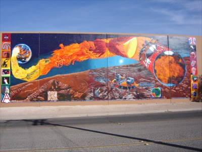
| Authority control |
|
|---|