South Tyneside
South Tyneside is a metropolitan borough in Tyne and Wear in North East England.
Borough of South Tyneside | |
|---|---|
 South Shields Town Hall | |
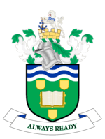 Coat of Arms of the Borough Council | |
| Motto(s): Always Ready | |
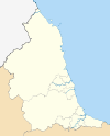
 South Tyneside within Tyne and Wear and England | |
| Coordinates: 54.959°N 1.438°W | |
| Sovereign state | United Kingdom |
| Country | England |
| Region | North East |
| County | Tyne and Wear |
| Settled | ~160 AD |
| Established | 1 April 1974 |
| Admin HQ | South Shields |
| Government | |
| • Type | Leader and Cabinet |
| • MPs | Stephen Hepburn (L) Emma Lewell-Buck (L) |
| Area | |
| • Total | 24.88 sq mi (64.43 km2) |
| • Land | 24.87 sq mi (64.41 km2) |
| • Water | 0.008 sq mi (.02 km2) |
| Population (2011 Census) | |
| • Total | 148,127 |
| • Estimate (Mid-year 2018) | 150,265[1] |
| • Density | 6,178/sq mi (2,385.5/km2) |
| • Ethnicity (2011 census) | 95.1% White 1.7% South Asian [2] |
| Time zone | UTC+0 (Greenwich Mean Time) |
| • Summer (DST) | UTC+1 (British Summer Time) |
| Website | www |
It is bordered by three other boroughs - Gateshead to the west, Sunderland in the south and North Tyneside to the north. The border county of Northumberland lies further north. The borough was formed on 1 April 1974 by the merger of the County Borough of South Shields along with the municipal borough of Jarrow and the urban districts of Boldon and Hebburn from County Durham.
South Tyneside forms part of the Tyneside conurbation, the sixth largest in the United Kingdom, with a geographical area of 64.43 km2 (24.88 sq mi) and an estimated population of 153,700 (Mid-year 2010), measured at the 2011 Census as 148,127.[3] It is bordered to the east by the North Sea and to the north by the River Tyne. A Green Belt of 23.64 km2 (9.13 sq mi) is at its southern boundary.
The main administrative centre and largest town is South Shields. Other riverside towns are Jarrow and Hebburn, while the villages of Cleadon, Whitburn and The Boldons border the South Tyneside green belt, with Wearside to the south at Sunderland.
South Tyneside is represented by two Members of Parliament with two constituencies: South Shields (including Whitburn) and Jarrow (which also serves Hebburn, the Urban Fringe villages and eastern parts of Gateshead).
Mr. Martin Swales has been Chief Executive at South Tyneside Council since December 3, 2009. Mr. Swales previously served as Strategic Director of Development at North Tyneside Council.
History
Celts, Romans, Angles, Saxons, Jutes, Vikings, the early 20th century arrival of the Arabs and more recently the settling of people from the Commonwealth, notably the Indian sub-continent, and the European Union reflect the present-day culture of South Tyneside.
In South Shields (Latin 'Arbeia', Brythonic 'Caer Urfa'), excavations and a reconstructed fort are found at Arbeia (AD 160). This fort served as a garrison and an outpost of the Roman Empire, and is part of Hadrian's Wall World Heritage Site. The hospitality strip at Ocean Road is famed throughout the region for its Indian, Italian, Middle Eastern and Chinese cuisine. Mill Dam, with former Customs House (now a theatre, cinema and arts complex), cobbled lanes and Mission to Seafarers centre, stands tribute to the long and proud history of shipping in the town and the river Tyne.
Bede's World in Jarrow (Anglo Saxon 'Gyrwe') is dedicated to the life of the Venerable Bede, the 'Father of English History'. The nominated World Heritage Site is straddled by two rivers - the Tyne and the Don. There is a medieval monastery (St. Paul's Church, AD 681), an Anglo-Saxon farm with rare breed animals and buildings constructed in original materials from that period, and the Georgian Jarrow Hall. The Jarrow Crusade of 1936 was a key event in the town's history and the original banner carried by the marchers to London can be viewed at Jarrow Town Hall.[4]
There has been a fairly sizeable Arab community in South Shields since the 1890s.[5] This is also one hypothesised explanation of the term "Sandancer" (derived from "sand dancer") for people born and brought up in South Shields.
Council
South Tyneside Council is formed of 54 members. Following the 2018 local elections this consists of fifty-three Labour councillors and one Conservative.[6]
Economy
Shipbuilding and repairing, coal mining and exports, and the chemical industries declined from the latter half of the 20th Century, resulting in mass unemployment. In more recent years, however, this trend has reversed and South Tyneside attracts new industries, most notably in the service sector. There is still a considerable manufacturing base of ship-repair and offshore services, engineering, electronics, clothing, furniture, paper products, timber and small precision engineering.
At one time, Tyneside built 25% of the world's ships. South Tyneside College specialises in maritime training and attracts students from around the world, though it recently gave away its telescope, and turned over its locally famous domed planetarium for use as a mosque.
Tourism is also an important and growing industry.
Places of interest
South Shields town centre and riverside are undergoing significant regeneration, with new housing, business, retail and leisure uses replacing old industrial sites. The town centre offers high street shopping, a regular market by the Grade I listed old town hall, a new library and exhibition space called The Word, the head post office, museum & art gallery, a new bus/Metro interchange due to open in 2019, cross-river pedestrian ferry to North Shields, Harton Quays office development and promenade, the town hall and civic offices. The Customs House is located within the historic Mill Dam conservation area and hosts a theatre, cinema, art gallery and restaurant. Arbeia formed the easternmost extremity of the Roman Empire at Hadrian's Wall and is located at the mouth of the River Tyne on the North Sea coast. Excavations, a reconstructed fort and museum are open to the public on the historic Lawe Top site (Old English: hill top).
The foreshore boasts a quality seaside experience, with the local landmarks of the Groyne lighthouse and mile-long South Pier to the north, and Marsden Rock and Souter Lighthouse to the south. There are award-winning sandy beaches at Littlehaven, Sandhaven and Marsden Bay; revitalised seafront promenades and scenic cliff top walks; the traditional thrills of Ocean Beach Pleasure Park and Dunes Adventure Island including fairground rides, an indoor bowling alley and amusement arcades; the North and South Marine parks with bandstand, boating lake, outdoor play areas and miniature steam railway; new state-of-the-art swimming pools, waterslides and fitness centre at Haven Point, a sailing club and Gypsies Green Stadium; the original Tyne Lifeboat, Jubilee Memorial and bronze statues of the Conversation Piece; a range of hotels, guest houses, chalets and caravan & camping sites; plus numerous restaurants, pubs and cafes, including the legendary local Minchella's ice cream and Colman's fish and chips.
In summer there is a free festival, including a large street parade and entertainment from local and international stars at the outdoor amphitheatre and at Bents Park. An open-top tour bus connects the numerous places of interest during the busy summer tourist season. The Great North Run is the world's biggest half marathon and takes place every September/October, starting in Newcastle and finishing on The Leas at South Shields.
On the coast road to Whitburn is Marsden Rock - an impressive limestone sea stack colonised by sea birds and a longstanding tourist attraction. Further down the coast is Souter Lighthouse, the first in the world to be powered by electric current. Much of the coastal scenery in this area was, until two decades ago, dominated by the spoil heaps and pit head winding gear of Westoe and Whitburn collieries, but these are now gone and the area's natural environment has been restored.
Jarrow is home to St. Paul's Monastery, Bede's World museum, Jarrow Hall, the Viking Shopping Centre and J Barbour factory outlet.
Hebburn riverside has open views of the renewable and offshore-related industries across-river at Wallsend. The town centre has undergone redevelopment with new residential building and civic and leisure facilities.
The suburban villages of Cleadon, East and West Boldon, Harton, Monkton, Westoe and Whitburn have traditional pubs, historic buildings and independent boutiques. There is an athletics track at Monkton and cricket grounds at Westoe and Whitburn.
Environment
The physical environment of South Tyneside varies greatly in a small area: from the bustling riverside towns of South Shields, Jarrow and Hebburn to the urban fringe villages of Boldon, Cleadon and Whitburn; from established industrial areas at the Port of Tyne and Tyne Dock riverside to new business parks at Monkton, St Hilda’s and Boldon; from the highest point at Cleadon Hills down to the River Don estuary at St Paul’s and Bede’s World; from traditional Victorian terraces and impressive Edwardian mansions to typical inter- and post-war suburban housing; from the remains and reconstructed gatehouse of Arbeia Roman Fort to the UK’s first purpose built mosque at Laygate; from the great River Tyne to the expanse of Shields Harbour at Littlehaven; from the stunning natural coastline of The Leas and the sandy beaches, bays and limestone cliffs at Marsden Bay and Whitburn to the traditional seaside parks, amusements and funfair at South Shields seafront; and from Marsden Quarry to the Great North Forest.
The EcoCentre at Hebburn is a building constructed from recycled materials, self-reliant in power generation by means of its own wind turbine and is efficient in waste management. There is also a local authority-managed wind turbine at Middlefields.
The weather in South Tyneside as with the rest of the North East region is variable and typical of a Maritime Climate.
Transport
The A194(M), A19 and other trunk roads link South Tyneside to the national road network. The Tyne & Wear Metro is a light rail system connecting the area with the rest of the Tyne & Wear conurbation, including Sunderland and Newcastle station and Newcastle Airport. The Tyne Road and Pedestrian Tunnels traverse the river between Jarrow and Howdon. A pedestrian ferry also serves the towns of North and South Shields. The Port of Tyne situated at Tyne Dock is a growing terminal handling large volumes of freight, including exports from the Nissan car plant in Washington.
People
Well-known South Tynesiders include author Dame Catherine Cookson,[7] former three times Prime Minister of New Zealand Sir William Fox,[8] actress Dame Flora Robson,[9] Monty Python actor Eric Idle,[10] Hollywood director Ridley Scott, waxed jacket inventor J Barbour and athlete Steve Cram. Author Lewis Carroll was inspired to write 'Alice's Adventures in Wonderland' and 'Through the Looking-Glass' by local residents he met when staying in Whitburn. Singer Joe McElderry who won the 2009 X Factor also comes from the area as well as two members of 2011 X Factor winners Little Mix, Jade Thirlwall and Perrie Edwards. South Shields is the only town to have two X Factor winners from its area. Ginger of British rock heroes The Wildhearts is from South Shields.
Sister cities
South Tyneside is twinned with Épinay-sur-Seine, France; Noisy-le-Sec, France; and Wuppertal, Germany
Climate
Climate in this area has mild differences between highs and lows, and there is adequate rainfall year-round. The Köppen Climate Classification subtype for this climate is "Cfb" (Marine West Coast Climate/Oceanic climate).[11]
| Climate data for South Tyneside, UK | |||||||||||||
|---|---|---|---|---|---|---|---|---|---|---|---|---|---|
| Month | Jan | Feb | Mar | Apr | May | Jun | Jul | Aug | Sep | Oct | Nov | Dec | Year |
| Average high °C (°F) | 7 (45) |
8 (46) |
9 (48) |
10 (50) |
13 (55) |
15 (59) |
18 (64) |
18 (64) |
16 (61) |
13 (55) |
9 (48) |
7 (45) |
12 (54) |
| Average low °C (°F) | 3 (37) |
3 (37) |
4 (39) |
5 (41) |
8 (46) |
10 (50) |
13 (55) |
13 (55) |
10 (50) |
8 (46) |
5 (41) |
3 (37) |
7 (45) |
| Average precipitation mm (inches) | 33 (1.3) |
33 (1.3) |
30 (1.2) |
43 (1.7) |
48 (1.9) |
43 (1.7) |
38 (1.5) |
48 (1.9) |
48 (1.9) |
53 (2.1) |
53 (2.1) |
51 (2) |
520 (20.6) |
| Average precipitation days | 13 | 13 | 15 | 15 | 12 | 14 | 11 | 11 | 13 | 15 | 15 | 15 | 162 |
| Source: Weatherbase [12] | |||||||||||||
References
- https://www.citypopulation.de/en/uk/admin/tyne_and_wear/E08000023__south_tyneside/
- "Neighborhood Statistics". www.neighbourhood.statistics.gov.uk. Retrieved 10 May 2016.
- "Local Authority population 2011". Retrieved 6 July 2015.
- "Mayor helps out with Jarrow March feature". www.shieldsgazette.com. Retrieved 10 May 2016.
- "BBC - Nation on Film - Family and Community - Yemeni Riots". www.bbc.co.uk. Retrieved 10 May 2016.
- "Full results for the South Tyneside Council elections 2018". Shields Gazette. 4 May 2018. Retrieved 9 May 2018.
- "Wor Kate's life story like one of her books". Evening Chronicle. 28 February 2013. Retrieved 1 August 2018.
- Sinclair, Keith and Dalziel, Raewyn. "Fox, William 1812? - 1893". Dictionary of New Zealand Biography. Ministry for Culture and Heritage. Retrieved 1 August 2018.CS1 maint: uses authors parameter (link)
- GRO Register of Births: JUN 1902 10a 829 S. SHIELDS – Flora McKenzie Robson
- "Search Register Office records – South Tyneside Council". South Tyneside Births Deaths and Marriages.
- Climate Summary for South Tyneside, UK
- "Weatherbase.com". Weatherbase. 2013. Retrieved on 10 July 2013.
External links
- South Tyneside Council and Community website
- South Tyneside Youth Orchestra Official Web Site featuring Concert Dates, a List of Members, and all About STYO.
| County Durham |
|  |
|---|---|---|
| Northumberland | ||
| Tyne and Wear |
| |
| Teesside, North Yorkshire |
| |
| Districts |
|  |
|---|---|---|
| Councils |
| |
| Local elections |
| |