Puducherry
Puducherry (/pʊdʊˈtʃɛri/), formerly known as Pondicherry (/pɒndɪˈtʃɛri/), is one of the 8 union territories of India. It was formed out of four territories of former French India, namely Pondichéry (Pondicherry; now Puducherry), Karikal (Karaikal), Mahé and Yanaon (Yanam), excluding Chandernagore. It is named after the largest district, Puducherry. Historically known as Pondicherry (Pāṇṭiccēri), the territory changed its official name to Puducherry on 20 September 2006.[9][10]
Puducherry | |
|---|---|
 Aerial view of Puducherry | |
| Anthem: Tamil Thai Valthu (Invocation to Mother Tamil) | |
 Location of Puducherry (marked in red) in India | |
| Coordinates: 11.911082°N 79.812533°E | |
| Country | |
| Region | South India |
| Formation | 1 November 1954 |
| Capital and Largest city | Pondicherry |
| Districts | 4 |
| Government | |
| • Lieutenant Governor | Kiran Bedi[1] |
| • Chief Minister | V Narayanasamy (INC) [2] |
| • Chief Secretary | Ashwani Kumar, IAS[3] |
| • Director General of Police | S Sundri Nanda, IPS[4] |
| • Legislature | Unicameral (30*seats) [5] |
| Area | |
| • Total | 483 km2 (186 sq mi) |
| Area rank | 33rd |
| Population (2011) | |
| • Total | 1,394,467 |
| • Rank | 29th |
| • Density | 2,900/km2 (7,500/sq mi) |
| Demonym(s) | Puducherrian, Pondicherrian, Pondian |
| Languages | |
| • Official | Tamil, English[6] |
| • Additional | Malayalam (in Mahé), Telugu (in Yanam), French[7] |
| Time zone | UTC+05:30 (IST) |
| PIN CODE | 605014 |
| ISO 3166 code | IN-PY |
| Vehicle registration | PY 01, PY 02, PY 03, PY 04, PY 05, PY 05V |
| HDI (2018) | |
| Website | www.py.gov.in |
| ^* 30 elected, 3 nominated | |
| Song | Invocation to Tamil Goddess (written by Bharathidasan)[8] |
|---|---|
| Mammal | Squirrel[8] |
| Bird | Koel[8] |
| Flower | Cannonball tree flower[8] |
| Tree | Bael fruit tree[8] |
The Union Territory of Puducherry lies in the southern part of the Indian Peninsula. The areas of Puducherry district and Karaikal district are bound by the state of Tamil Nadu, while Yanam district and Mahé district are enclosed by the states of Andhra Pradesh and Kerala respectively. Puducherry is the 29th most populous and the third most densely populated of the states and union territories of India. It has a gross domestic product (GDP) of ₹210 billion (US$2.9 billion) and ranks 25th in India.[11]
History
The earliest recorded history of the municipality of Puducherry can be traced to the second century AD. The Periplus of the Erythraean Sea mentions a marketplace named Poduke (ch 60). G. W. B. Huntingford suggested this might be a site about 2 miles from the modern Puducherry, which was possibly the location of Arikamedu (now part of Ariyankuppam). Huntingford noted that Roman pottery was found at Arikamedu in 1937. In addition, archaeological excavations between 1944 and 1949 showed that it was "a trading station to which goods of Roman manufacture were imported during the first half of the 1st century" Subsequent investigation by Vimala Begley from 1989 to 1992 modified this assessment, and now place the period of occupation from the third or second century BC to the eighth century AD.[12][13]
In 1674, the municipality of Pondicherry (Pondichéry) became a French colony of the French colonial empire. Together with Chandernagor (already French since 1673), Mahé (since 1721), Yanam (Yanaon) (since 1731), Karaikal (Karikal) (since 1739) and Masulipatam (1760), it formed the French colony of French India, under a single French governor in Pondicherry, although French rule over one or more of these enclaves was repeatedly interrupted by British occupations. The territories of French India were completely transferred to the Republic of India de facto on 1 November 1954, and de jure on 16 August 1962, when French India ceased to exist, becoming the present Indian constituent union territory of Pondicherry, combining four coastal enclaves (with the exception of Chandernagor, which merged with the state of West Bengal in 1954).
Geography
The Union Territory of Puducherry consists of four small unconnected districts: Puducherry district (293 km2 or 113 sq mi), Karaikal district (161 km2 or 62 sq mi) and Yanam district (20 km2 or 7.7 sq mi) on the Bay of Bengal and Mahé district (9 km2 or 3.5 sq mi) on the Laccadive Sea, covering a total area of 483 km2 (186 sq mi). Puducherry and Karaikal have the largest areas and population, and are both enclaves of Tamil Nadu. Yanam and Mahé are enclaves of Andhra Pradesh and Kerala, respectively. Its population, as per the 2011 Census, is 1,244,464.
Some of Puducherry's regions are themselves amalgamations of non-contiguous enclaves, often called "pockets" in India. The Puducherry region is made of 11 such pockets, some of which are very small and entirely surrounded by the territory of Tamil Nadu. Mahé region is made up of three pockets. This unusual geography is a legacy of the colonial period with Puducherry retaining the borders of former French India.
All four regions of Puducherry are located in the coastal region. Five rivers in Puducherry district, seven in Karaikal district, two in Mahé district and one in Yanam district drain into the sea, but none originates within the territory.
Districts of Union Territory of Puducherry

- Puducherry district is an enclave of Tamil Nadu.
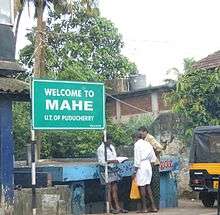
- Mahé district is an enclave of Kerala.
- Yanam district is an enclave of Andhra Pradesh.
- Karaikal district is an enclave of Tamil Nadu.
Demographics
| Historical population | ||
|---|---|---|
| Year | Pop. | ±% p.a. |
| 1901 | 246,354 | — |
| 1911 | 257,179 | +0.43% |
| 1921 | 244,156 | −0.52% |
| 1931 | 258,628 | +0.58% |
| 1941 | 285,011 | +0.98% |
| 1951 | 317,253 | +1.08% |
| 1961 | 369,079 | +1.52% |
| 1971 | 471,707 | +2.48% |
| 1981 | 604,471 | +2.51% |
| 1991 | 807,785 | +2.94% |
| 2001 | 974,345 | +1.89% |
| 2011 | 1,247,953 | +2.51% |
| source:[14] | ||
Hinduism is the major religion with 87.3% of the population adhering to it. Other religions include Christianity (6.2%) and Islam (6%).[15]
Government and administration

Puducherry is a Union Territory of India rather than a state, which implies that governance and administration falls directly under federal authority. However, Puducherry is one of the three union territories in India (the other being Delhi and Jammu & Kashmir) that is entitled by a special constitutional amendment to have an elected legislative assembly and a cabinet of ministers, thereby conveying partial statehood.[16]
The Centre is represented by the Lieutenant Governor, who resides at the Raj Nivas (Le Palais du Gouverneur) at the Park, the former palace of the French governor. The central government is more directly involved in the territory's financial well-being unlike states, which have a central grant that they administer. Consequently, Puducherry has at various times, enjoyed lower taxes, especially in the indirect category.
Special administration status

According to the Treaty of Cession of 1956, the four territories of former French India territorial administration are permitted to make laws with respect to specific matters. In many cases, such legislation may require ratification from the federal government or the assent of the President of India.
Article II of the Treaty states:
The Establishments will keep the benefit of the special administrative status which was in force prior to 1 November 1954. Any constitutional changes in this status which may be made subsequently shall be made after ascertaining the wishes of the people.
Official languages
French was the official language according to Article XXVIII of the Traité de Cession (Treaty of Cession) of 1956. According to the treaty, "the French language shall remain the official language of the Establishments so long as the elected representatives of the people shall not decide otherwise".[17][18] After independence, the new official languages got recognized by The Pondicherry Official Language Act, 1965 (Act No. 3 of 1965) which makes no mention of French (but also not officially denying it[19]) This act stated that "the Tamil language shall (...) be the language to be used for all or any of the official purposes of the Union territory". It also provides for the use of the Malayalam and Telugu languages in the Mahé and Yanam districts. The law also states that English "may be used for all or any of the official purposes of the Union territory".[20] While the Union Territory official gazette's name is in Tamil, English and French (La Gazette de L'État de Poudouchéry) it is published exclusively in English.[21] Through the 1963 Union Territories Act, Tamil, Telugu and Malayalam became official languages used region-wide.
Culture
Economy

The gross domestic product of Puducherry, at market prices estimated by Ministry of Statistics and Programme Implementation with figures in millions of Indian rupees grew from 1,840 to 258,190 million rupees from 1980 to 2014.
| Year | Gross domestic product |
|---|---|
| 1980 | 1,840 |
| 1985 | 3,420 |
| 1990 | 6,030 |
| 1995 | 13,200 |
| 2000 | 37,810 |
| 2010 | 130,920 |
| 2014 | 258,190[22][23][24] |
Fisheries
The potential for fisheries is substantial in the Union Territory. The four regions of the Union Territory have a coastline of 45 km with 675 of inshore waters, 1.347 hectares (3.33 acres) of inland water and 800 ha of brackish water. 27 marine fishing villages and 23 inland fishing villages host a fishermen population of about 65,000 of which 13,000 are actively engaged in fishing. Tanks and ponds are also tapped for commercial fish rearing.
Tourism


Puducherry is one of the most popular tourist spots for national and international tourists. Puducherry was the residence of Sri Aurobindo (1872–1950) and the Sri Aurobindo Ashram still operates from Puducherry. A unique experimental city Auroville, the brainchild of the Mother, whose inhabitants are drawn from all parts of the world is situated on the outskirts of the city. There are several temples, churches, monuments, parks, and mosques which attract tourists.

Transport
Rail

Puducherry is connected by a railway branch line from the five-way junction at Viluppuram and Chennai. The railway line is a broad gauge line with 16 originating trains and 17 terminating trains.[25]
Road
Puducherry has a network all weather metalled roads connecting the territory. Puducherry has a road length of 2,552 km (road length per 4.87 km2), the highest in the country.

| Road length comparison with Tamil Nadu and India as a whole | |||
|---|---|---|---|
| Total road length (in Puducherry) | 2,552 km | ||
| Road length per 1000 km2 | Puducherry | Tamil Nadu | India |
| 4,575 | 1,572 | 663 | |
| Sl. No. | Type of road | Length (km) |
|---|---|---|
| 1 | National highways | 64.450 |
| 2 | State highways | 49.304 |
| 3 | District and other roads | |
| Puducherry – 173.384 | ||
| Karaikal – 55.162 | ||
| Mahé – 19.622 | ||
| Yanam – 26.460 | ||
| 274.628 | 274.628 | |
| 4 | Rural roads | |
| Puducherry – 164.964 | ||
| Karaikal – 83.470 | ||
| 248.434 | 248.434 | |
| Grand total | 636.816 |
Education
According to the 2011 census, Puducherry had a literacy rate of 86.55.[26] Pondicherry University is a university centrally located in Puducherry.[27] Other educational institutions include Jawaharlal Institute of Postgraduate Medical Education & Research (JIPMER), Indira Gandhi Medical College and Research Institute (Government of Puducherry), Mahathma gandhi post graduate institute of dental science[GOVT OF PUDUCHERRY], Tagore Arts and Science College, Indira Gandhi College of Arts and Science (Government of Puducherry), Mahatma Gandhi Medical College and Research Institute, National Institute of Technology, Puducherry, Perunthalaivar Kamarajar Institute of Engineering and Technology,[28] Pondicherry Engineering College, Mother Theresa Post Graduate and Research Institute of Health Sciences, Achariya College of Engineering Technology (ACET), Rajiv Gandhi College of Engineering and Technology, Rajiv Gandhi College of Veterinary and Animal Sciences, Mahatma Gandhi Medical College & Research Institute, Sri Manakula Vinayagar Medical College Hospital, Sri Ganesh College of Engineering and Technology, and Sri Venkateshwaraa Medical College Hospital and Research Centre.
In popular culture
- Puducherry was the setting for Yann Martel's first third of his Booker Prize-winning novel Life of Pi (2001). A portion of the subsequent film adaptation was filmed there.[29]
- Lee Langley's novel A House in Pondicherry (1996) was set there.
- Prince Pondicherry is an Indian character from Roald Dahl's children's novel Charlie and the Chocolate Factory (1964). The prince orders Willy Wonka to build a palace of chocolate in India; the palace melts in the hot sun.
See also
- Puducherry (Lok Sabha constituency)
- Chandannagar
- Causes for liberation of French colonies in India
- French East India Company
- French colonial empire
- Municipal Administration in French India
References
- "narendra modi appointe Lieutenant Governor of Puducherry". The Hindu. 22 May 2016. Archived from the original on 22 May 2016. Retrieved 25 May 2016.
- "V Narayanasamy to be new Puducherry Chief Minister". Archived from the original on 2 June 2016. Retrieved 3 June 2016.
- Varma, M. Dinesh (6 June 2015). "New Chief Secretary assumes charge". The Hindu. ISSN 0971-751X. Retrieved 9 November 2016.
- February 2016|url-status=live|df=dmy-all
- "PUDUCHERRY LEGISLATIVE ASSEMBLY". Archived from the original on 3 November 2017. Retrieved 26 October 2017.
- "The Pondicherry Official Languages Act, 1965" (PDF). lawsofindia.org. Laws of India. Retrieved 10 June 2019.
- "Official Languages of Pondicherry - E-Courts Mission, Government of India". Archived from the original on 2 April 2015. Retrieved 12 June 2015.
- "Tamil Nadu News : Puducherry comes out with list of State symbols". The Hindu. 21 April 2007. Archived from the original on 4 January 2013. Retrieved 10 February 2014.
- "South Asia | New name for old French territory". BBC News. 20 September 2006. Archived from the original on 22 February 2014. Retrieved 10 February 2014.
- "National : Bill to rename Pondicherry as Puducherry passed". The Hindu. 22 August 2006. Archived from the original on 21 October 2012. Retrieved 10 February 2014.
- "State Domestic Product and other aggregates, 2004–05 series". Ministry of Statistics and Programme Implementation. 27 February 2015. Archived from the original on 23 March 2015. Retrieved 18 June 2015.
- Vimala Begley. "The Dating of Arikamedu and its Bearing on the Archaeology of Early Historical South India" (PDF). Archived (PDF) from the original on 1 January 2019. Retrieved 1 January 2019.
- The Periplus of the Erythraean Sea: Travel and Trade in the Indian Ocean by a Merchant of the First Century. Kessinger Publishing. July 2007. p. 119. ISBN 978-0-548-20943-1. Archived from the original on 17 May 2016. Retrieved 15 November 2015.
- Decadal Variation In Population Since 1901
- "Population by religion community – 2011". Census of India, 2011. The Registrar General & Census Commissioner, India. Archived from the original on 25 August 2015.
- "Lanka BBC Info Know Puducherry: Government Name Pondicherry As Puducherry". lankabbc.com. 29 June 2012. Archived from the original on 2 February 2017. Retrieved 24 January 2017.
- "The Government of Union Territories Act, 1963" (PDF). Ministry of Home Affairs, Government of India. Archived from the original (PDF) on 5 March 2016. Retrieved 1 June 2015.
- "Puducherry code volume 1" (PDF). Government of Puducherry. Archived (PDF) from the original on 25 September 2015. Retrieved 1 June 2015.
- "Archived copy". Archived from the original on 2 April 2015. Retrieved 12 June 2015.CS1 maint: archived copy as title (link)
- CIDIF. "06-Le français à Pondichéry, par Roland Breton". go1.cc. Archived from the original on 9 April 2015.
- http://gstcouncil.gov.in/sites/default/files/sgst-notification/PUD-(R)-(18)-9.pdf
- http://statisticstimes.com/economy/economy-of-puducherry.php
- http://www.southasiaathudson.org/indian-states-1/2016/4/5/puducherry
- List of Indian states by GDP
- karthik. "Pondicherry Station - 16 Train Departures SR/Southern Zone - Railway Enquiry". indiarailinfo.com. Archived from the original on 17 August 2017. Retrieved 17 August 2017.
- "Ranking of states and union territories by literacy rate: 2011" (PDF). Government of India. Archived (PDF) from the original on 6 July 2015. Retrieved 2 January 2016.
- "Pondicherry University". Pondicherry University. Archived from the original on 25 April 2011.
- "Welcome to the Website of PKIET". Pkiet.edu.in. Archived from the original on 17 February 2014. Retrieved 10 February 2014.
- "Filming Locations". Internet Movie Database. Archived from the original on 1 December 2012. Retrieved 3 December 2012.
External links
| Wikivoyage has a travel guide for Pondicherry (union territory). |
| Wikimedia Commons has media related to Pondicherry. |
| Wikiquote has quotations related to: Puducherry |
- Official website of the Government of the Union Territory of Puducherry
- Treaty establishing De Jure Cession of French Establishments in India
- Official website of Department of Tourism, Pondicherry

| Districts |
| ||||
|---|---|---|---|---|---|
| Municipalities |
| ||||
| Languages | |||||
| Education |
| ||||
| History |
| ||||
| Places of interest |
| ||||
| Transport |
| ||||
| Sports |
| ||||
| States | |
|---|---|
| Union territories |
|
| |
| Authority control |
|---|