M5 motorway
The M5 is a motorway in the UK linking the Midlands with South West England. It runs from junction 8 of the M6 at West Bromwich near Birmingham to Exeter in Devon. Heading southwest, the M5 runs east of West Bromwich and west of Birmingham through Sandwell Valley. It continues past Bromsgrove (and from Birmingham and Bromsgrove is part of the Birmingham Motorway Box), Droitwich Spa, Worcester, Tewkesbury, Cheltenham, Gloucester, Bristol, Weston-super-Mare, Bridgwater, Taunton, terminating at junction 31 for Exeter. Congestion on the section south of the M4 is common during the summer holidays, on Friday afternoons and bank holidays.
| ||||
|---|---|---|---|---|
_map.svg.png) | ||||
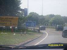
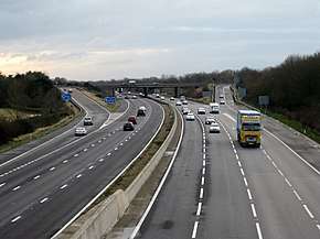 Looking south towards junction 20 | ||||
| Route information | ||||
| Maintained by Highways England | ||||
| Length | 162.9 mi (262.2 km) | |||
| Existed | 1962–present | |||
| History | Opened: 1962 Completed: 1977 | |||
| Major junctions | ||||
| Northeast end | West Bromwich | |||
M6 motorway J4a → M42 motorway J8 → M50 motorway J15 → M4 motorway J18a → M49 motorway | ||||
| Southwest end | Exminster | |||
| Location | ||||
| Counties | West Midlands, Worcestershire, Gloucestershire, Bristol, Somerset, Devon | |||
| Primary destinations | West Bromwich Birmingham Bromsgrove Worcester Cheltenham Gloucester Bristol Weston-super-Mare Bridgwater Taunton Exeter | |||
| Road network | ||||
| ||||

Route
The M5 follows the route of the A38 road quite closely. The two deviate slightly around Bristol and the area south of Bristol from junctions 16 to the Sedgemoor services north of junction 22. The A38 goes straight through the centre of Bristol and passes by Bristol Airport, while the M5 skirts both, with access to the airport from junctions 18, 19 or 22. The A38 continues south into Devon from junction 31, near Exminster. Between junction 21, Weston-super-Mare and junction 22, Burnham-on-Sea, the M5 passes by an isolated landmark hill called Brent Knoll. The Willow Man sculpture is visible from both carriageways, and acts as a landmark just to the south of junction 23.
Junction 15 of the M5 is a large four-level stack interchange, named the Almondsbury Interchange, where the M5 meets the busy M4. The Avonmouth Bridge, between junctions 18 and 19, is often a bottleneck during heavy traffic periods, due mainly to lane drops at either ends of the bridge for the respective junctions, and the sharp angle in the centre of the bridge, which causes larger vehicles to slow considerably.[1] There are split-level carriageways where the M5 ascends the hillsides above the Gordano Valley, between Portishead, junction 19 and Clevedon, junction 20.
History
Construction
The first 26 miles (42 km) of the M5 motorway was constructed as a dual two-lane motorway with Worcestershire County Council acting as engineer.[2] This section – from junction 4 (Lydiate Ash) in the north to a trumpet junction with the M50 in the south – opened in July 1962.[2][3] This original section of the M5, from junctions 4 to 8, was widened to provide six lanes in the early 1990s. During this work, the northbound Strensham services were rebuilt further away from a new junction. [4] Worcestershire County Council, the Police and particularly the County Surveyor of Worcestershire made repeated representations that a dual 3-lane standard motorway was appropriate. The Ministry of Transport insisted that a dual 2-lane motorway would be built at a cost of around £8 million. The Motorways archive also records that the carriageways were also built to a lower overall width of 88 feet rather than 100 to reduce the loss of agricultural land. When the decision became necessary to widen the Worcestershire section of M5, it cost £123 million.[5]
The 2 miles (3.2 km) dual two-lane section between Junctions 16 and 17 built at Filton, near Bristol, was also opened in 1962, and was intended to replace the pre-war Filton bypass.[2][3][6] Gloucestershire County Council acted as engineer for this section, which was widened to a dual three-lane motorway in 1969.[3]
North of Junction 4 the M5 was constructed in sections, from 1967 to 1970, together with the Frankley services. Much of the northern section beyond Junction 3, from about Quinton to the junction with the M6 motorway, was constructed as an elevated dual 3-lane motorway using concrete pillars.[3]
The M5 was also extended southwards, in sections, from 1967 to 1977, through Gloucestershire & Somerset, to Exeter in Devon as a dual three-lane motorway,[3] together with the Strensham services.
The short section between Junctions 27 and 29 was built between 1967 and 1969, by Devon County Council, as the A38 Cullompton Bypass, with the intention that it should become part of the M5.[2] The termini for this section have since been removed, although part of the southern terminal roundabout is now used as an emergency access.[7] The section was developed to motorway standards, and incorporated into the M5 in 1975.[2]
Operational history
Junction 1 surrounds a surviving gatehouse from the former Sandwell Hall. The section from Junctions 16 and 18 was illuminated in about 1973 as part or a wider policy announced by UK Minister for Transport Industries in 1972 to illuminate the 86 miles (138 km) of UK motorway particularly prone to fog.[8]
In the late 1980s Junction 4a was built as part of the M42 motorway construction project. The route of the M42 was decided as early as 1972 but, owing to planning delays, the short section of the M42 north of Bromsgrove did not open until December 1989.[9]
As the M5 traffic increased in the 1980s Junction 11, the main Gloucester & Cheltenham access (via the A40 Golden Valley by-pass) became increasingly congested. At the same time there were plans for large scale business & housing developments at Brockworth, near Gloucester. To relieve Junction 11 of some of the new traffic generated, & avoid more congestion around both Cheltenham & Gloucester, a new junction, Junction 11A, some 3.5 miles south of Junction 11, was constructed & opened in the mid-1990s.
The Avonmouth Bridge was converted to eight lanes (four lanes in each direction) in the early 2000s. Later, in 2005–2006, parts of the M5 between Junctions 17 and 20 were widened to 7 lanes (four lanes climbing the hills and three lanes descending the hills); variable message signs were added and parts of the central reservation was converted to a concrete step barrier. During this stage of construction the M5 became Britain's longest contraflow system,[10][11] spanning 9 miles (14 km) between Junctions 19 and 20. The M5 contraflow was said to be the most complicated ever built in the UK as the motorway is on a split level around the steep hills of the Gordano Valley; meaning four lanes plus an additional emergency vehicle lane were squeezed into that section.[12]
In 2002, extended exits for Junction 12 were constructed. The Highways Agency did not anticipate the traffic flows through the junction and the resultant queues can now extend back onto the motorway.[13] This is because of an increase in traffic from Stroud intending to use the M5 northbound. The distance from Junctions 12 and 13 is similar and traffic congestion is heavy on the A419 towards Junction 13 whereas it is usually lighter on the B4008 towards Junction 12. As traffic leaving the M5 northbound towards Gloucester needs to give way to this traffic coming from the B4008, the queue on the motorway can extend beyond the first sign for the junction.
The Cullompton services are signed on the motorway in the northbound direction only. This was implemented to reduce congestion at the low capacity junction, although there is still access available to the services southbound through the junction. Also, the northbound exit slip to the junction was reduced to one lane instead of two to reduce traffic on the small roundabout at the west side of the junction.
In 2009, it was announced that the lighting between junctions 30 and 31 would be turned off between midnight and 5.00am to save energy.[14]
Proposals were announced in September 2009 for a new Gloucester Services between junctions 11a and 12.[15] A planning application was submitted in December 2009. Stroud District councillors approved the services in August 2010.[16] The Services opened in May 2014[17]
Future developments
There have been suggestions that the Government extend the M5 south, to the city of Plymouth, which currently relies on the A38 road. The argument for such an extension has intensified in light of the closure of Plymouth City Airport in 2011, and the 2014 breaching of the South Devon Railway sea wall following storms that in turn, cut off Plymouth and Cornwall's rail access.[18][19]
Improvements to junction 25 at Taunton were approved with an £18 million programme that will include the enlargement of the junction roundabout, the widening of the eastern junction slip road exit, and an additional roundabout southeast of the junction to provide access to a new business park and to a proposed bypass of the hamlet of Henlade.[20]
Incidents and events
2011 multi-vehicle collision
On the evening of Friday 4 November 2011, seven people were killed and a further 51 injured in a major crash involving over 50 vehicles which included cars, vans and large goods vehicles near Junction 25 in West Monkton, near Taunton.[21] Several vehicles were burnt out in the fire which developed at the scene as the result of a series of explosions, and the road surface was seriously damaged, not just by the fire and explosions, but also by fuel spillage.[22] The cause of the crash, which took place in wet foggy conditions close to a firework display, was investigated. One person was charged for breach under health and safety laws and found not guilty.[23]
Discovery of bones
In October 2009, workmen clearing vegetation from the bottom of the M5 at Junction 14 discovered human bones in a black bin bag dumped in the bushes at the side of the motorway. The police were called soon after, and it was soon established that the bones were those of a young female. A few days later, DNA found on the remains confirmed that the body was that of Melanie Hall, who disappeared in June 1996 after a night out in Bath, Somerset, and who had been declared dead in absentia in 2004. Dental records confirmed that the body was hers, and the police began a formal investigation into her murder.[24] As of 2016 no one has been prosecuted in connection with this case.
Junctions
Data from driver location signs are used to provide distance and carriageway identifier information.[25][26][27] Where both the start and end point of the junction are known, both have been included.
| M5 motorway junctions | |||||
| mile | km | North-east bound exits (B carriageway) | Junction | South-west bound exits (A carriageway) | Coordinates |
|---|---|---|---|---|---|
| 0.0 | 0.0 | London (M1, M40), Birmingham (N&E), The NORTH WEST, Walsall, Wolverhampton M6 | M6 J8 | Start of motorway | 52.5360°N 1.9699°W |
| 2.7 3.3 |
4.3 5.3 |
West Bromwich, Birmingham (NW) A41 | J1 | West Bromwich, Sandwell, Birmingham (NW) A41 | 52.5119°N 1.9754°W |
| 5.2 5.8 |
8.4 9.3 |
Dudley, Wolverhampton, Sandwell A4123 | J2 | Birmingham (W), Dudley A4123 | 52.4927°N 2.0188°W |
| 8.6 9.0 |
13.8 14.5 |
Birmingham (W&C) A456 | J3 | Kidderminster A456 | 52.4491°N 2.0152°W |
| Entering West Midlands | Entering Worcestershire | 52.43292°N 2.01751°W | |||
| Frankley services | Services | Frankley services | 52.4292°N 2.0179°W | ||
| 14.0 14.4 |
22.5 23.2 |
Birmingham (SW) A38, Stourbridge A491 | J4 | Birmingham (SW), Bromsgrove A38 | 52.3786°N 2.0465°W |
| 16.1 | 25.9 | End of variable speed limit |
J4A | London (M40), N.E.C., Birmingham |
52.3543°N 2.0711°W |
| 16.6 | 26.7 | The NORTH EAST, N.E.C., Birmingham |
Start of variable speed limit | ||
| 21.4 21.7 |
34.5 35.0 |
Bromsgrove, Droitwich A38 | J5 | Droitwich A38 | 52.2876°N 2.1202°W |
| 27.0 27.5 |
43.5 44.2 |
Worcester (N), Kidderminster A449 | J6 | Worcester (N) A449, Evesham A4538 | 52.2128°N 2.1579°W |
| Start of variable speed limit |
End of variable speed limit | ||||
| 30.2 30.7 |
48.6 49.4 |
Worcester (S), Evesham A44 | J7 | Worcester (S) A44 | 52.1687°N 2.1803°W |
| Strensham services (northbound) | Services | No access | 52.0652°N 2.1577°W | ||
| No access | Strensham services (southbound) | 52.0574°N 2.1426°W | |||
| 39.7 | 63.9 | Entering Worcestershire | J8 | SOUTH WALES, Ross M50 | 52.0478°N 2.1356°W |
| 40.0 | 64.4 | SOUTH WALES, Ross M50 | Entering Gloucestershire | ||
| Entering Gloucestershire | River Avon | 52.03071°N 2.12548°W | |||
| River Avon | Entering Worcestershire | ||||
| Entering Worcestershire | Entering Gloucestershire | 52.01131°N 2.12113°W | |||
| 43.4 43.9 |
69.8 70.6 |
Tewkesbury A438, Evesham A46 | J9 | Evesham A46, Tewkesbury A438 | 51.9965°N 2.1237°W |
| 48.3 48.5 |
77.7 78.0 |
No access (on-slip only) | J10 | Cheltenham A4019 | 51.9290°N 2.1400°W |
| 51.0 51.4 |
82.1 82.8 |
Gloucester, Cheltenham A40 | J11 | Cheltenham, Gloucester, Staverton Airport A40 | 51.8897°N 2.1514°W |
| 53.4 54.0 |
85.9 86.9 |
Gloucester, Cirencester A417 | J11A | London, Cirencester A417 | 51.8578°N 2.1735°W |
| Gloucester services | Services | Gloucester services | 51.8621°N 2.1667°W | ||
| 60.2 60.5 |
96.9 97.4 |
Gloucester (A38) | J12 | Gloucester (A38) | 51.7982°N 2.2889°W |
| 63.3 63.7 |
101.8 102.5 |
Stroud A419 | J13 | Stroud, Dursley A419 | 51.7598°N 2.3227°W |
| 71.9 | 115.7 | Michaelwood services | Services | Michaelwood services | 51.6567°N 2.4292°W |
| 73.6 73.9 |
118.4 119.0 |
Dursley B4509 | J14 | Thornbury B4509 | 51.6368°N 2.4521°W |
| End of variable speed limit |
J15 | Start of variable speed limit |
51.5514°N 2.5524°W</sma | ||
| 81.1 81.7 |
130.5 131.5 |
SOUTH WALES, Chepstow (M48) M4(W) London M4(E) |
London, Bristol (C) (M32) M4(E) SOUTH WALES, Chepstow (M48) M4(W) | ||
| 82.0 82.3 |
132.0 132.5 |
Thornbury, Filton A38 | J16 | Thornbury, Filton A38 | 51.5472°N 2.5684°W |
| 84.2 84.6 |
135.5 136.2 |
Bristol (W), Cribbs Causeway A4018 | J17 | Bristol (W), Cribbs Causeway A4018 | 51.5286°N 2.6102°W |
| Start of variable speed limit |
End of variable speed limit | ||||
| Entering Gloucestershire | Entering Bristol | 51.51304°N 2.65208°W | |||
| 87.4 87.7 |
140.6 141.2 |
SOUTH WALES, Cardiff, Newport M49 (M4(W)) | J18A | No access (on-slip only) | 51.5021°N 2.6740°W |
| 88.0 88.2 |
141.6 142.0 |
Bristol A4 Avonmouth, Docks (A403) |
J18 | Avonmouth, Bristol (West), Airport A4 | 51.5026°N 2.6728°W |
| Avonmouth Bridge | Bridge | Avonmouth Bridge | 51.4890°N 2.6928°W | ||
| 90.1 | 145.0 | Portishead, Royal Portbury Dock, Clifton (Toll) A369 Gordano Services |
J19 Services |
Portishead, Royal Portbury Dock A369 Gordano services |
51.4774°N 2.7117°W |
| 96.7 | 155.6 | Nailsea, Clevedon B3133 | J20 | Clevedon, Nailsea B3133 | 51.4322°N 2.8387°W |
| 102.3 | 164.6 | Weston-super-Mare, Bristol (South) A370 | J21 | Weston-super-Mare A370, Wells (A371) | 51.3589°N 2.8936°W |
| 109.1 | 175.6 | Sedgemoor services | Services | Sedgemoor services | 51.2689°N 2.9214°W |
| 111.7 | 179.8 | Burnham-on-Sea, Bristol (South), Airport A38 Weston-S-Mare (A370) |
J22 | Highbridge, Burnham-on-Sea A38 | 51.2360°N 2.9467°W |
| 116.9 | 188.1 | Highbridge A38 Glastonbury, Wells A39 |
J23 | Glastonbury, Wells A39 Bridgwater A38 |
51.1670°N 2.9809°W |
| 121.8 122.0 |
196.0 196.3 |
Bridgwater, Minehead A38 Bridgwater services |
J24 Services |
Minehead, A38 (A39) Bridgwater services, North Petherton |
51.1019°N 2.9940°W |
| 128.4 128.6 |
206.7 206.9 |
Taunton, Yeovil A358 | J25 | Honiton, Yeovil, Weymouth A358, Taunton (A38) | 51.0178°N 3.0636°W |
| 133.3 | 214.5 | Taunton Deane services | Services | Taunton Deane services | 50.9769°N 3.1468°W |
| 135.3 135.5 |
217.8 218.0 |
Wellington, Taunton A38 | J26 | Wellington A38 | 50.9730°N 3.1914°W |
| Entering Somerset | Entering Devon | 50.94953°N 3.27365°W | |||
| 143.4 143.7 |
230.7 231.3 |
Barnstaple, Tiverton A361, Wellington A38 | J27 | Barnstaple, Tiverton A361, Willand (B3181) | 50.9177°N 3.3566°W |
| 147.6 147.9 |
237.5 238.0 |
Cullompton B3181 Cullompton services |
J28 Services |
Cullompton B3181, Honiton A373 | 50.8609°N 3.3838°W |
| 157.7 158.1 |
253.8 254.4 |
Honiton A30 Exeter International Airport |
J29 | Honiton A30 (East) Exeter International Airport |
50.72880°N 3.4624°W |
| 158.9 159.3 |
255.7 256.3 |
Exeter A379, Exmouth A376 Sidmouth (A3052), Exeter services |
J30 Services |
Exeter, Dawlish A379 Sidmouth, Exmouth A376 Exeter services |
50.7124°N 3.4638°W |
| 162.4 162.6 |
261.4 261.7 |
Start of motorway | J31 | Penzance, Bodmin, Okehampton A30 | 50.6801°N 3.5166°W |
| 162.7 | 261.8 | Penzance, Bodmin, Okehampton A30 Non-motorway traffic |
Road becomes A38 to Plymouth and Torquay (A380) | 50.6780°N 3.5228°W | |
| 1.000 mi = 1.609 km; 1.000 km = 0.621 mi Junction information gathered from Advanced Direction Signs March to June 2011 (J4A – J31). Coordinates from Google Maps, taken at the approximate centre of the junction | |||||
Cultural references
M5#1 is a song from the 1994 album Middle Class Revolt by post-punk band The Fall which uses the M5 to describe reverting to a romanticised agricultural past that never really existed.[28]
See also
| Wikinews has related news: M5 motorway closed after shots fired at police car |
- List of motorways in the United Kingdom
References
Notes
- "Out and About In Bristol". Tour UK. Archived from the original on 2 April 2012. Retrieved 15 November 2011.
- Charlesworth, George (1984), pp.135–140.
- Charlesworth, George (1984), Table 7.3 – pp.100–123.
- "The Motorway Archive – M5 Widening, junctions 3 to 8". Iht.org. Archived from the original on 19 February 2009. Retrieved 31 December 2011.
- "Archived copy". Archived from the original on 3 November 2015. Retrieved 7 November 2015.CS1 maint: archived copy as title (link)
- Ordnance Survey One Inch Map of Great Britain, Series 7 Sheet 156, major roads revised 1963.
- "SABRE Photo Gallery".
- "News: Motorway lighting". Autocar. Vol. 137 nbr 3978. 13 July 1972. p. 19.
- "The Motorway Archive – M42". Iht.org. Archived from the original on 14 June 2009. Retrieved 31 December 2011.
- Sky News – UK's Longest Contraflow Archived 14 June 2007 at the Wayback Machine
- "'Most complex' contraflow". BBC News. 29 October 2005. Retrieved 31 December 2011.
- Western Daily Press – West beware! It's Britain's biggest road contraflow
- "Agency admits error over junction". BBC News. British Broadcasting Corporation. 18 November 2005. Retrieved 1 January 2008.
- "Night switch-off for M5 lighting". BBC News. 12 March 2009. Retrieved 10 August 2010.
- "Eco-services plan for M5". This is Gloucestershire. 17 September 2009. Archived from the original on 11 September 2012. Retrieved 15 January 2010.
- "Plans for Gloucestershire M5 service station approved". BBC News Gloucestershire. 10 August 2010. Retrieved 10 August 2010.
- "Planning background". Gloucestershiregatewayservies. Archived from the original on 28 October 2010. Retrieved 11 November 2010.
- "M5 will be extended to Plymouth if these business leaders get their wish". Cornwall Live. Retrieved 13 December 2017.
- "Calls to extend M5 from Exeter to Plymouth". ITV. Retrieved 13 December 2017.
- "Taunton £18m motorway upgrade approved". BBC News. 9 March 2018.
- "Seven confirmed dead in M5 accident in Somerset". BBC News. 5 November 2011. Retrieved 6 November 2011.
- O'Carroll, Lisa (5 November 2011). "M5 Crash: Latest Updates: Live". The Guardian. Retrieved 5 November 2011.
- Bayley, Jon (7 November 2011). "Police investigate smoke as possible cause of M5 pile-up in which seven died". Western Morning News. Archived from the original on 15 January 2014. Retrieved 15 February 2016.
- "Man held over Melanie Hall M5 murder inquiry". BBC News. 1 July 2010. Retrieved 3 March 2013.
- "Traffic England Live Traffic Condition Map". Locations extracted from Traffic Camera Popup (J1 to J10). Highways Agency. Archived from the original on 10 February 2012. Retrieved 4 November 2009.
- J11-J18: Driver Location Signs, M5 J18-11, M4 J22-15 (map) Highway Authority 2009
- J19-J30: Driver Location Signs, M5 J19-30 (map) – Highway Authority, 2009
- "The Annotated Fall - M5 #1". The Annotated Fall. 17 November 2019. Retrieved 9 December 2019.
Sources
- Charlesworth, George (1984). A History of British Motorways. London: Thomas Telford Ltd. ISBN 0-7277-0159-2.
Further reading
- Jackson, Mike (2003). The M5 Sights Guide. Severnpix. ISBN 978-0954540203.
External links
| Wikimedia Commons has media related to M5 motorway. |
- Central Motorway Police Group
- CBRD Motorway Database – M5
- CBRD videos – M5
- Major roads of Great Britain – M5
- The Motorway Archive
Motorways in the United Kingdom | ||||||
|---|---|---|---|---|---|---|
| Great Britain | .svg.png) | |||||
| Northern Ireland |
| |||||
| Former |
| |||||
| Unbuilt |
| |||||
| Junctions |
| |||||
| Related articles |
| |||||
| ||||||
| Area 1 |
| |
|---|---|---|
| Area 2 | ||
| Area 3 | ||
| Area 4 | ||
| Area 5 | ||
| City centre streets |
|
|---|---|
| City centre squares |
|
| Suburban streets |
|
| A roads |
|
| Motorways |
|
| Defunct |
|
| |