Kowloon
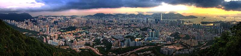
Kowloon (/ˌkaʊˈluːn/; Chinese: 九龍; Cantonese Yale: Gáulùhng) is an urban area in Hong Kong comprising the Kowloon Peninsula and New Kowloon. It is bordered by the Lei Yue Mun strait to the east, Mei Foo Sun Chuen and Stonecutter's Island to the west, a mountain range, including Tate's Cairn and Lion Rock to the north, and Victoria Harbour to the south. With a population of 2,019,533 (2 million) and a population density of 43,033/km2 in 2006, it is the most populous urban area in Hong Kong. The peninsula's area is approximately 47 km2 (18 sq mi).
Kowloon 九龍 | |
|---|---|
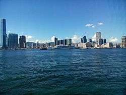 Kowloon as viewed from Hong Kong Island | |
| Nickname(s): Dragon City | |
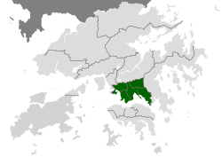 Location within Hong Kong (in green) | |
| City | Kowloon |
| Area | |
| • Land | 67 km2 (26 sq mi) |
| Population (2011) | |
| • Total | 2,108,419 (2.1 million) |
| • Density | 43,033/km2 (111,450/sq mi) |
| Time zone | UTC+8 (Hong Kong Time) |
| Kowloon | |||||||||||||||||||||
|---|---|---|---|---|---|---|---|---|---|---|---|---|---|---|---|---|---|---|---|---|---|
| Traditional Chinese | 九龍 | ||||||||||||||||||||
| Simplified Chinese | 九龙 | ||||||||||||||||||||
| Jyutping | Gau2-lung4 | ||||||||||||||||||||
| Literal meaning | "Nine Dragons" | ||||||||||||||||||||
| |||||||||||||||||||||
History
The name Kowloon stems from the term nine dragons, alluding to eight mountains and a Chinese emperor: Kowloon Peak, Tung Shan, Tate's Cairn, Temple Hill, Unicorn Ridge, Lion Rock, Beacon Hill, Crow's Nest and Emperor Bing of Song.[1] The part of Kowloon south of Boundary Street, together with Stonecutters Island, was ceded by Qing China to the United Kingdom under the Convention of Peking of 1860. For many years the area remained largely undeveloped, used by the British mainly for tiger-hunting expeditions.[2] The part of Kowloon north of Boundary Street (New Kowloon) was leased by the British as part of the New Territories under the 1898 Second Convention of Peking for 99 years. Within New Kowloon is Kowloon City, an area of Hong Kong where the Kowloon Walled City used to be located. The Kowloon Walled City itself was demolished in 1993. The same area was called Guanfuchang (官富場) during the Song dynasty (960–1279). "New Kowloon" has remained part of the New Territories.
Statutorily, "Kowloon" is only the area south of Boundary Street and Stonecutters Island, but in common use, New Kowloon is not regarded as part of the New Territories but as an integral part of the Kowloon urban area whether north or south of Boundary Street.
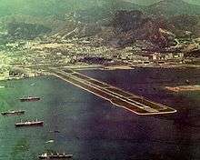
Large-scale development of Kowloon began in the early-20th century, with the construction of the Kowloon-Canton Railway and the Kowloon Wharf, but because of Kowloon's close proximity to Kai Tak Airport, building construction was limited by flight paths. As a result, compared to Hong Kong Island, Kowloon has a much lower skyline.[1] After World War II, Kowloon became extremely congested when slums for refugees from the newly established China gave way to public housing estates, mixed with private residential, commercial and industrial areas.
The area of reclaimed land known as West Kowloon was once home to a dockyard for the Royal Navy.
A 13-foot high stone wall was built in 1847 around Kowloon. The 1911 census recorded a population of 7,306, with most being Hakka.[3] The invasion of China by Japan in 1937 caused the population of Kowloon to grow drastically. Between 1937 and 1939, 750,000 refugees arrived in Kowloon and nearby areas, with many not having residence.[4]
Demographics
As of 2011, 2,108,419 people lived in Kowloon.[5]
94.2% of Kowloon's residents are of Cantonese ethnicity. The largest ethnic minority groups are Indonesians (1.8%), Filipinos (1.5%), Indians (0.5%), Nepalese (0.4%), and British (0.3%).[5] 86% of Kowloon's residents use Cantonese as their usual language, while 2.3% use English and 1.2% use Mandarin.[5]
Localities
Kowloon comprises the following localities of Hong Kong:
- Anderson Road
- Austin
- Cha Kwo Ling
- Cheung Sha Wan
- Diamond Hill
- Jordan
- Hammer Hill
- Hung Hom
- Ho Man Tin
- Kai Tak
- Kowloon Bay
- Kowloon City
- Kowloon Tong
- Kwun Tong
- Lai Chi Kok
- Lam Tin
- Lei Yue Mun
- Ma Tau Wai
- Mong Kok
- Ngau Chi Wan
- Ngau Tau Kok
- Prince Edward
- San Po Kong
- Sau Mau Ping
- Sham Shui Po
- Shek Kip Mei
- Tai Kok Tsui
- To Kwa Wan
- Tsim Sha Tsui
- Tsz Wan Shan
- West Kowloon
- Wong Tai Sin
- Yau Ma Tei
- Yau Tong
Administration
Kowloon comprises the following districts:
- Kowloon City
- Kwun Tong
- Sham Shui Po
- Wong Tai Sin
- Yau Tsim Mong
Politics
Kowloon covers two geographical constituencies for the Legislative Council of Hong Kong:
- Kowloon East includes Wong Tai Sin and Kwun Tong.
- Kowloon West includes Yau Tsim Mong, Sham Shui Po and Kowloon City.
Education
Primary education
Secondary education
- The Church of Christ in China Ming Yin College
- King George V School
Tertiary education
- City University of Hong Kong
- Hong Kong Polytechnic University
- Hong Kong Baptist University
- Open University of Hong Kong
- Tung Wah College
- Hong Kong Nang Yan College of Higher Education
- Gratia Christian College
Gallery
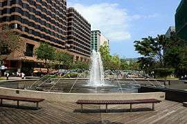 Centenary Garden Fountain, Tsim Sha Tsui
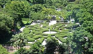 Maze Garden, Kowloon Park, Tsim Sha Tsui
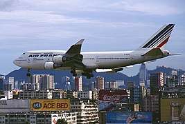 An Air France Boeing 747 passing above Kowloon, prior to landing at the old airport in 1998.
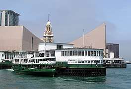 Star Ferry Pier, with the Hong Kong Cultural Centre and Tsim Sha Tsui Clock Tower in the background.
 Kowloon Masjid
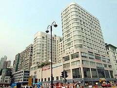 The Salisbury, YMCA of Hong Kong
References
- Fallon, Steve. (2006) Hong Kong and Macau. Lonely Planet Publishing. ISBN 981-258-246-0
- 10,000 Chinese Numbers. Lulu.com. p. 207. ISBN 9780557006212. Archived from the original on 23 August 2016.
- James Hayes, The Hong Kong Region 1850–1911. Hong Kong, 2012. ISBN 9888139118
- "Hong Kong 2003 – History". www.yearbook.gov.hk. Archived from the original on 26 September 2011. Retrieved 28 April 2018.
- District Profiles, Hong Kong Census, 2011, archived from the original on 27 September 2013, retrieved 27 September 2013
External links
| Wikivoyage has a travel guide for Kowloon. |
