Cox's Bazar
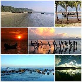
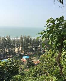
Cox's Bazar (Bengali: কক্সবাজার, pronounced [kɔksbadʒaɾ]) is a city, fishing port, tourism centre and district headquarters in southeastern Bangladesh. The beach in Cox's Bazar is sandy and has a gentle slope and with an unbroken length of 155 km (96 mi) it is often termed the "longest natural unbroken sea beach" in the world.There many disputes over that claim since the Federal Republic of Brazil has over 4,500 miles of coastline on the South Atlantic which covers sand beaches such Copacabana in the State of Rio de Janeiro. [2][3][4] It is located 150 km (93 mi) south of the divisional headquarter of Chittagong. Cox's Bazar is also known by the name Panowa, which translates literally as "yellow flower". Another old name was "Palongkee".
Cox's Bazar কক্সবাজার | |
|---|---|
 | |
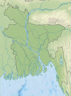
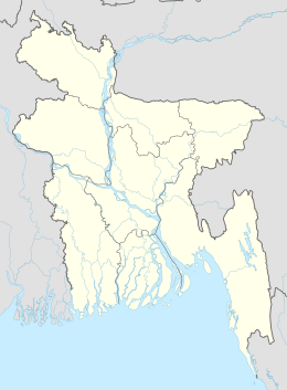 Cox's Bazar Location of Cox's Bazar in Bangladesh 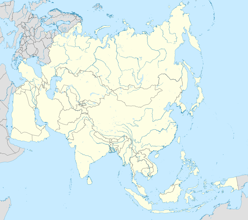 Cox's Bazar Cox's Bazar (Asia) | |
| Coordinates: 21.443°N 91.978°E | |
| Country | |
| Division | Chittagong Division |
| District | Cox's Bazar District |
| Government | |
| • Type | Mayor–Council |
| • Body | Cox's Bazar Municipality |
| • Mayor | Mujibur Rahman |
| Area | |
| • City | 23.4 km2 (9.0 sq mi) |
| Population (2011
Total population represents population in city and metro represents entire district.[1]) | |
| • City | 223,522 |
| • Density | 9,600/km2 (25,000/sq mi) |
| • Metro | 2,655,000 |
| Time zone | UTC+6 (BST) |
| Airport | Cox's Bazar Airport |
The modern Cox's Bazar derives its name from Captain Hiram Cox, an officer of the British East India Company. Cox was appointed Superintendent of Palongkee outpost after Warren Hastings became Governor of Bengal. He embarked upon the task of rehabilitation and settlement of the Arakanese refugees in the area.[5] Captain Cox died in 1799 before he could finish his work. To commemorate his role in rehabilitation work, a market was established and named Cox's Bazar after him. Unlike many locations in the Indian Subcontinent where place names dating from the colonial period have been changed, Cox's name is still retained in the city he founded.
Today, Cox's Bazar is one of the most visited tourist destinations in Bangladesh, although not a major international tourist destination. In 2013, the Bangladesh Government formed the Tourist Police unit to protect local and foreign tourists better, as well as to look after the nature and wildlife in the tourist spots of Cox's Bazar.[6]
History
Cox's Bazar Town was constituted in 1869, eventually becoming a B-grade municipality in 1989. Located along the Bay of Bengal in South Eastern Bangladesh, Cox's Bazar Town is a health resort. But it is famous mostly for its long natural sandy beach. The municipality covers an area of 6.85 km2 (2.64 sq mi) with 27 mahallas and 9 wards and has a population of 51,918.[7] Cox's Bazar is connected by road and air with Chittagong.[8][9]
The greater Chittagong area, including Cox's Bazar, was under the rule of Arakan kings from the early 9th century until its conquest by the Mughals in 1666 AD.[10] When the Mughal Prince Shah Shuja was passing through the hilly terrain of the present-day Cox's Bazar on his way to Arakan, he was attracted to its scenic and captivating beauty. He commanded his forces to camp there. His retinue of one thousand palanquins stopped there for some time. A place named Dulahazara, meaning "one thousand palanquins," still exists in the area. After the Mughals, the place came under the control of the Tipras and the Arakanese, followed by the Portuguese and then the British.
The name Cox's Bazar originated from the name of a British East India Company officer, Captain Hiram Cox, who was appointed as the Superintendent of Palonki (today's Cox's Bazar) outpost. He succeeded Warren Hastings, who became the Governor of Bengal following the British East India Company Act in 1773. The Captain rehabilitated many refugees in the area, but died in 1799 before he could finish his work. To commemorate him, a market was established and named after him, called Cox's Bazar. Cox's Bazar then was first established in 1854 and became a municipality in 1869.[10]
After the Sepoy Mutiny (Indian Rebellion of 1857) in 1857, the British East India Company was highly criticised and questioned on humanitarian grounds, specially for its opium trade monopoly over the Indian Sub-Continent. However, after its dissolution on 1 January 1874, all of the company's assets including its Armed Forces were acquired by the British Crown. After this historic takeover, Cox's Bazar was declared a district of the Bengal Province under the British Crown.
After the end of British rule in 1947, Cox's Bazar became part of East Pakistan. Captain Advocate Fazlul Karim, the first chairman (after independence from the British) of Cox's Bazar Municipality, established the Tamarisk Forest along the beach. He wanted to attract tourists as well as to protect the beach from tsunami. He donated much of his father-in-law's and his own lands as sites for constructing a public library and a town hall. He was inspired to build Cox's Bazar as a tourist spot after seeing beaches of Bombay and Karachi, and was a resort pioneer in developing Cox's Bazar as a destination. He established a maternity hospital, the stadium and the drainage system by procuring grants from the Ford Foundation and Rockefeller Foundation through correspondence. T. H. Matthews, the principal of the Dacca Engineering College (1949~1954), was a friend who had helped him in these fundraising efforts. Engineer Chandi Charan Das was the government civil engineer who worked on all these projects. In 1959 the municipality was turned into a town committee.[10]
In 1961 the Geological Survey of Pakistan initiated investigation of radioactive minerals like monazite around the Cox's Bazar sea-beach area.[11]


In 1971, Cox's Bazar wharf was used as a naval port by the Pakistan Navy's gunboats. This and the nearby airstrip of the Pakistan Air Force were the scene of intense shelling by the Indian Navy during the Bangladesh Liberation War. During the war, Pakistani soldiers killed many people in the town, including eminent lawyer Jnanendralal Chowdhury. The killing of two freedom fighters named Farhad and Subhash at Badar Mokam is also recorded in history.[7]
After Bangladesh's independence, Cox's Bazar started to receive administrative attention. In 1972 the town committee of Cox's Bazar was turned into a municipality. In 1975, The Government of Bangladesh established a pilot plant at Kalatali.[11] Later, in 1984 Cox's Bazar subdivision was promoted to a district, and five years later (in 1989) the Cox's Bazar municipality was elevated to B-grade.[10] In 1994 (jobs) the Marine Fisheries and Technology Station (MFTS) was established at Cox's Bazar. MFTS is a research station of Bangladesh Fisheries Research Institute (BFRI) headquartered in Mymensingh. The station covers a land area of four hectares and contains five laboratories.[12] In April 2007 Bangladesh got connected to the submarine cable network as a member of the SEA-ME-WE-4 Consortium, as Cox's Bazar was selected as the landing station of the submarine cable.[13] In September 2012 the municipality was the site of the Cox's Bazar and Ramu riots, where local Muslims attacked the Buddhist community over an alleged Quran desecration posted to Facebook.[14]
Geography and climate
Cox's Bazar town has an area of 6.85 km2 (2.64 sq mi), and is bounded by Bakkhali River on the north and East, Bay of Bengal in the West, and Jhilwanj Union in the south.[15]
The climate of Bangladesh is mostly determined by its location in the tropical monsoon region: high temperature, heavy rainfall, generally excessive humidity, and distinct seasonal variations.[16] The climate of Cox's bazar is mostly similar to the rest of the country. It is further characterised by the location in the coastal area. The annual average temperature in Cox's Bazar remains at about a maximum of 34.8 °C (94.6 °F) and a minimum of 16.1 °C (61.0 °F). The average amount of rainfall remains at 3,524 mm (138.7 in).
| Climate data for Cox's Bazar | |||||||||||||
|---|---|---|---|---|---|---|---|---|---|---|---|---|---|
| Month | Jan | Feb | Mar | Apr | May | Jun | Jul | Aug | Sep | Oct | Nov | Dec | Year |
| Record high °C (°F) | 32.8 (91.0) |
33.9 (93.0) |
36.1 (97.0) |
37.2 (99.0) |
35.0 (95.0) |
36.1 (97.0) |
33.3 (91.9) |
33.3 (91.9) |
34.4 (93.9) |
33.9 (93.0) |
33.3 (91.9) |
31.7 (89.1) |
37.2 (99.0) |
| Average high °C (°F) | 26.7 (80.1) |
28.5 (83.3) |
30.9 (87.6) |
32.1 (89.8) |
32.3 (90.1) |
30.7 (87.3) |
30.0 (86.0) |
30.2 (86.4) |
30.9 (87.6) |
31.6 (88.9) |
30.0 (86.0) |
27.5 (81.5) |
30.1 (86.2) |
| Average low °C (°F) | 15.0 (59.0) |
17.0 (62.6) |
20.7 (69.3) |
23.9 (75.0) |
25.1 (77.2) |
25.2 (77.4) |
25.1 (77.2) |
25.0 (77.0) |
25.0 (77.0) |
24.3 (75.7) |
21.1 (70.0) |
16.5 (61.7) |
22.0 (71.6) |
| Record low °C (°F) | 7.8 (46.0) |
9.4 (48.9) |
11.1 (52.0) |
16.1 (61.0) |
16.7 (62.1) |
20.6 (69.1) |
21.7 (71.1) |
19.4 (66.9) |
21.7 (71.1) |
17.2 (63.0) |
13.3 (55.9) |
8.9 (48.0) |
7.8 (46.0) |
| Average precipitation mm (inches) | 4.1 (0.16) |
17.0 (0.67) |
34.7 (1.37) |
121.8 (4.80) |
286.8 (11.29) |
801.9 (31.57) |
924.6 (36.40) |
667.1 (26.26) |
330.1 (13.00) |
213.6 (8.41) |
109.4 (4.31) |
13.0 (0.51) |
3,524.1 (138.74) |
| Average precipitation days | 1 | 2 | 3 | 6 | 13 | 19 | 22 | 21 | 14 | 7 | 4 | 1 | 113 |
| Average relative humidity (%) | 72 | 71 | 75 | 78 | 80 | 87 | 89 | 88 | 86 | 82 | 77 | 74 | 80 |
| Source #1: Bangladesh Meteorological Department[17][18][19][20][21] | |||||||||||||
| Source #2: Deutscher Wetterdienst (extremes)[22] | |||||||||||||
Educational institutions
1962: Cox's Bazar Government College is the earliest Secondary and bachelor's degree offering college founded in Cox's Bazar.
1985: Cox's Bazar Law College is the first profession-based college founded in this district.
1991: Cox's Bazar Govt. Women's College is the first Secondary and bachelor's degree offering college in this district solely for women.
2008: Cox's Bazar Medical College is the first medical college in this district and 200 bedded hospital
2014: Cox's bazar international university is the first private university founded in this district.
Other Colleges in this area: Cox's Bazar City College, Ramu Degree College, Ukhiya Degree College, Moin uddin Memorial College Nheela,Teknaf Degree College, Moheskhali degree college
High Schools:Cox's Bazar Model High School, Ramu Cantonment English School, (Ramu Khizari Govt. High School) Cox's Bazar Govt. High School, Cox's Bazar Govt. Girls High School, Cox's Bazar Model High School, Biam Laboratory School and College, Kishalaya Model High School, Chakaria korak biddyapith, Chakaria Govt. High School, Palong Model High School, Shilkhali High School, Pekua, Ukhiya Govt. High School, Nheela High School, Poura Preparatory High School.
Economy and development
 Bangladesh | |
| |
| Location | Cox's Bazar Bangladesh |
|---|---|
| Coordinates | 21°25′53″N 91°58′42″E |
| Year first constructed | n/a |
| Foundation | concrete base |
| Construction | metal skeletal tower[23] |
| Tower shape | square prism skeletal tower with balcony and lantern[23] |
| Markings / pattern | white tower, orange lantern[23] |
| Tower height | 7 metres (23 ft)[24] |
| Focal height | 54 metres (177 ft)[24] |
| Range | 21 nautical miles (39 km; 24 mi)[24] |
| Characteristic | Fl W 15s.[24] |
| Admiralty number | F1056.4[24] |
| NGA number | 26756 [24] |
| ARLHS number | BAN-001[23] |
| Managing agent | Bangladesh Department of Shipping[23] |

The major economic activity in Cox's Bazar is tourism. A number of hotels, guest houses, and motels have been built in the city and coastal region, and many people are involved in the service industry.
People are also involved in fishing and collecting seafood and sea products for their livelihood. Oysters, snails, pearls and their ornaments are very popular with tourists. Some people are involved in the transportation business for tourists. Cox's Bazar is one of the few major spots for aquaculture in Bangladesh.[25] Along with Khulna, it is considered a major source of revenue from foreign exchanges. Besides a mix of small-scale agriculture, marine and inland fishing and salt production are other industrial sources that play important roles in the national economy.
Tourism
The beach is the main attraction of the town. There are several 3 stars and 5 star hotels provide the exclusive beachside area with accessories for the tourist. Visitors in other hotels visit Laboni beach which is the area of the beach closest to the town. Other than the beach there are several places of interest near the town which can easily be visited from the town center.
- Himchari National Park : [26] Himchari is located just south of the Cox's Bazar town. It consists of lush tropical rain forest, grasslands and trees, and features a number of waterfalls, the biggest of which cascades down toward the sandy, sun-drenched beach. The National Park was established in 1980 by the Government of Bangladesh as a conservation area for research, education, and recreation. Once it was the stomping grounds of herds of Asian elephant. It is still home to a limited number of these mammals.[27]
- Aggmeda Khyang: a large Buddhist monastery, and a place revered by around 400,000 Buddhist people of Cox's Bazar; and the Chittagong Hill Tracts. The main sanctuary is posted on a series of round timber columns. It has a prayer chamber and an assembly hall along with a repository of large and small bronze Buddha images and a number of old manuscripts.
- Ramu: about 10 km (6 mi) from Cox's Bazar,[28] is a village with a sizeable Buddhist population. The village sells handicrafts and homemade cigars. There are monasteries, khyangs and pagodas containing images of Buddha in bronze, gold and other metals with precious stones. One of the temples, on the bank of the Baghkhali river, houses relics and Burmese handicrafts, and also a large bronze statue of Buddha measuring thirteen feet high which rests on a six feet high pedestal. Weavers ply their trade in open workshops and craftsmen make handmade cigars in their pagoda like houses.
- Bangabandhu Sheikh Mujib Safari Park: Bangabandhu Sheikh MujibSafari Park is the first Safari Park in Bangladesh. Dulahazara Safari Park was developed on an undulating landscape of around 2,224 acres (9.00 km2) of area at Chakaria Upazila in Cox's Bazar District. The nature of the forest is tropical evergreen and rich with Garjan, Boilam, Telsur, and Chapalish along with herbs, shrubs, and creepers. Safari Park is a declared protected area where the animals are kept in a fairly large area with natural environment and visitors can easily see the animal whenever they visit by bus, jeep or on foot. This park was established on the basis of South Asian model. This safari park is an extension of an animal sanctuary located along the Chittagong-Cox's Bazar road about 50 km (30 mi) from Cox's Bazar town. The sanctuary itself protects a large number of wild elephants which are native to the area. In the safari park, there are domesticated elephants which are available for a ride. Other animal attractions include lions, Bengal tigers, Crocodiles, Bears, Chitals and lots of different types of birds and monkeys.which is a wonderful project to attract the tourist.
The only aquarium in Bangladesh is in Cox's Bazar. Attractions also include parasailing, water biking, beach biking, horse riding, Cox Carnival circus show, Daria Nagar Ecopark, Cox's Bazar Development Authority, numerous architectural attractions, Shishu Parks and numerous photogenic sites. The largest safari park in the country, Bangabandhu Safari Park, is nearby. There is a forest reserve at Teknaf which also has a cable car planned.[29]
- Inani Beach Inani is a stony beach near Cox's Bazar.
- Darianagar a beach with waterways flowing through it.
- Radiant Fish World Radiant Fish World is a sea aquarium.
See also
- Cox's Bazar District
- Cox's Bazar Sadar Upazila
- Cox's Bazar Airport
- List of lighthouses in Bangladesh
- Mermaid Beach Resort
References
- "Area, Population of Cox's Bazar". citypopulation.de.
- Ethirajan, Anbarasan (26 December 2012). "Bangladesh's Cox's Bazar: A paradise being lost?". BBC World. Retrieved 29 January 2015.
- Panday, V.C., ed. (2004). Environment, Security and Tourism Development in South Asia: Tourism development in South Asia. Environment, Security and Tourism Development in South Asia. 3. New Delhi: Gyan Publishing House. pp. 100–101. ISBN 978-81-8205-139-3.
- "Bangladesh: Tourism". The Europa World Year Book. Taylor & Francis. 2003. p. 679. ISBN 978-1-85743-227-5.
- Nandita Haksar (2009). Rogue Agent: How India's Military Intelligence Betrayed the Burmese Resistance. Penguin Books India. pp. 55–56. ISBN 978-0-14-306489-3.
- Mahmud, Tarek (31 August 2013). "Seashores to get tourist police". Dhaka Tribune. Retrieved 18 June 2015.
- Alam, Badiul (2012). "Cox's Bazar Sadar Upazila". In Islam, Sirajul; Jamal, Ahmed A. (eds.). Banglapedia: National Encyclopedia of Bangladesh (Second ed.). Asiatic Society of Bangladesh.
- "Cox's Bazar, Bangladesh". Encyclopædia Britannica. 12 January 2015. Retrieved 14 January 2008.
- কক্সবাজার জেলা. coxsbazar.gov.bd (in Bengali). Retrieved 4 December 2018.
- Siddiqi, Mohammad Mahibbullah (2012). "Cox's Bazar District". In Islam, Sirajul; Jamal, Ahmed A. (eds.). Banglapedia: National Encyclopedia of Bangladesh (Second ed.). Asiatic Society of Bangladesh.
- Chowdhury, Sifatul Quader (2012). "Beach Sand Heavy Mineral". In Islam, Sirajul; Jamal, Ahmed A. (eds.). Banglapedia: National Encyclopedia of Bangladesh (Second ed.). Asiatic Society of Bangladesh.
- Kabir, SM Humayun (2012). "Bangladesh Fisheries Research Institute". In Islam, Sirajul; Jamal, Ahmed A. (eds.). Banglapedia: National Encyclopedia of Bangladesh (Second ed.). Asiatic Society of Bangladesh.
- "Much needed Submarine Cable – Bangladesh". Bangladesh Development Gateway. 2 March 2006. Archived from the original on 20 April 2006. Retrieved 14 January 2008.
- "Bangladesh rampage over Facebook Koran image". BBC News. 30 September 2012. Retrieved 8 December 2019.
- ভৌগলিক পরিচিতি - কক্সবাজার জেলা-NULL. coxsbazar.gov.bd (in Bengali). Retrieved 4 December 2018.
- Ahmed, Rafique (2012). "Climate". In Islam, Sirajul; Jamal, Ahmed A. (eds.). Banglapedia: National Encyclopedia of Bangladesh (Second ed.). Asiatic Society of Bangladesh.
- "Monthly Maximum Temperature". Bangladesh Meteorological Department. Retrieved 31 January 2016.
- "Monthly Minimum Temperature". Bangladesh Meteorological Department. Retrieved 31 January 2016.
- "Normal Monthly Rainfall". Bangladesh Meteorological Department. Retrieved 31 January 2016.
- "Normal Monthly Rainy Day". Bangladesh Meteorological Department. Retrieved 31 January 2016.
- "Normal Monthly Humidity". Bangladesh Meteorological Department. Retrieved 31 January 2016.
- "Klimatafel von Koks Bazar (Cox's Bazar) / Bangladesch" (PDF). Baseline climate means (1961–1990) from stations all over the world (in German). Deutscher Wetterdienst. Retrieved 31 January 2016.
- "Bangladesh". The Lighthouse Directory. University of North Carolina at Chapel Hill. Retrieved 30 September 2016.
- List of Lights, Pub. 112: Western Pacific and Indian Oceans Including the Persian Gulf and Red Sea (PDF). List of Lights. United States National Geospatial-Intelligence Agency. 2016.
- Reeves, Peter. "The Development of Export-Oriented Shrimp Aquaculture in Bangladesh: a preliminary assessment of moves to more intensive production in southeastern Bangladesh". University of Edinburgh (Abstract). Archived from the original on 1 September 2005. Retrieved 1 February 2008.
- Bangladesh, Tour to. "Welcome to Himchari National Park". tourtobangladesh.com. Retrieved 4 December 2018.
- "Himchari National Park – A Birdwatcher's Paradise". Bangladesh.com. Retrieved 1 February 2015.
- Hossain, Mofazzal (2012). "Cox's Bazar". In Islam, Sirajul; Jamal, Ahmed A. (eds.). Banglapedia: National Encyclopedia of Bangladesh (Second ed.). Asiatic Society of Bangladesh.
- "BEZA to set up 9.5 km cable car route at Naf Tourism Park". The Independent. Dhaka. BSS. 22 March 2019.
External links
Ministry of Public Administration Ministry of Local Government, Rural Development and Co-operatives | ||
| Metropolis |
|  |
| Cities |
| |
| Towns |
| |
- Population and Housing Census 2011 - Volume 3: Urban Area Report (PDF), Bangladesh Bureau of Statistics, August 2014