Zuni-Bandera volcanic field
Zuni-Bandera volcanic field (also known as Bandera lava field, Grants Malpais and Malpais volcanic field) is a volcanic field located in the state of New Mexico, United States.[1]
| Zuni-Bandera Volcanic Field | |
|---|---|
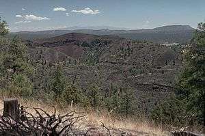 Bandera Crater in the center is part of the Zuni-Bandera lava field. | |
| Highest point | |
| Elevation | 8,366 ft (2,550 m) [1] |
| Coordinates | 34°48′00″N 108°00′00″W [1] |
| Geography | |
| Location | Cibola County, New Mexico, US |
| Geology | |
| Age of rock | 3.8 million years |
| Mountain type | Volcanic field[1] |
| Last eruption | 1170 BCE ± 300 years[1] |
The volcanic field has been considered for geothermal exploitation.[2]
It is on the Trails of the Ancients Byway, one of the designated New Mexico Scenic Byways.[3]
Notable Vents
| Name | Elevation | Coordinates | Last eruption |
| Cerro Bandera[4][5] | 2,552 metres (8,373 ft) | 35.0°N 108.1°W | - |
| Bandera Crater[4][5] | 2,533 metres (8,310 ft) | 35.0°N 108.08°W | 9,500-10,900 years ago[6] |
| El Calderon[4][7] | 2,320 metres (7,612 ft) | 34.97°N 108.02°W | - |
| Cerro Colorado[4] | - | - | - |
| Cerro Encierro[4] | 2,298 metres (7,539 ft) | 34.88°N 108.05°W | - |
| Hoyo De Cibola[4] | 2,380 metres (7,808 ft) | 34.88°N 108.12°W | - |
| Cerro Hueco (Deer Mountain)[4] | 2,441 metres (8,009 ft) | - | - |
| Laguna[4] | - | - | - |
| Lost Woman[4] | 2,459 metres (8,068 ft) | 34.97°N 108.08°W | - |
| McCarty's Flow[5][8] | 2,244 metres (7,362 ft) | 35.0°N 107.8°W | 2,500-3,900 years ago[6] |
| Paxton Springs[4][5] | 2,490 metres (8,169 ft) | 35.07°N 108.07°W | - |
| Cerro Rendija[4][5] | 2,494 metres (8,182 ft) | 34.95°N 108.13°W | - |
| La Tetra (Cerro Tetra)[4] | 2,458 metres (8,064 ft) | 34.98°N 108.05°W | - |
| El Tintero[5] | 2,201 metres (7,221 ft) | - | - |
| Twin Craters[4] | 2,423 metres (7,949 ft) | 34.98°N 108.07°W | 15,800-17,800 years ago[6] |
References
- "Zuni-Bandera". Global Volcanism Program. Smithsonian Institution. Retrieved 2008-05-30.
- Laughlin, A.W.; West, F.G. (1975-12-01). Zuni Mountains, New Mexico as a potential dry hot rock geothermal energy Site (Report). United States Department of Energy. doi:10.2172/7366687. OSTI 7366687.
- "Trail of the Ancients". New Mexico Tourism Department. Archived from the original on August 21, 2014.
- "Zuni-Bandera - Synonyms and Subfeatures". Global Volcanism Program. Smithsonian Institution. Retrieved 2007-05-07.
- Ander, M.E.; Heiken, G.; Eichelberger, J.; Laughlin, A.W.; Huestis, S. (1981-05-01). Geologic and geophysical investigations of the Zuni-Bandera volcanic field, New Mexico (Report). United States Department of Energy, Los Alamos National Laboratory. doi:10.2172/6516124. OSTI 6516124.
- "Background on the Zuni-Bandera Volcanic Field". New Mexico Bureau of Geology and Mineral Resources. Retrieved 2009-06-30.
- "Into a Lava-Lined Underworld Near Albuquerque". The New York Times. 2014-08-28.
Additional lava caves reachable from El Calderon trailhead
- "McCartys Flow, Zuni - Bandera Volcanic Field, New Mexico". Volcano World. Retrieved 2007-05-08.
This article is issued from Wikipedia. The text is licensed under Creative Commons - Attribution - Sharealike. Additional terms may apply for the media files.