Zugerberg
The Zugerberg is a mountain overlooking Zug and Lake Zug in the Zug. It lies approximately halfway between Lake Zug and Lake Ägeri.
| Zugerberg | |
|---|---|
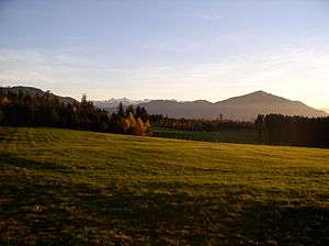 Zugerberg from the south | |
| Highest point | |
| Peak | Hünggigütsch |
| Elevation | 1,039 m (3,409 ft) |
| Prominence | 79 m (259 ft) [1] |
| Isolation | 2.74 km (1.70 mi) |
| Coordinates | 47°08′21″N 8°32′18″E |
| Geography | |
 Zugerberg Location in Switzerland | |
| Location | Zug |
| Country | Switzerland |
| Parent range | Schwyzer Alps |
| Topo map | Swiss Federal Office of Topography swisstopo |
The Zugerbergbahn funicular connects the Zugerberg from Zug. The upper station is located at a height of 925 metres and is a popular vantage point as well as a recreational area. The summit proper is entirely wooded.
A road pass named Sätteli (975 m) is located north of the summit.
References
- Retrieved from the Swisstopo topographic maps. The key col is located near Ewegstafel at 960 metres.
- "Zugerberg". Zug-Tourismus. 2009. Retrieved 2009-05-21.
This article is issued from Wikipedia. The text is licensed under Creative Commons - Attribution - Sharealike. Additional terms may apply for the media files.