Zhuravlev Bay
Zhuravlev Bay (Russian: залив Журавлева, Zaliv Zhuravleva),[2] is a bay in Severnaya Zemlya, Krasnoyarsk Krai, Russia.[1] This bay is blocked by ice most of the year.
| Zhuravlev Bay | |
|---|---|
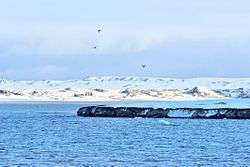 View of the shore of Zhuravlev Bay | |
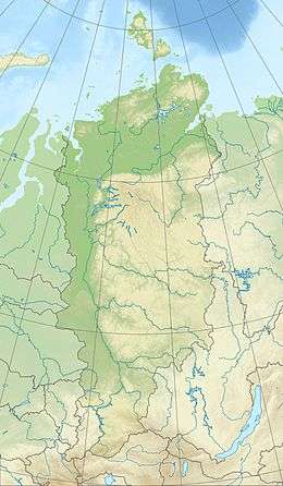 Zhuravlev Bay Location in Krasnoyarsk Krai | |
 | |
| Location | Komsomolets Island, Severnaya Zemlya, Krasnoyarsk Krai |
| Coordinates | 80°38′N 92°48′E |
| Native name | залив Журавлева |
| Ocean/sea sources | Kara Sea |
| Basin countries | Russia |
| Max. length | 17 km (11 mi)[1] |
| Max. width | 10 km (6.2 mi) |
| Islands | Shar Island |
History
This bay was named by the 1930–1932 expedition to the archipelago led by Georgy Ushakov and Nikolay Urvantsev after Soviet Arctic explorer, invaluable member of the expedition and veteran surveyor Sergei Prokopyevich Zhuravlev (1892–1937).[3]
Geography
Zhuravlev Bay is a body of water in the northeastern area of Komsomolets Island, the northernmost island of Severnaya Zemlya.[4][5]
The bay is open to the Kara Sea in the southwest. It has a maximum width at its mouth of about 10 km (6.2 mi), steadily narrowing towards the inner bay. The edge of the massive Academy of Sciences Glacier runs all along the eastern shore, while the northwestern shoreline is bound by a stretch of unglaciated area with Shar Island, 1 km (0.62 mi) in diameter, at the end of the headland.[1]
Further reading
- Два года на северной земле (Two years in Severnaya Zemlya)
See also
References
- GoogleEarth
- "Zaliv Zhuravlëva". Mapcarta. Retrieved 24 December 2016.
- Архипелаг Северная Земля — один из наиболее крупных районов оледенения на территории России
- Map U-47-XXXI,XXXII,XXXIII бух. Кренкеля. Scale: 1 : 200 000. Состояние местности на 1988 год. Издание 1992 г.
- Залив Журавлева. Остров Комсомолец
External links

- Журавлев Сергей Прокопьевич (08(20).10.1892–26.11.1937)
- Polarpost - Журавлев Сергей Прокопьевич (1892–1937)
- Eurasian Arctic Tectonics - DiVA