Yennora
Yennora is a suburb of Sydney in the state of New South Wales, Australia, 29 kilometres west of the Sydney central business district. The residential part of the suburb is primarily in the local government area of the City of Fairfield, although the industrial area in west is a part of Cumberland Council. It is part of the Greater Western Sydney region.
| Yennora Sydney, New South Wales | |||||||||||||||
|---|---|---|---|---|---|---|---|---|---|---|---|---|---|---|---|
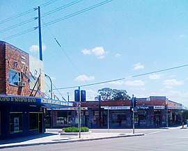 Yennora Shops | |||||||||||||||
Yennora | |||||||||||||||
| Coordinates | 33°51′46″S 150°57′58″E | ||||||||||||||
| Population | 1,615 (2016 census)[1] | ||||||||||||||
| Postcode(s) | 2161 | ||||||||||||||
| Location | 29 km (18 mi) west of Sydney CBD | ||||||||||||||
| LGA(s) |
| ||||||||||||||
| State electorate(s) | Fairfield | ||||||||||||||
| Federal Division(s) | McMahon | ||||||||||||||
| |||||||||||||||
History
Yennora is an Aboriginal word meaning walking or to stroll. Aboriginal people from the Cabrogal tribe, a sub-group of the Gandangara tribe, have lived in the Fairfield area for over 30,000 years.
European settlement began in Fairfield in the early 19th century. A siding platform was built by the New South Wales Government Railways in 1927 and given the name Yennora. The public school was opened in 1955 and the Wool Stores were established in June 1971.[2]
Transport and commercial area
A portion of Yennora is dominated by an industrial zone, which includes the 300,000m2 Yennora Distribution Centre.[3] It was opened in June 1971 as the Yennora Wool Centre.[4][5][6] The Yennora Distribution Centre has a connection to the Main Southern railway line, and is used by Qube Logistics for freight services running between Port Botany and the suburb. Yennora also has some small shops and restaurants.
Yennora railway station is on the Inner West & Leppington and Cumberland lines of the Sydney Trains network. Trains run frequently from Yennora to Leppington, Richmond and the City Circle.[7] Yennora is also serviced by bus services operated by Transdev NSW.[8]
Demographics
According to the 2016 census, 40.7% of people stated that they were born in Australia, with Vietnam (8.2%), Iraq (6.8%), Lebanon (5.8%), Myanmar (3.8%) and China (3.0%) being other common responses. A high percentage (72.4%) of people spoke a language other than English at home, with Arabic (25.3%), Vietnamese (9.5%), Karen (4.5%), Cantonese (3.9%), and Spanish (3.4%) being the most commonly spoken non-English languages.
The median age of people in Yennora was 40 years, with 17.2% of people aged between 0–14 years and 23.2% aged 65 years and over. With regards to employment, 51.1% of people were employed full-time, 30.3% were employed part-time, 6.9% were employed but away from work and 11.7% were unemployed.[1] Furthermore, Yennora is known to be the most poorest suburb of Sydney, where the median personal income is just $19,000.[9]
Gallery
 Yennora Public School
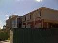 Rosary Village Retirement Centre
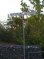 Yennora Railway Station Cycle Path
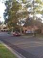 Tara Close
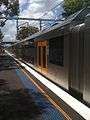
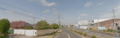 Railway Parade Yennora
References
- Australian Bureau of Statistics (27 June 2017). "Yennora (State Suburb)". 2016 Census QuickStats. Retrieved 18 March 2018.

- The Book of Sydney Suburbs, Compiled by Frances Pollon, Angus & Robertson Publishers, 1990, Published in Australia ISBN 0-207-14495-8, page 277
- Yennora Distribution Centre Stockland
- Wool selling centre to be established Freight & Container Transportation January 1969 page 11
- Containerisation at Yennora Wool Village Network February 1974 page 3
- Yennora Wool Village Freight & Container Transportation September 1976 pages 24/25
- Yennora Station Transport for NSW
- Parramatta, Bankstown and Liverpool bus network map Transdev NSW
- The stark difference between Sydney’s richest and poorest suburbs by News.com.au
External links
![]()