Yei, South Sudan
Yei is a medium-sized city in South Sudan's southwest. It lies close to the borders of two of the country's trading partners, Uganda and the Democratic Republic of Congo. It is a business hub, attracting traders and customers from all three countries. Ivory Bank, Equity bank, Eden Commercial Bank, Kenya Commercial Bank and bank of south Sudan maintain branches in the city. Yei is served by Yei Airport, and a marram road connecting yei to Juba, Uganda through the Kaya border and DRC through the Lasu border
Yei | |
|---|---|
 Yei landscape | |
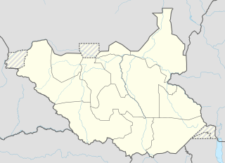 Yei Location in South Sudan | |
| Coordinates: 04°06′00″N 30°40′12″E | |
| Country | South Sudan |
| State | Yei River |
| County | Yei River |
| Population (2014 Estimate) | |
| • Total | 260,720 |
| Climate | Aw |
Location
The city of Yei is located in Yei County, Yei River State[1] in southwestern South Sudan, close to the international borders with the Democratic Republic of the Congo and the Republic of Uganda. It is approximately 170 kilometres (110 mi), by road, southwest of Juba, the capital and largest city in South Sudan.[2] The geographic coordinates of the city of Yei are: 4° 6' 0.00"N, 30° 40' 12.00"E (Latitude: 4.1000; Longitude: 30.6700).
History
Before the Second Sudanese Civil War
The name Yei was given to the location where the current city stands by three traditional chiefs, one each from the Pojulu, Gimunu and Azande ethnic groups. The chiefs also conferred the name to the river that flows through the area and is now called River Yei. The three above ethnic groups had a traditional rivalry with the Kakwa, who also occupy neighbouring parts of Uganda and DRC. The first three ethnicities traditionally were found in what today is called Mukaya Payam, while the Kakwa were found in Marakonye Payam. They lived in co-existence with other smaller ethnicities, having rivalries from time to time.
At the end of the nineteenth century, under the rule of the Congo Free State, a government military station was created at Yei [3], where the road to the Nile crossed the Yei river[4]. On taking over the Lado Enclave in 1910, the Anglo-Egyptian government immediately made Yei the centre of a campaign to fight sleeping sickness[5]. In 1951, British missionaries built a small medical clinic on the northern bank of River Yei.
Before the onset of the Second Sudanese Civil War (1983 - 2005), Yei was a thriving urban, commercial center. Due to its location, at the borders of Uganda and DRC, the city handled a lot of commerce between the three neighboring countries. At that time, it attracted visitors, from as far away as Juba, about 170 kilometres (110 mi), by road, to the north of Yei. Civil servants and other Juba residents would flock to Yei on weekends to participate in the exchange of goods and services offered in the many bars, shops and hotels. Yei became known as Small London because of its cosmopolitan nature.
Second Sudanese Civil War
In course of the civil war, the area around Yei became the center of two Ugandan rebel movements that were supported by the Sudanese government, namely the WNBF and UNRF (II). Both waged an insurgency in Uganda, but also fought alongside the Sudanese government against the Sudan People's Liberation Army (SPLA) rebels. The SPLA eventually launched a major offensive (codenamed Operation Thunderbolt) against Yei in early 1997, effectively destroying the WNBF and UNRF (II) and capturing Yei itself in January 7th 1997.[6] The town remained under SPLA control until the end of the civil war. Following its capture in 1997, the SPLA fortified and turned Yei into a garrison town.
The presence of large numbers of SPLA in town attracted air raids and shelling from the Sudanese Armed Forces (SAF). The population fled and the SPLA brought in more troops, who started families and started to grow the population of the city again. As the city became safer, later during the civil war, South Sudanese displaced from other parts of the country, particularly from the Bahr el Ghazal Region, began flocking to Yei for safety, and later for humanitarian assistance (food, medicine and housing).
After the Second Sudanese Civil War
Following the cessation of major hostilities and the signing of the Comprehensive Peace Agreement in 2005, South Sudanese who had fled to Uganda and DRC began to return, and many chose Yei as their entry point. Due to the relative safety in the city, and the ready availability of International humanitarian aid, many of the returnees from other South Sudanese states chose to stay in Yei, instead of proceeding to their respective states of origin. This has created tension between the returnees who are native to Yei on one hand, and the IDPs who are native to other areas in South Sudan on the other. Local authorities and international aid partners are still grappling with finding acceptable, equitable and permanent solutions to the land claims and counter-claims and the resulting wrangles. And more returnees were coming in 2011.[7]
In 2016, Yei has reportedly been depopulated as a result of conflict during the South Sudanese Civil War.[8]
Demographics
As of July 2011, the exact population of Yei was not known. Sources have come up with different estimates of the city's population over the past 30 years, including the following:
- In 1983 the Sudanese census estimated the population of the city at about 23,500[9]
- In 2006, USAID estimated the population of Yei at about 60,000[10]
- In 2010, the mid-year population of the city was estimated at 86,000 by extrapolating the census figures.[11]
- In 2010, a Gfa/Gitec study estimated the population at about 171,400.[12]
- In 2011, the South Sudan Relief and Rehabilitation Commission (SSRRC) estimated the population of Yei at about 185,000.[13]
The table below summarizes the population estimates, including the sources for each set of figures:
| Year | Source/Method | Population |
|---|---|---|
| 1983 | Sudanese National Census | 23,400 |
| 2006 | USAID Estimate | 60,000 |
| 2010 | Calculation From Previous Census Data | 86,000 |
| 2010 | Gfa/Gitec Study - Household Survey | 171,400 |
| 2011 | Southern Sudan Relief and Rehabilitation Commission (SSRRC) - Estimate | 185,000 |
| 2014 | - Estimate | 260,720 |
Yei County is traditionally inhabited by many ethnicities including the Kakwa, the Bari, the Pojolu, the Baka, the Mundu, and the Avukaya.
Education
The city is home to the Yei Agricultural and Mechanical University, Yei Day Senior Secondary School.
Economic activity
The area around Yei receives adequate rainfall year-round, which allows for the cultivation of food and cash crops as well as the raising of domestic livestock. Coffee and cassava are some of the crops grown locally. Lush farmlands cover the landscape on the city outskirts. Four commercial banks maintain branches in the city: Equity Bank (South Sudan), Ivory Bank, Kenya Commercial Bank (South Sudan) and Eden Commercial Bank
The road network to neighboring cities and towns is actively undergoing repairs. For example, the road between Yei and Kaya, on the Ugandan border, has been repaired. It was financed by HABITAT and WFP. With the improvements the travel time to Kaya was reduced from five hours to one. Yei is also served by Yei Airport. The civil war decimated the city's infrastructure. However, with the cessation of hostilities in 2005 and the attainment of independence by South Sudan in July 2011, the prospects of Yei recapturing its former days of Small London look good indeed.
Bibliography
- Bell, H. (1999) Frontiers of Medicine in the Anglo-Egyptian Sudan, 1899-1940, Clarendon Press: Oxford.
- Gleichen, A.E.W. (ed.) (1905) The Anglo-Egyptian Sudan: A Compendium prepared by officers of the Sudan Government, Harbisons & Sons: London.
- Leopold, Mark (2001). "'Trying to Hold Things Together?' International NGOs caught up in an Emergency in North-Western Uganda, 1996–97". In Ondine Barrow; Michael Jennings (eds.). The Charitable Impulse: NGOs & Development in East & North-East Africa. Oxford, Bloomfield: James Curry Ltd; Kumarian Press. pp. 94–108.CS1 maint: ref=harv (link)
References
- Yei River State residents fleeing to villages Archived 2016-08-18 at the Wayback Machine Radio Tamazuj
- Estimated Road Distance Between Juba And Yei With Map
- Gleichen, p. 279.
- 1905 map of Bahr el Ghazal by Topographical Section, General Staff, UK
- Bell, p. 138
- Leopold (2001), pp. 99–100.
- "Challenges of Reintegration of Returnees & IDPs In Yei County, South Sudan" (PDF). Archived from the original (PDF) on 2012-03-14. Retrieved 2011-07-16.
- "Genocide or mere atrocity? The chaos in South Sudan keeps getting worse". The Economist. 9 December 2016. Retrieved 9 December 2016.
- "Yei's Population Per 1983 Census". Archived from the original on 2012-05-23. Retrieved 2011-07-16.
- "USAID Estimated Population of Yei In 2006" (PDF). Archived from the original (PDF) on 2012-03-14. Retrieved 2011-07-16.
- "Calculated Population of Yei In 2010". Archived from the original on 2012-05-23. Retrieved 2011-07-16.
- Gfa/Gitec:Feasibility Study for the Establishment of Water Supply and Sanitation Services for Yei, May 2010. (1,607 households surveyed).
- "Estimated Population of Yei In 2011" (PDF). Archived from the original (PDF) on 2012-03-14. Retrieved 2011-07-16.
External links
| Wikimedia Commons has media related to Yei, South Sudan. |
| Wikivoyage has a travel guide for Yei. |
- Gurtong Peace Project with information about South Sudan
State capital: Juba | ||
| Counties | 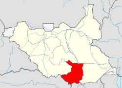 | |
| Populated places | ||
| Universities | ||
| Airports |
| |
| Other | ||