Y Garn (Plynlimon)
Y Garn is a subsidiary summit of Pen Pumlumon Fawr and the fourth highest peak on the Plynlimon massif, a part of the Cambrian Mountains in the county of Ceredigion, Wales.
| Y Garn | |
|---|---|
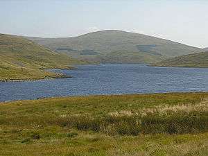 View over Nant-y-moch Reservoir | |
| Highest point | |
| Elevation | 684 m (2,244 ft) |
| Prominence | 56 m (184 ft) |
| Parent peak | Pen Pumlumon Fawr |
| Listing | Hewitt, Nuttall |
| Coordinates | 52.4505°N 3.8031°W |
| Naming | |
| Language of name | Welsh |
| Geography | |
| Location | Ceredigion, Wales |
| Parent range | Cambrian Mountains |
| OS grid | SN789869 |
| Topo map | OS Landranger 135 |
The summit is marked by a large shelter cairn, hollowed out from an ancient burial cairn. The views include Rhos Fawr, Drygarn Fawr, Pen y Garn to the south and Aran Fawddwy, Glasgwm, Tarrenhendre and Tarren y Gesail to the north. The Nant-y-moch Reservoir can also be seen to the north, with the smaller summits of Drosgol at 550 m (1,800 ft) and Banc Llechwedd-mawr at 560 m (1,840 ft).[1] both Marilyns.
References
- Nuttall, John & Anne (1999). The Mountains of England & Wales - Volume 1: Wales (2nd edition ed.). Milnthorpe, Cumbria: Cicerone. ISBN 1-85284-304-7.
This article is issued from Wikipedia. The text is licensed under Creative Commons - Attribution - Sharealike. Additional terms may apply for the media files.