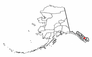
Wrangell Island
Wrangell Island (Russian: Остров Врангеля) is in the Alexander Archipelago in the Alaska Panhandle of southeastern Alaska. It is 48 kilometres (30 miles) long and 8 to 23 kilometres (5.0–14.3 miles) wide. It has a land area of 544.03 square kilometres (210.05 square miles), making it the 29th largest island in the United States. Wrangell is separated from the mainland by the narrow Blake Channel.
The first European to sight the island was James Johnstone, one of George Vancouver’s officers during his 1791-1795 expedition, in 1793. He only charted its east coast, not realizing it was an island.[1] It was occupied in 1834 by the Russians. It is named after Ferdinand Wrangel, a Baltic German explorer in Russian service, and government official. From 1867 to 1877 it was a U.S. military post; later it became an outfitting point for hunters and explorers, and for miners using the Stikine River route to the Yukon.
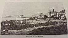
The island contains the city of Wrangell, Alaska. Wrangell Island is heavily forested and contains an abundance of wildlife. The only other community is Thoms Place on the southwest side, across the Zimovia Strait from Etolin Island. Wrangell Island's total population was 2,401 at the 2000 census.
Fishing and mining are pursued in the area. A lumber mill closed in the 1990s. The island and surrounding areas contain many recreational areas. It is at the mouth of the Stikine River, which provides many recreational opportunities.
References
- Vancouver, George, and John Vancouver (1801). A voyage of discovery to the North Pacific ocean, and round the world. London: J. Stockdale.
External links
| Wikimedia Commons has media related to Wrangell, Alaska. |
| Authority control |
|
|---|